c) Andrew Carter, 2021
Who ordered up the cold weather?
c) Andrew Carter, 2021
Who ordered up the cold weather?
c) Andrew Carter, 2021
The mountain I said might be Liin Peak is actually Toro peak. Not sure how I mistook a lion for a bull, but it happens.
c) Andrew Carter, 2021
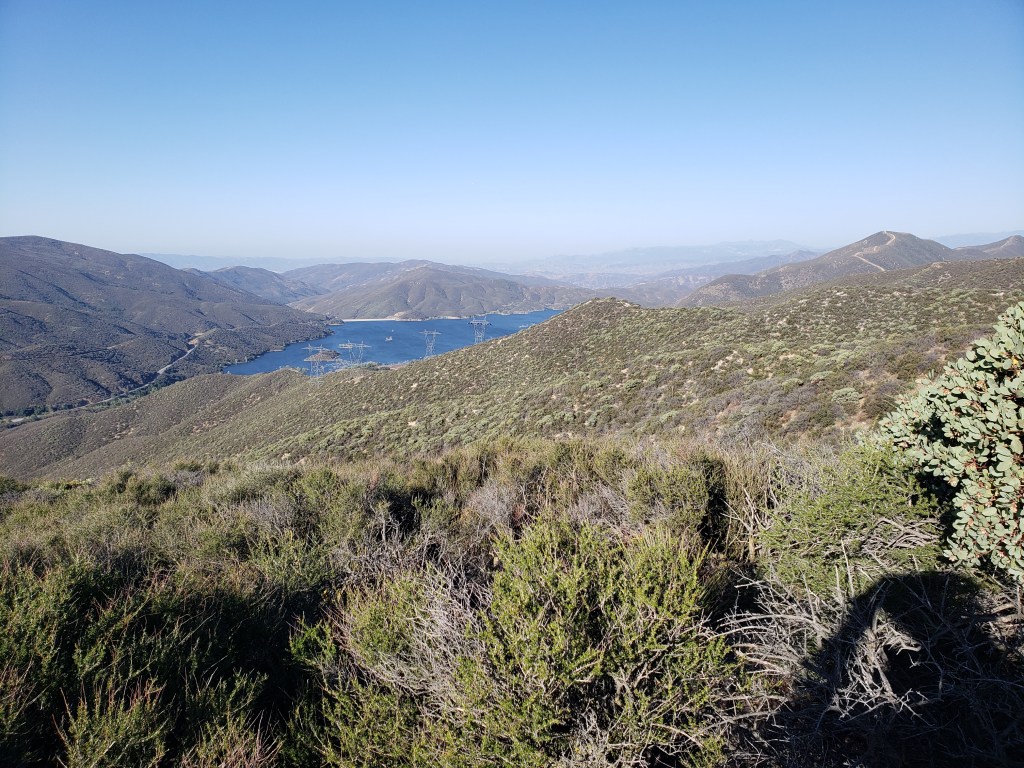
In climbing out of the Coachella Valley to the shoulder of Mt. San Jacinto, there’s a 20 mile stretch between proven drinking water sources — a faucet provided by the Desert Water Authority at their Snow Creek collection facility at the edge of the Valley and the headwaters of San Jacinto River on the mountain high above. I was able to cut 5 miles off that gap by melting snow I found in the trees at 7900 feet.
c) Andrew Carter, 2021
Here’s a video I shot yesterday when I made it to the trees on Mt. San Jacinto after 12 miles of climbing and 4000 feet of elevation gain to escape the hot, sunny Coachella Valley near Palm Springs.
c) Andrew Carter, 2021
This is for my brother Tom. Don’t blame him for the length of the video and the static visuals. Also, don’t blame the on-screen talent. My editor, producer, copywriter, and cameraman did poor work. I’ll try to find new ones tomorrow.
c) Andrew Carter, 2021
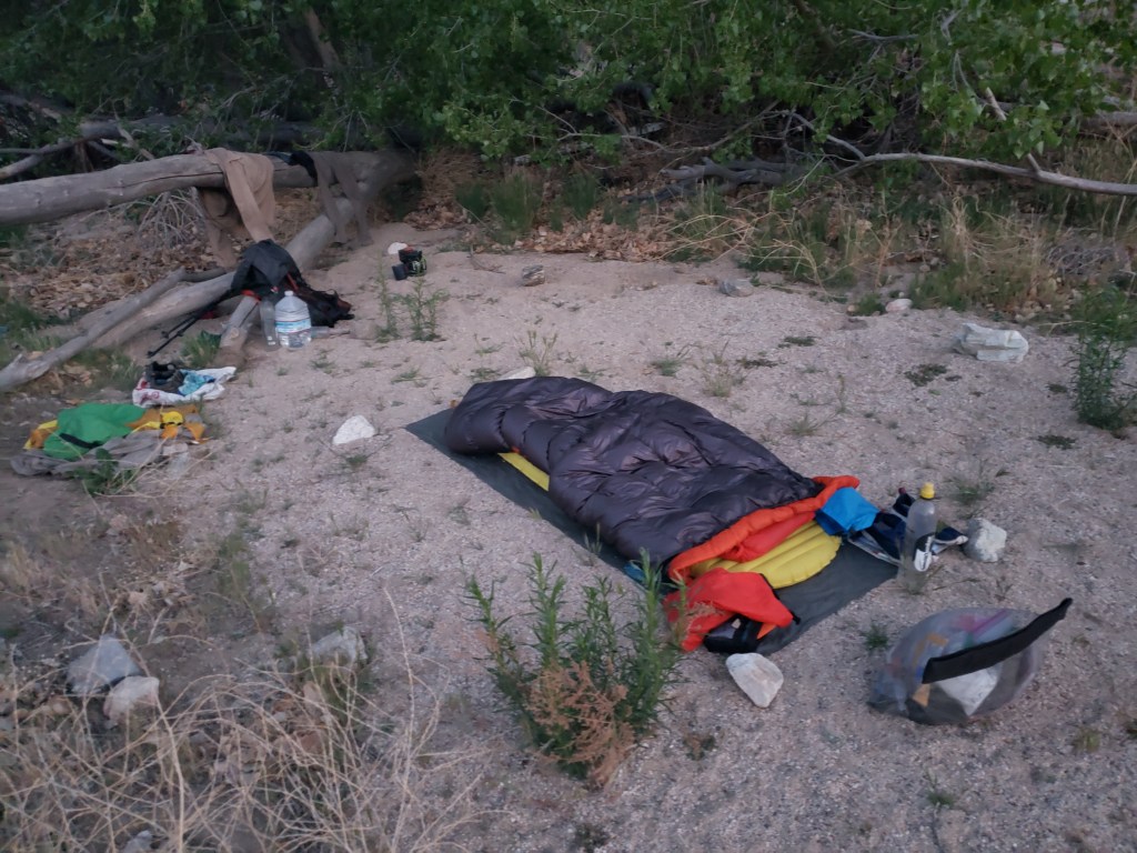
Yesterday, I camped beside the Whitewater River, which disappears into the sand and empties into the Coachella Valley near Palm Springs. Here’s a video tour of my campsite. This is by far the nicest campsite I’ve had so far (in 400+ miles).
And here’s me enjoying the Whitewater River Spa.
c) Andrew Carter, 2021
I hiked only 2 miles on 5/7, then got a ride into Big Bear for a “nearo.” Everything seemed to go slightly wrong during my stay.
First, I made the mistake of staying at the Motel 6 at the edge of Big Bear City instead of a motel or hostel in Big Bear Lake. I did this because the motels in Big Bear Lake cost more and many require a two-day stay on the weekend. (I was there on Friday.) As for the hostel, I was worried about the lack of social distancing followed by the young hikers I meet.

A Motel 6 is a Motel 6, that wasn’t the issue. The issue is there isn’t much within walking distance and what is there closes at sundown. I didn’t realize this until I headed out to eat at 8:00 pm.
Fortunately, there is a dance hall across the street which does serve food. The chicken BBQ pizza was so-so, but the beer was cold, and the live band (no cover) was pretty good. I put $5 in the tip jar.
In the morning, I discovered no restaurants open. Breakfast consisted of a Frappacino and a bagged Danish purchased for $6.98 at the nearby liquor store. I should have cranked up my camp stove in my room and made oatmeal and coffee. Sigh.
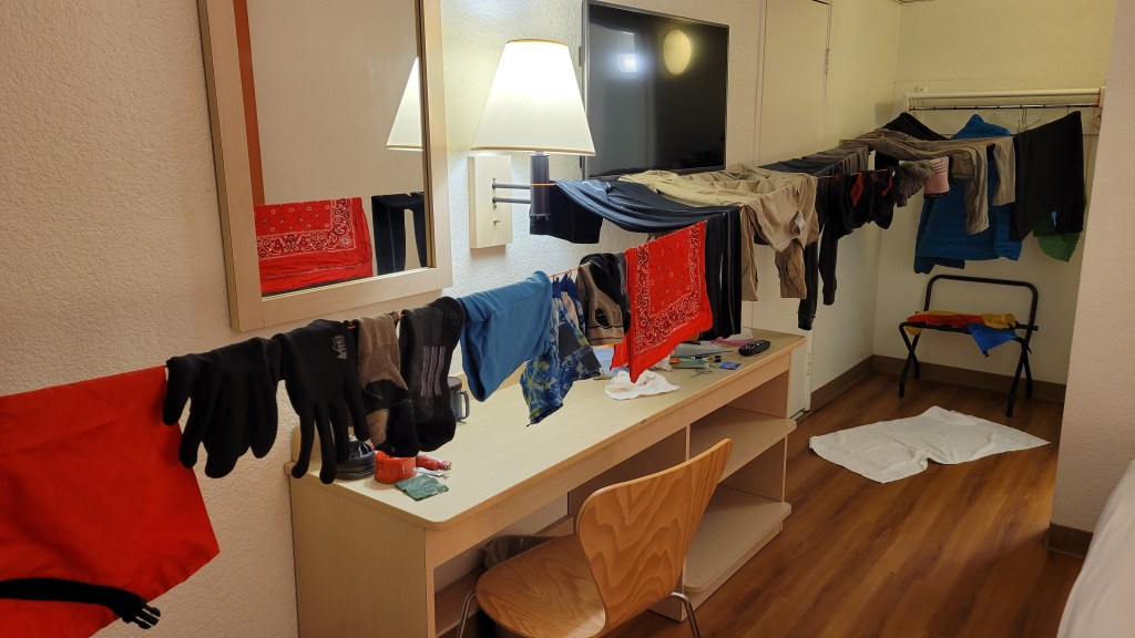
The Motel 6 does have coin-operated washing machines, but no dryers. Here’s the clothesline I created in my room to dry everything out.
I also had time to watch “Sex, Lies, and Videotape,” on HBO, Steven Soderbergh’s classic 1989 movie. And let’s not forget two hot showers.
Big Bear is set-up for cars, not pedestrians. From the Motel 6 to the grocery stores (Von’s and Stater Brothers), drug stores (Walgreens and CVS), and the Dollar Tree is about 1.5 miles. Then it’s another 1.5 miles to Big 5. And from there, another 1.5 miles to “the Village” — the downtown, touristy, commercial district.
Unfortunately, I needed to make purchases at all three places. At least there is an hourly bus, so I took it to the Village, then walked all the way back (4.5 miles) to the Motel 6, making purchases along the way.
The long walk gave me plenty of time to see what a sad place Big Bear is. Seemingly, no zoning and definitely no community design or maintenance standards. Sprawl and more sprawl. Tons of fast-moving car traffic on 4-lane Big Bear Boulevard. Tons of poorly maintained wood commercial buildings. Many closed, some abandoned. Then new construction next to all of that. Residential, next to commercial, next to service, next to industrial, next to empty lots.
What do you suppose is in the middle of the community health complex? A paving company with a gravel parking lot, parked machinery, and a debris pile.
I survived all that yesterday, but the final aggravation was this morning. I needed to take the city bus to the edge of town and hitchhike from the there to the trail.
Unfortunarely, the information put out by Mountain Transit is almost indecipherable.
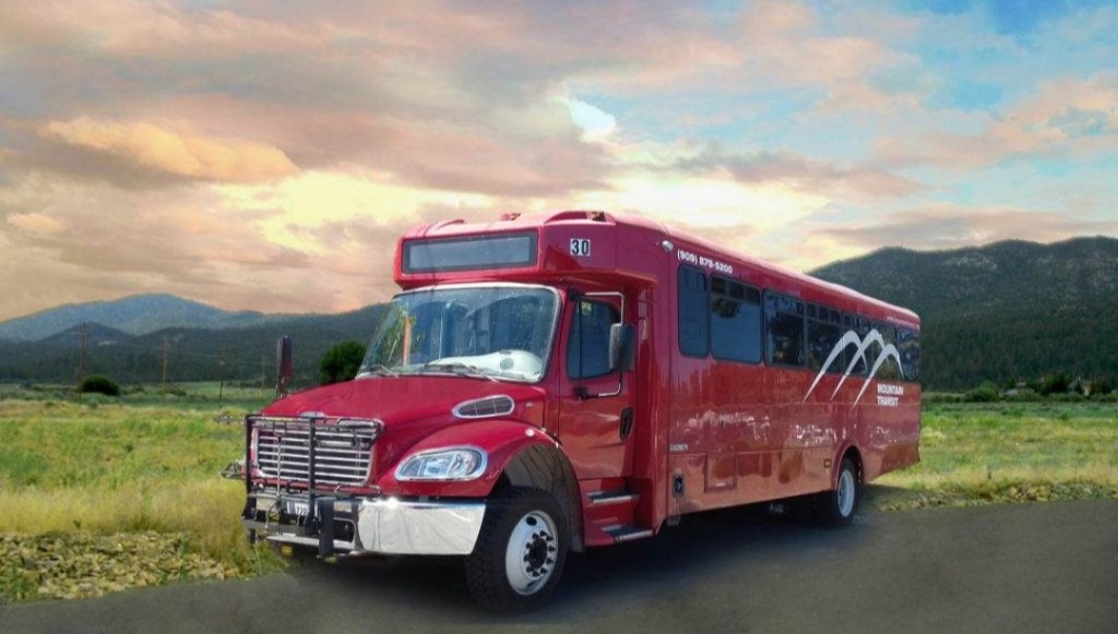
That’s true of the transit map. Which loops are inbound, which loops are outbound? Which routes operate 5-days-per-week, which routes operate on weekends? It’s hard to tell.
That’s true of the bus schedule. The printed ones available at the motel are pre-covid with the wrong times, and there are no new schedules available on the buses. There are only posted Xerox sheets. And most bus stops don’t have a posted schedule.
Then, there’s the online app which doesn’t show all the routes. That’s helpful.
Finally this morning, I told the bus driver when I got on, where I wanted to get off. But then, 20 minutes later, she wanted me to get off at a stop several miles from my intended destination. Fortunately, I realized it was the wrong place before I got off. Otherwise I would have been in a pickle.
Well, I’m back on the trail now. Big Bear is behind me. I don’t plan on returning anytime soon.
Editor’s note: The headline should read, “I Let Big Bear Steal My Zen.” That’s closer to the truth. I don’t think I’ll get it back today. Perhaps tomorrow.
c) Andrew Carter, 2021
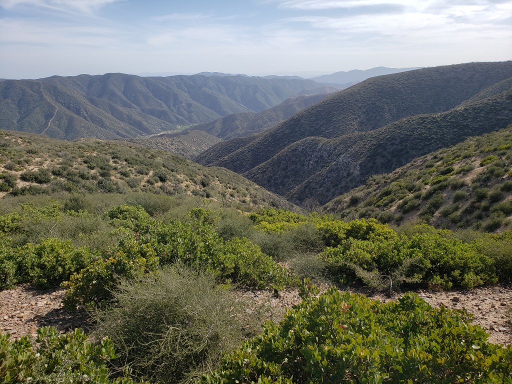
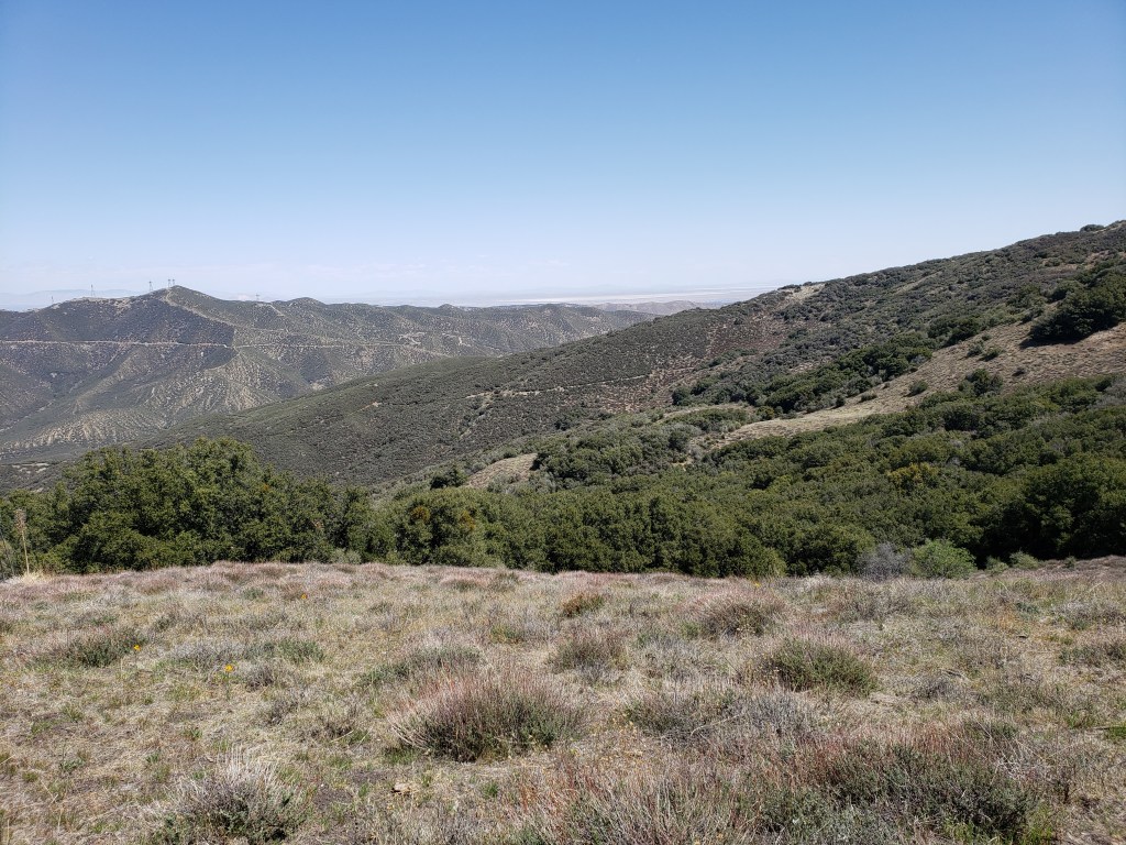
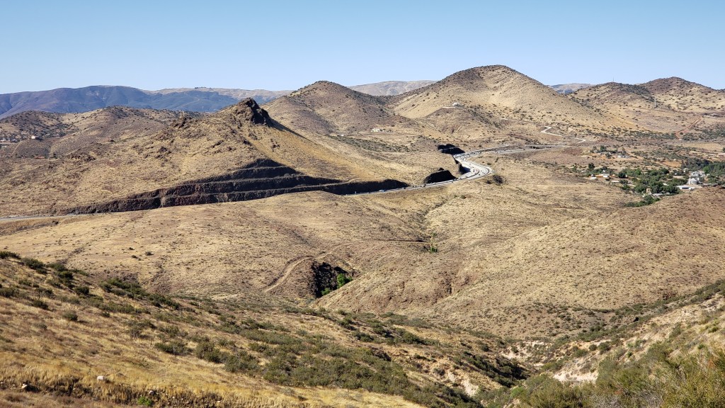
After I passed through the Lake Fire burn zone, I had to cross from one mountain range to another. The northern range is the Sierra Palona. The southern range is the San Gabriel. The San Gabriel is the range which serves as the backdrop to downtown Los Angeles when looking from the ocean. In between the Sierra Palona and the San Gabriel are two canyons — Escondido Canyon and Soledad Canyon. The Antelope Freeway uses Escondido Canyon to get from Santa Clarita to Palmdale. The Santa Clara River flows through Soledad Canyon. The climb out of Soledad Canyon to the crest of the San Gabriel was a beast — 4000 feet of altitude gain over 14 trail miles.


c) Andrew Carter, 2021
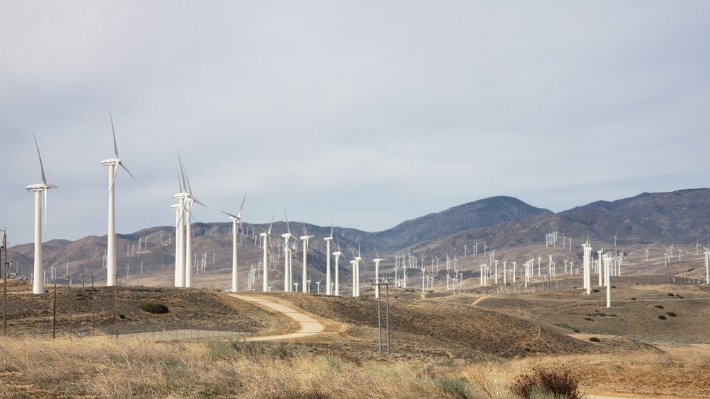
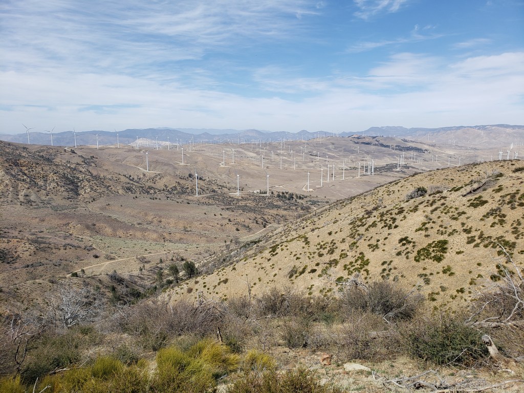
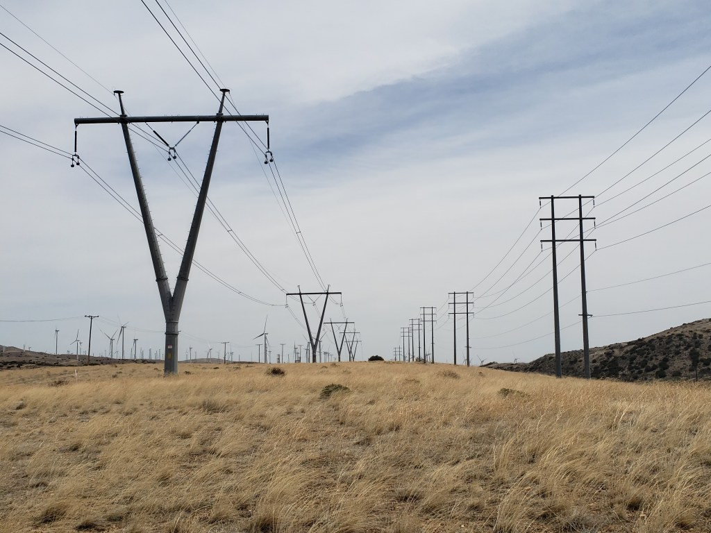
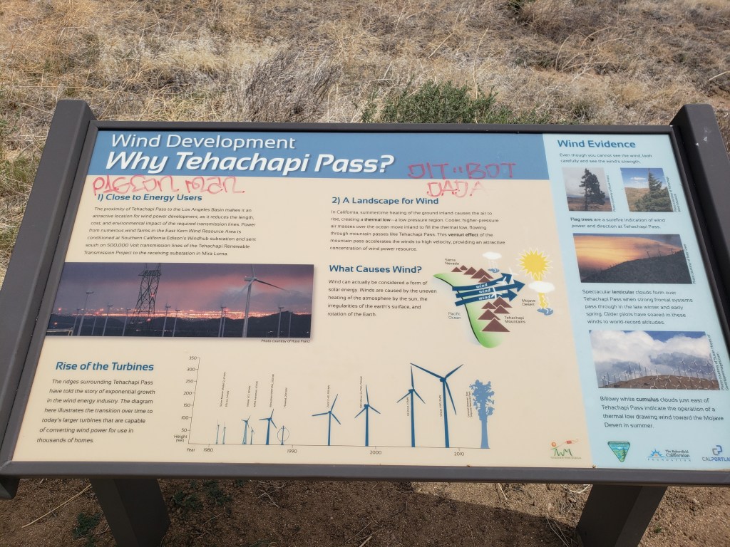
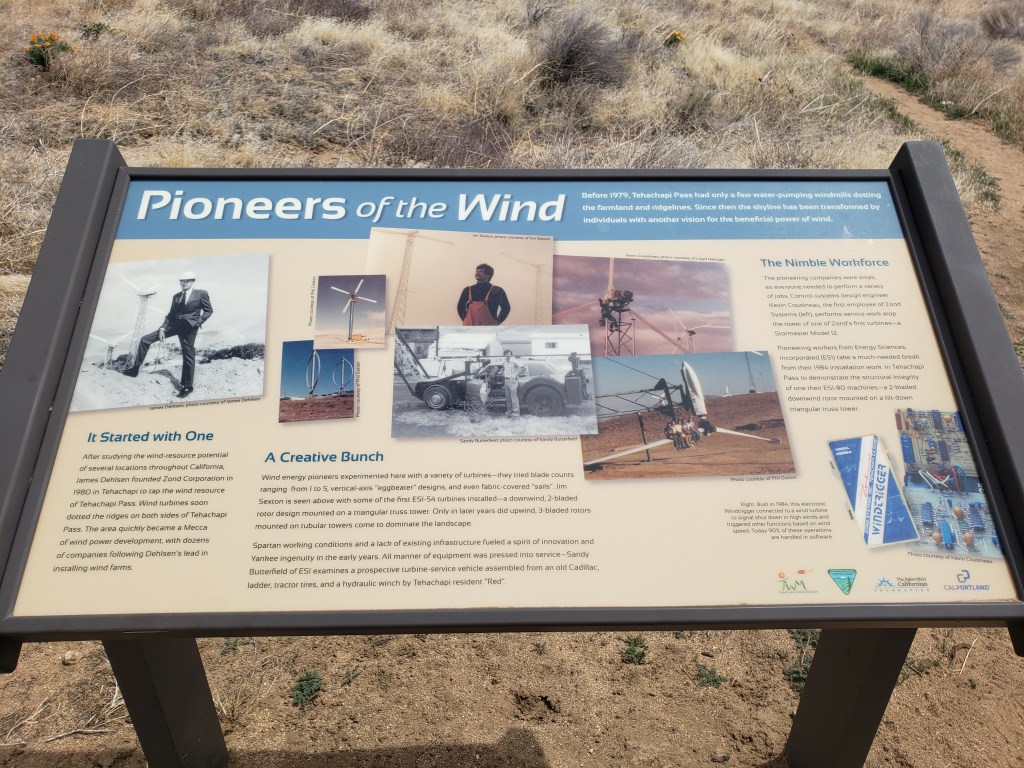
I’ve previously written about the wind turbines at Tehachapi. That includes turbines on both sides of Tehachapi Pass as well as turbines north and south of Tehachapi along the ridge of the Tehachapi Mountains. The ones north of Tehachapi are on the west side of the ridge. The turbines south of Tehachapi are on the east side of the ridge. Here are some photos, including pictures of a wind turbine exhibit where the PCT crosses a road near Tehachapi.


c) Andrew Carter, 2021
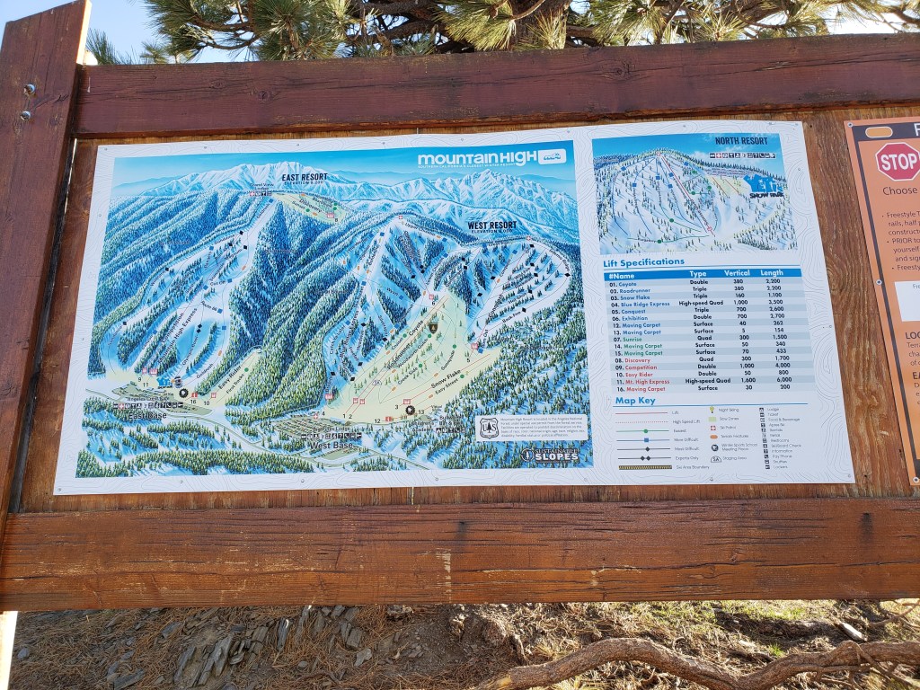
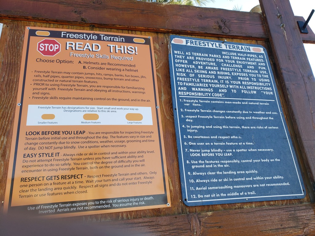
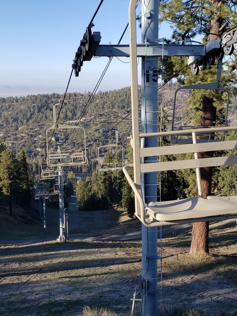
Unlike the national parks, the national forests in the United States are used for many different purposes. That includes timber cutting, mining, and cattle and sheep grazing. In addition, recreation of all types is encouraged — not just hiking and camping, but hunting and fishing, and many forms of “active” recreation. That includes off-road vehicle use and even skiing. The PCT passes by several ski areas in southern California. Here are some photos.