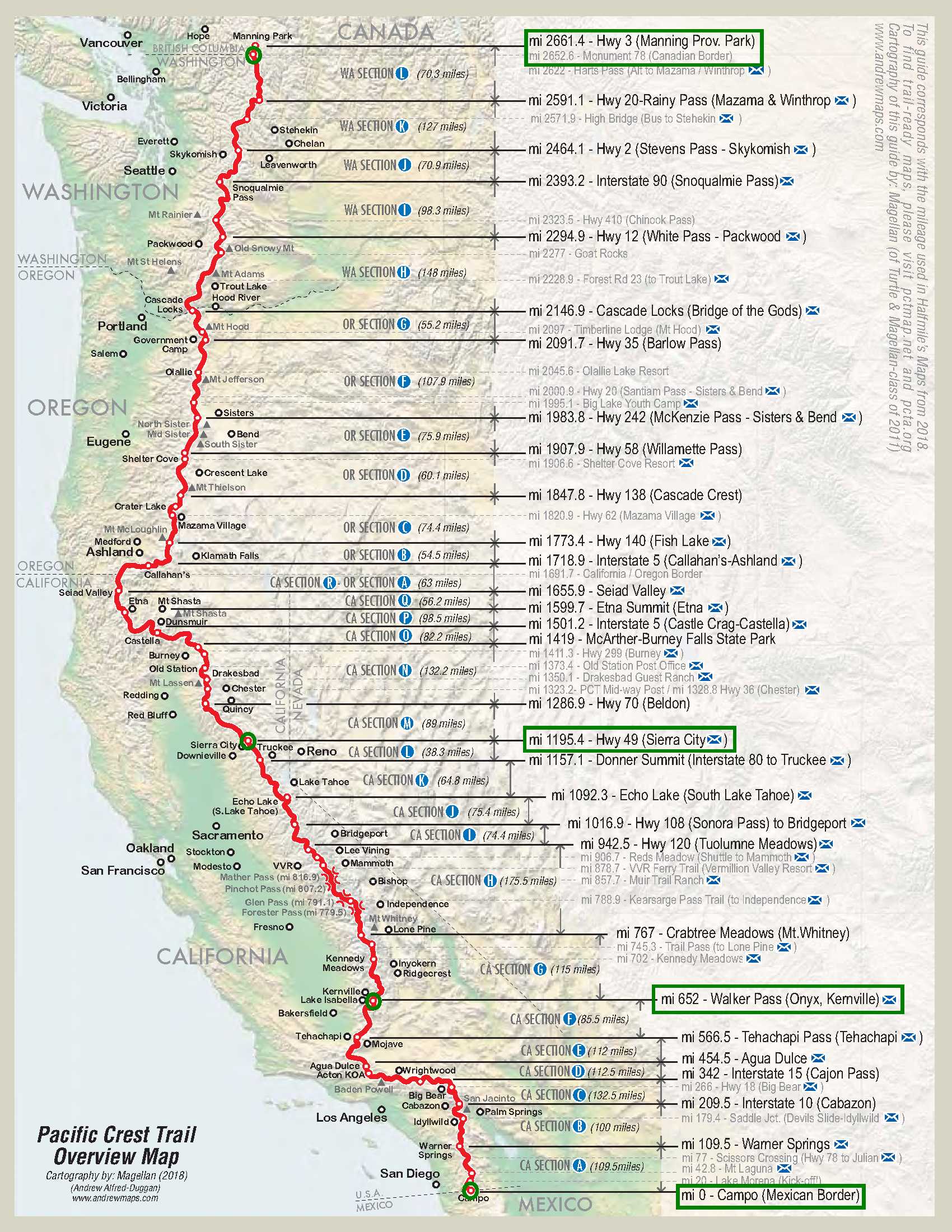
Here’s a map of the Pacific Crest Trail which shows the break points for the sections I’ll be hiking. First, Walker Pass, east of Bakersfield, to the Mexican border at Campo. Then Sierra City, north of Donner Pass, to the Canadian border near Manning Provincial Park, British Columbia. Then Sierra City to Walker Pass through the heart of the Sierra.