c) Andrew Carter, 2021
In Southern California, the PCT is close enough to the Pacific Ocean such that the marine layer rolls in toward the end of the day.
c) Andrew Carter, 2021
In Southern California, the PCT is close enough to the Pacific Ocean such that the marine layer rolls in toward the end of the day.
c) Andrew Carter, 2021
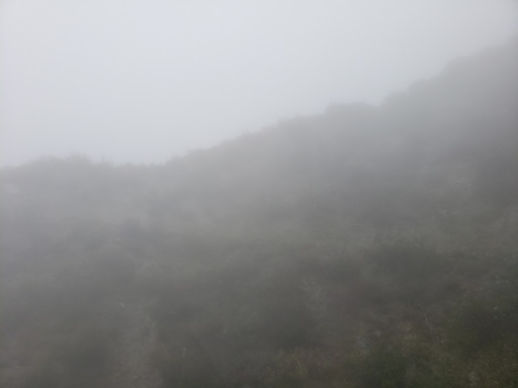
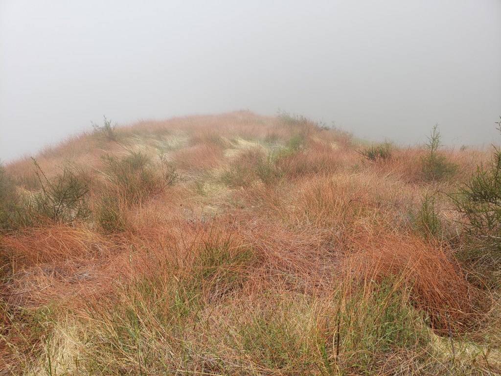
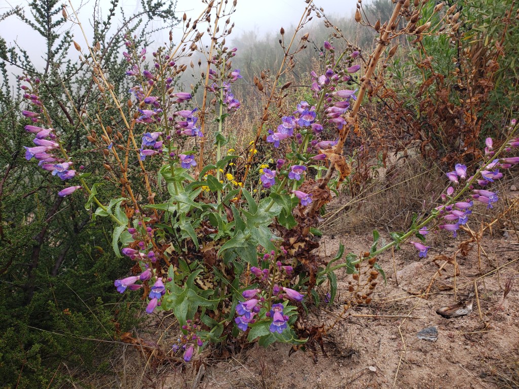
At the start of my last day on the trail before I getting off for a break to come home, I was camped on a ridge top above the I-15 at Cajon Pass. When I awoke, I found myself in a fog bank. Here are photos from that day, walking in the mist.


c) Andrew Carter, 2021
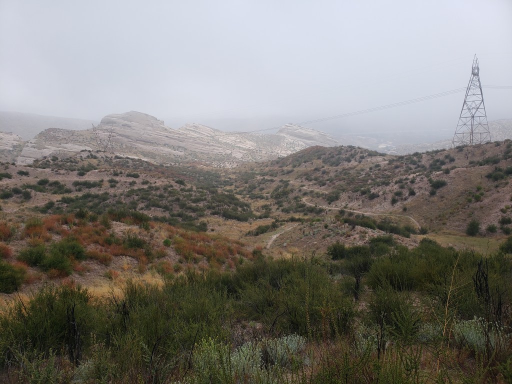
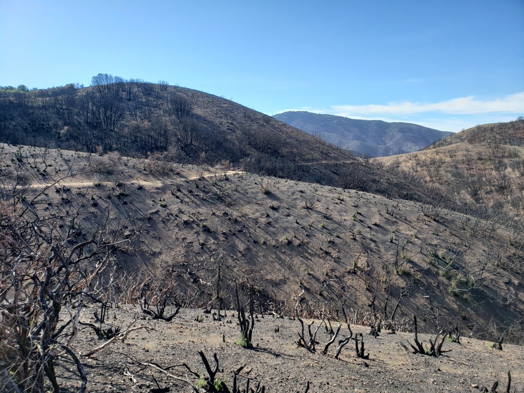
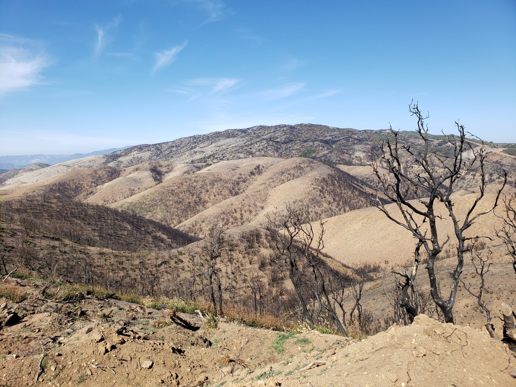
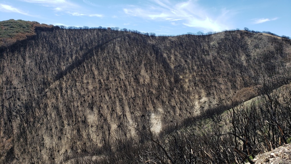
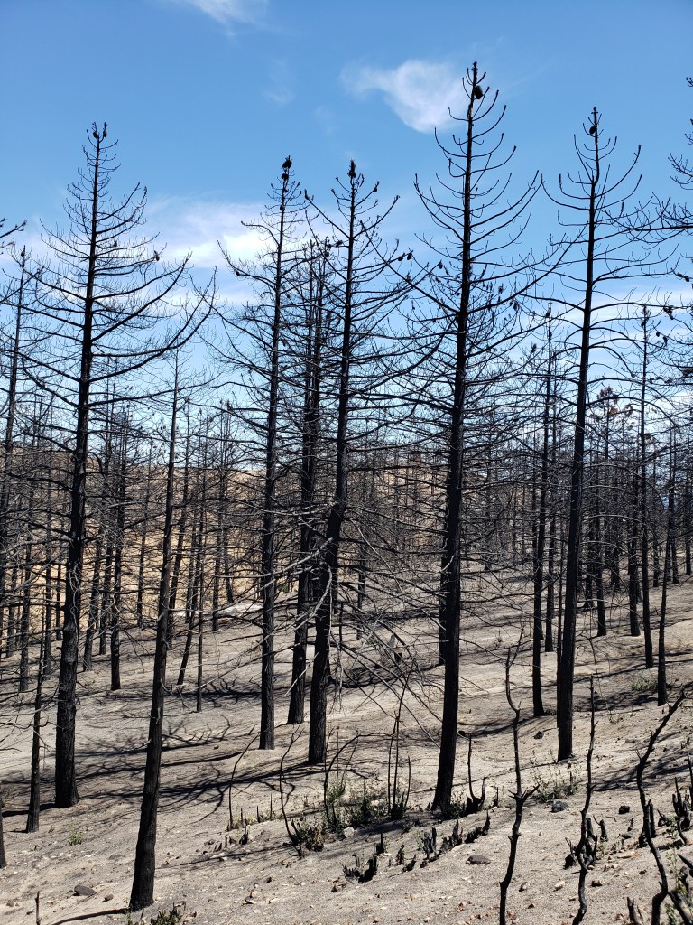
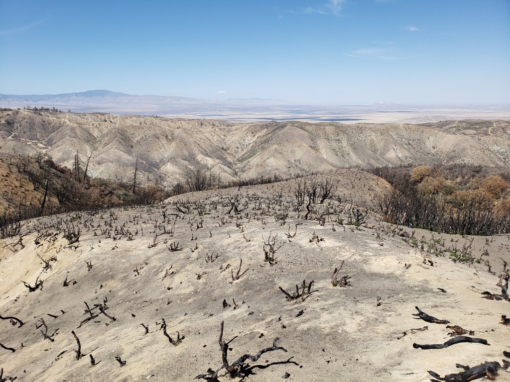
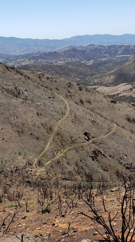
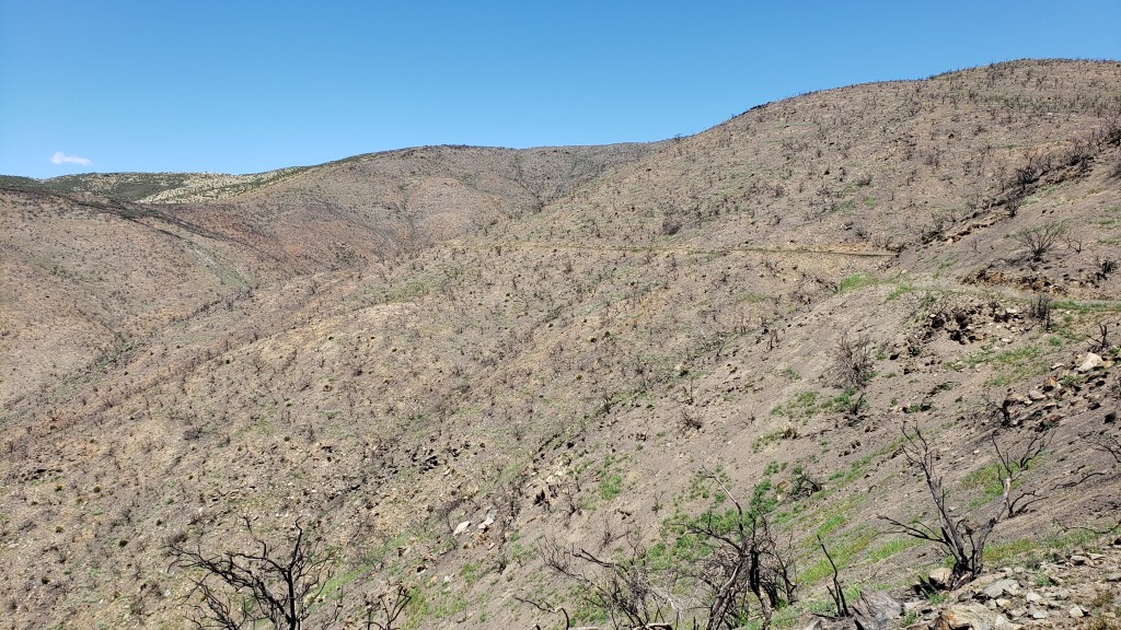
I’ve previously posted video footage of a 360-degree view from the heart of the decimated 2020 Lake Fire burn zone near Lake Hughes. I’ve also posted several photos from the edge of that fire zone, including one of where I camped one night.
Here are more photos of burn zones from the 2020 Lake Fire, the 2020 Bobcat Fire farther south in the Angeles National Forest, and from wildfires which took place in previous years.
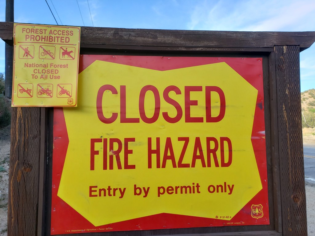
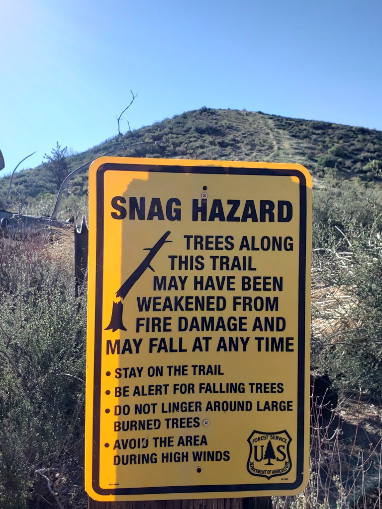
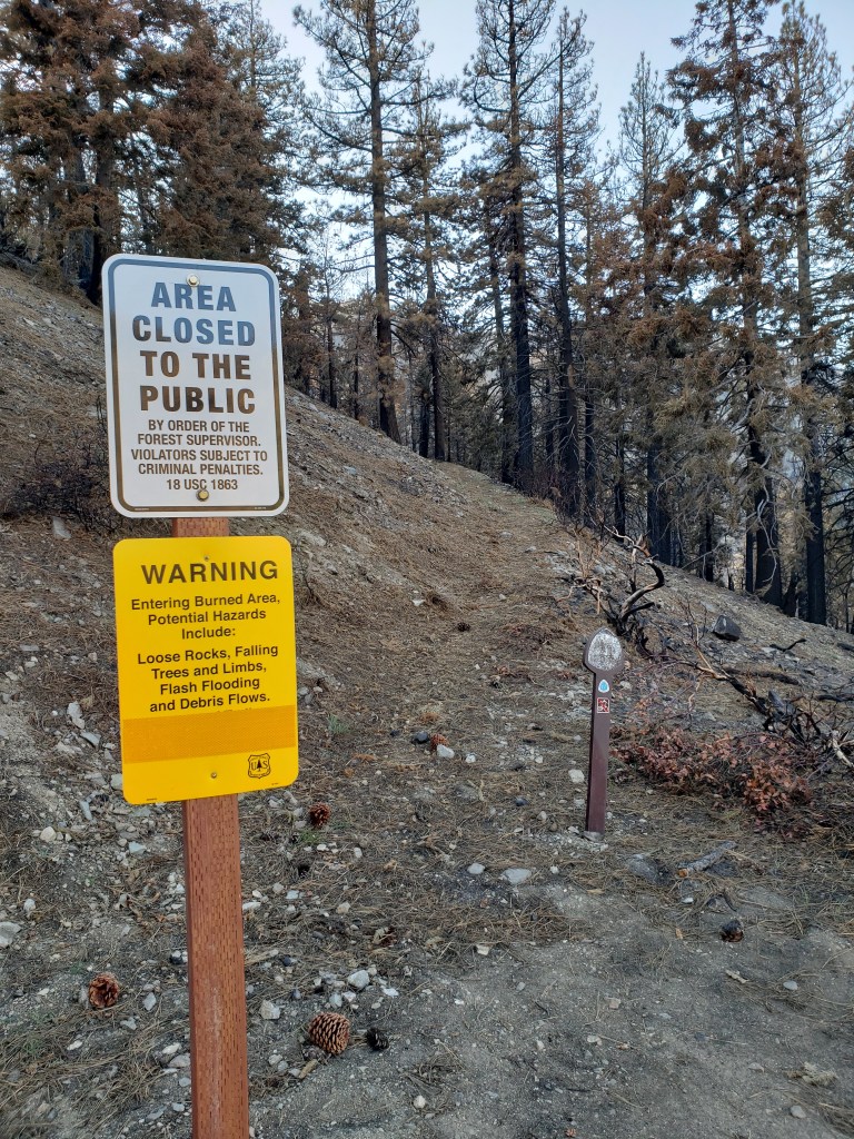
Fire is a fact of life in southern California. With climate change, it is only getting worse. Wildfire hits every year in multiple places along the PCT, including farther north in Oregon and even sometimes in Washington. That means that each year, there is inevitably some part of the trail which is closed due to fire.
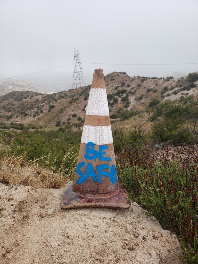
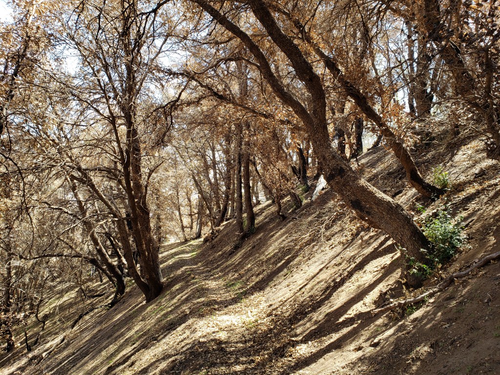
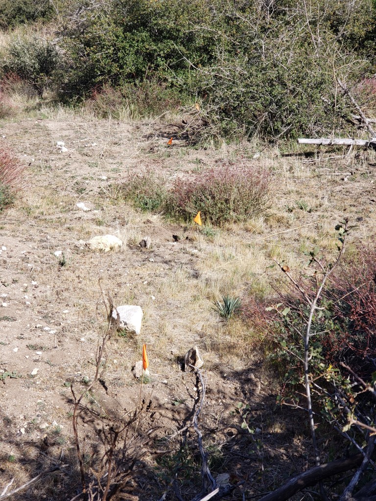
I hiked through the Lake Fire burn zone even though it was actually closed. I didn’t know it was closed, however, because there was no signage for southbound hikers. Just signage at the southern border of the zone for northbound hikers. (See sign below.)
I knew the Bobcat Fire burn zone was closed so I road-walked for 20 miles on the Angeles Crest Highway to get around it.
At the moment, there is one other burn zone which is currently closed. It’s in Oregon, near Mt. Jefferson. That burn zone is currently scheduled to open up before I get there, but sometimes closure orders are extended. If it doesn’t open, I will be in a pickle getting around it because it is in a very remote area.
I’ve got my fingers crossed that there will be no new fires this year which close part of the PCT. Here’s hoping.


c) Andrew Carter, 2021
If you have a question you’d like answered, submit it in the Comments section and I will try to address it.
Here’s a question that several people have asked, but often the real question is, “Have you seen a bear, a mountain lion, or rattlesnakes?” The answer to that specific question is, “No, I have not.”
Generally, you won’t see a bear unless you are in a campsite where bears have become habituated to the opportunity to steal hiker food. That’s not likely to happen until I reach the Sierra. And in the Sierra, in order to address this, hikers are required to carry a hard plastic bear container which bears can’t open or crush. The penalty for hikers is two pounds of dead weight. Ugg!
The only time I’ve seen bears while hiking is when I’ve come quietly around a corner from down-wind such that the bear had no warning (smell or sound) before actually seeing me. Once a truly wild bear sees you, they take off.
On the mountain lion front, I don’t want to see a mountain lion unless it’s from a great distance. They are stealth animals and if you see one up close, it’s generally not a good thing.
I have seen rattlesnakes often while hiking, just not yet on this trip. I have seen four non-venomous snakes.
Rattlers definitely get the adrenaline flowing, but the rattling is their way of saying, “Back off!” Rattlesnakes only tend to strike if you don’t heed this warning or in the rare instance when one is scrambling on rocks and happens to put one’s hand near an opening where a rattler is hiding. I don’t personally know anyone who has been bitten by a rattlesnake.
So what animals have I seen? Here’s a list:
Insects — beetles, caterpillars (just two or three), butterflies (just one), grasshoppers (just one), bees, ants, and gnats. Fortunately, no mosquitos yet, although those will come. And I have only experienced gnats on part of one day. One chose to commit suicide by flying down my throat. Ack. The moral here is to breath though your nose.
I do carry non-aerosol bug spray and a bug net with me for when the bugs do get bad. That’s going to happen once I flip north. Snowy mountains are notorious in the spring and summer for mosquitos, gnats, black flies, and the like.
Reptiles — lizards, lizards, and more lizards. Also, the four non-venomous snakes mentioned above.
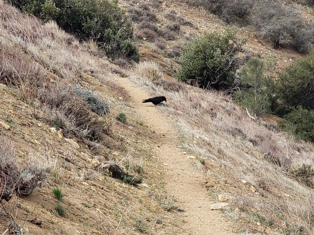
Birds — pheasant, quail, woodpeckers (heard and seen), owls (heard, not seen), ravens (I love their croaking), hawks (just one, amazingly), ducks flying in the desert (they must have been lost), and lots of smaller birds (some song birds, some not). On the small bird front, I’m partial to chickadees. That’s because 40 years ago when I was hiking the Appalachian Trail and I hit my first cold, rainy day, the only other animals I saw in the woods were the chickadees who kept me company while I hiked down the trail.
Here’s a raven hiking the trail.
Oh yes, I forgot. One rare white albatross.
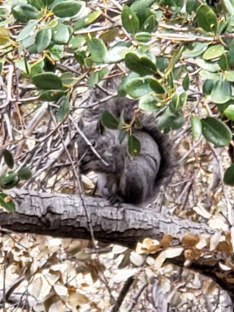
Mammals — ground squirrels, tree squirrels, chipmunks, rabbits, coyote (heard, not seen), deer, and one small grey fox. I came around a corner and there it was perhaps 50 or 60 yards ahead of me. It took off.
I’m sure I’ve seen the droppings of other animals. They often use the trail at night to get from one place to another.
Since the trail does pass through ranch land, I have seen cattle and horses. I’ve also seen a father and son on horseback, riding the trail. (The PCT can be hiked and ridden. In fact, it’s graded its entire length to make riding easier.)

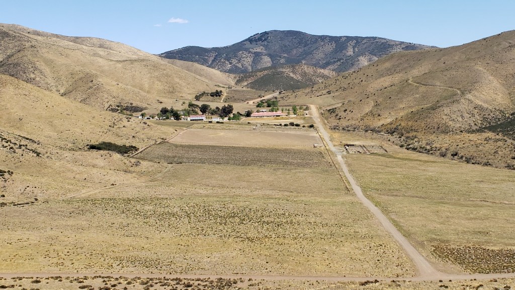
I did come across this one steer using the trail near Tehachapi.

Sadly, no one taught him about “Leave No Trace” practices.
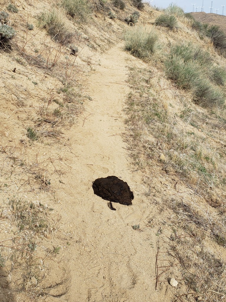
To be honest, his mother may have left this behind, not him.
Finally, there were the remains of this one cow who committed the cardinal sin of not bringing enough water with him into the desert.

A rough lesson, I know.
c) Andrew Carter, 2021
True confession time. You aren’t really a long-distance hiker until you’ve slept in a latrine. Here’s the “room” I stayed in the night I was road-walking part of the Angeles Crest Highway to get around a 20-mile section of the PCT which was closed due to last year’s Bobcat Fire.

Of course, some caveats. The Angeles Crest Highway is closed each winter due to snow. Part of the highway had just recently opened. As a consequence, this latrine had had little recent use and didn’t smell at all. I would have to be very hard up to spend the night in a smelly latrine. You will also note that there is a ground cloth separating my bed from the floor and I am as far away as possible from the actual toilet.
Now, why on earth would I spend the night in a latrine? One, it’s enclosed and I was on top of a very windy ridge. I’ve also spent the night in a latrine on a cold, rainy night. Two, I was walking through a fire zone, and I was not supposed to leave the highway and enter what remained of the woods to make camp. Three, a latrine floor is perfectly flat. No slope that causes you to slide off your air mattress in the night. And no rocks that dig into your back and backside.
I can tell you that I’ve become a connoisseur of latrines. Only the modular concrete ones are big enough to sleep in. Thank you, Americans with Disabilities Act. This concrete latrine (usually called a “vault toilet” or a “waterless restroom” by the industry) was manufactured by Boom Concrete in Newell, SD. I’ve also slept in one made by CXT of Spokane, WA and Hillsboro, TX. It was nicer because it was bigger. I’ve never had the opportunity to sleep in a Romtec or Missoula Concrete vault toilet. From an aesthetic standpoint, those are the top of the line, with the concrete sides molded into fancy faux field stone and faux log timber. But someday ….
So yes, I know that you, dear reader, are tittering while you read this. But until you’ve “been there,” I won’t bother to listen.
c) Andrew Carter, 2021
Of course, you have to take the off ramp.
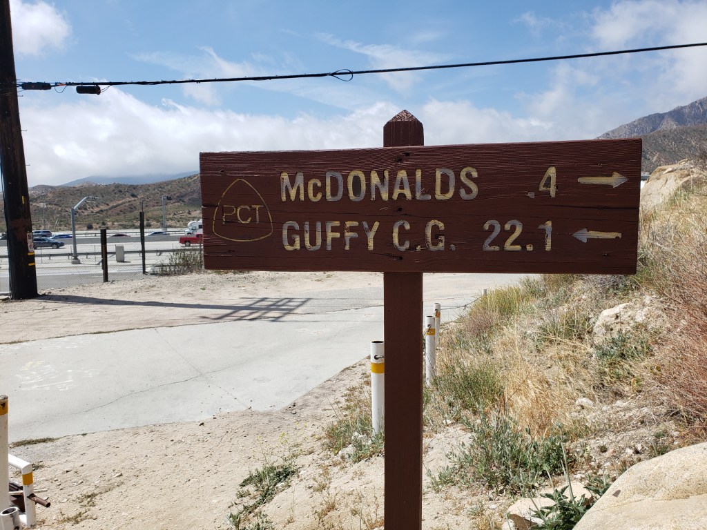
The PCT crosses under the I-15 at Cajon Pass north of San Bernardino at Exit 131. You’ll find there a Chevron gas station and convenience store, a Best Western motel, a Del Taco, a Subway, several taco trucks, fruit, and slushee vendors, and … a McDonald’s. There’s even a sign on the PCT, letting you know the McDonald’s is just 4/10’s of a mile from the trail. Here’s that sign and a picture of the McDonald’s with some happy “hiker trash” out front.
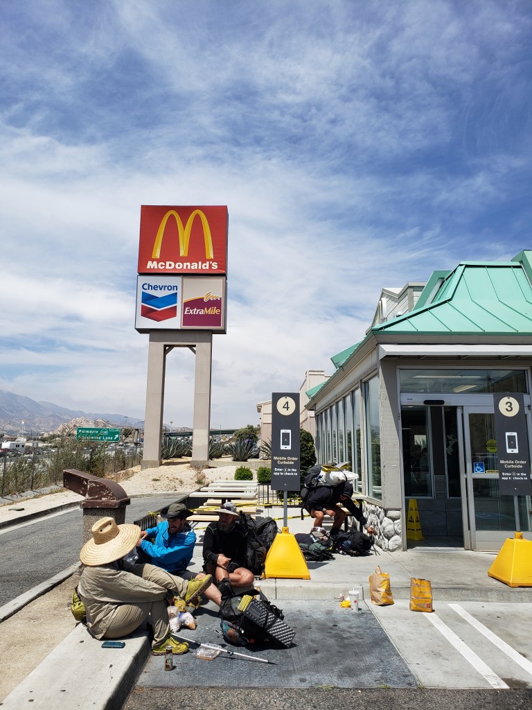
The hiker in dark clothing bending over his pack to the right of the #4 sign was actually stuffing the pack with six McDouble’s (2 for $3.50) which he planned to consume at dinner. Given the size of the two bags at the curb, which is where he had been sitting beforehand, I’m guessing he had six McDouble’s for lunch as well.
As for me, I had just two McDouble’s, a large cup of coffee, and two ice cream cones. Since my son William was going to pick me up in an hour, I didn’t want to ruin my appetite for dinner. For dinner, I ended up having a large pizza and three ice-cold Pacifico beers.
By the way, the Appalachian Trail does not have its own McDonald’s. Only in California.
c) Andrew Carter. 2021
Take the 3-week 310-mile PCT Challenge

“I haven’t weighed this little in 30 years,” says satisfied user Andrew Carter.
The typical PCT hiker can burn 4000 to 5000 calories a day when hiking, so losing weight can be easy and maintaining weight can be hard. You really have to focus on consuming those calories.
I’ve lost about ten pounds during the first three weeks of my hike, which isn’t that much. When I hiked the Appalachian Trail at the age of 20, I lost 15 pounds in the first ten days. Of course, I had a teenage metabolism back then.
For breakfast, I’ve switched from two packets of instant oatmeal, cream of wheat, or grits in the morning to three. (The grits are because I grew up in the South.) I add sugar and Nido fortified whole milk powder to these and wash them down with a “café mocha” (Nestle hot chocolate plus instant coffee).
During the day, I generally stop at least three times for a snack or lunch, which will consist of some combination of candy bars, granola bars, dried fruit, and tortillas. (Although I love jerky, I don’t eat it when hiking because it gives me indigestion.)
At dinner, I make sure to have at least two foil packets of tuna, chicken, spam, or pork BBQ plus a 4-serving packet of some sort of starch (instant potatoes, couscous, rice, pasta side dishes, etc.). I’ll often fortify these with a tablespoon or two of olive oil plus parmesan cheese, and some nights I’ll add a creamy soup course after.
Hikers are renowned for the amount of food they will eat when they hit town. Why eat one large pizza when you can have two? And why just one or two Big Macs when three or four will satisfy you more? And you might as well have two milk shakes instead of one, plus two large servings of fries. The quintessential hiker haven used to be the “all you can eat” buffet. Sadly, those have gone by the wayside during Covid.
c) Andrew Carter, 2021
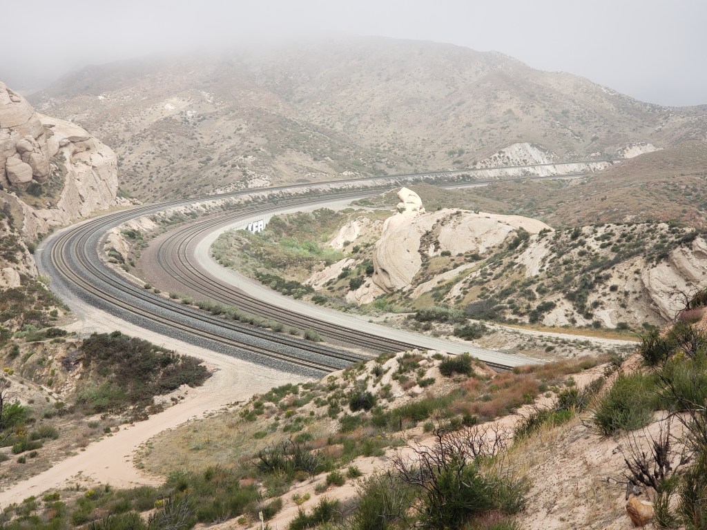
When the PCT has to cross interstates and railroad lines in the low passes it traverses, it often makes use of tunnels and culverts instead of overpasses and underpasses. Here’s the tunnel it uses to cross under the Burlington Northern Santa Fe and Union Pacific railroad tracks in the Cajon Pass north of San Bernardino.

And here’s the sound of my hiking sticks as I walked through the tunnel.
c) Andrew Carter, 2021
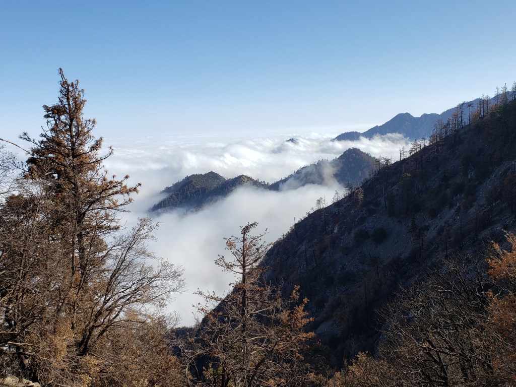
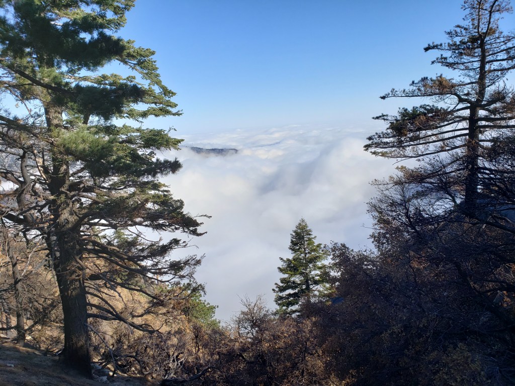
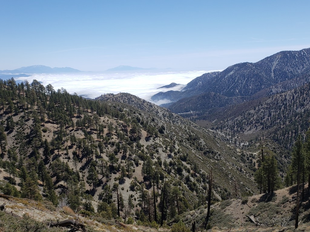
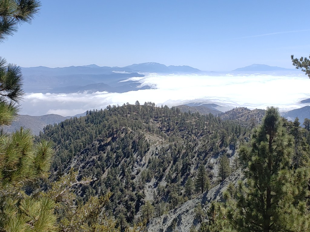
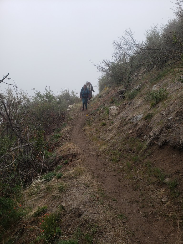
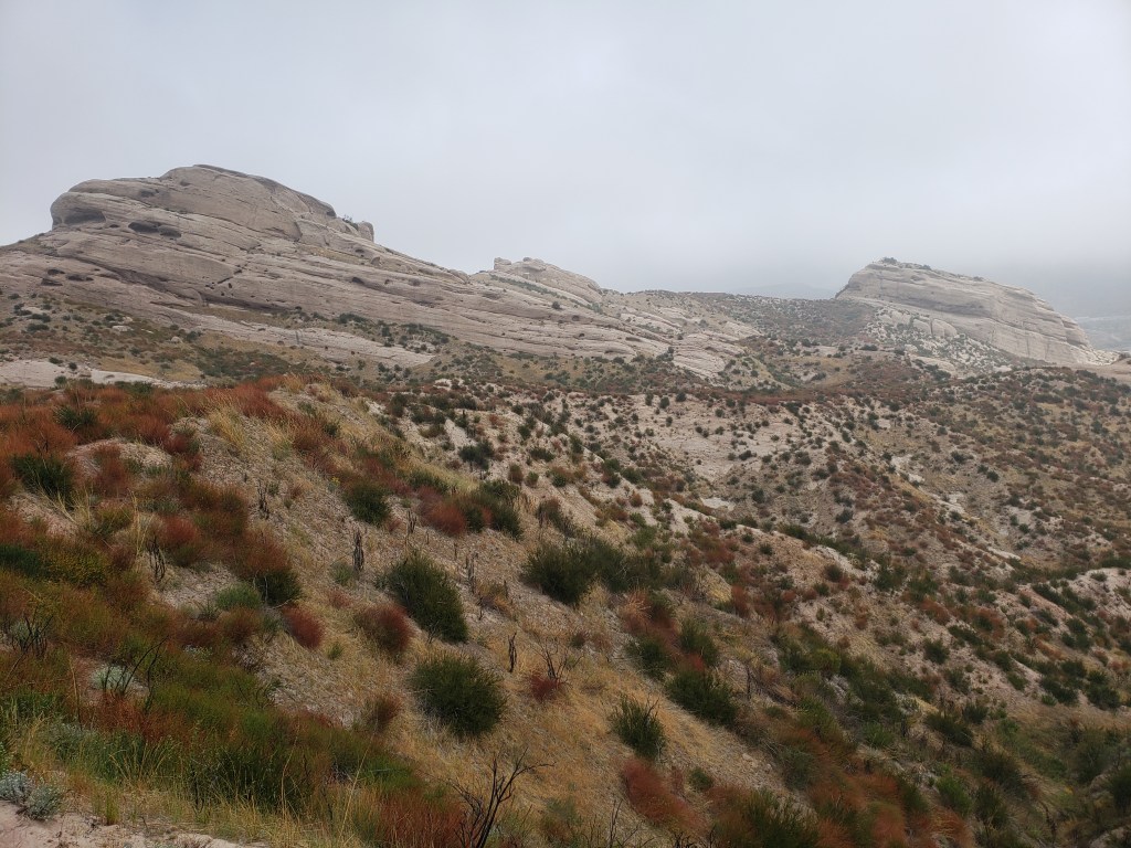
Now that I’ve gotten south to the Angeles National Forest and the Los Angeles basin, I’ve had several mornings where I’ve woken up to a ridgetop campsite shrouded in the mist of the marine layer which has settled in overnight or gotten to watch that layer roll in towards the end of the day.
c) Andrew Carter, 2021
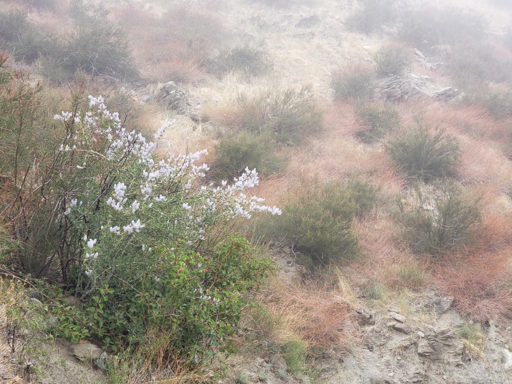
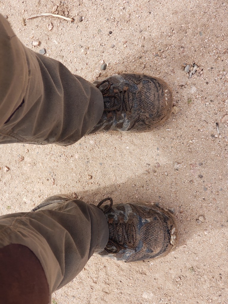
Hiking is not all looking at magnificent views. You also spend a lot of time looking at your feet to make sure you don’t trip over anything. Occasionally, you see more than your feet.
