Occasionally, I’m asked how many miles I’ve hiked in my life. My answer has always been an off-the-top-of-my-head estimate. Most recently that estimate has been 6000 miles.
The estimate was based on having hiked the Appalachian Trail (2100 miles) and the Pacific Crest Trail (2700 miles) plus the several shorter long-distance trails I’ve hiked over the past four years. All those alone would get me to more than 5500 miles, plus I’ve done other hiking besides that.
After I got back from my Long Trail hike, I decided to sit down and think it through and come up with something more exact. The answer? About 7300 miles. Holy heck!
The chart below shows how I came up with this number.
SEKI stands for Sequoia and Kings Canyon National Parks.“SE” for the first park, “KI” for the second.“Approx.” means the actual distance is within one or two miles of what’s shown. “Estimate” means the actual distance may be as much as five miles different from what’s shown. “Guess” means exactly that. I’ve tried to guess low vs. guess high.
I’ve been hiking since I was a kid. I had the good fortune to have a father who hiked. I went on my first overnight when I was five years old. The longest hike I did with my father was a 100-mile section hikers on the Appalachian Trail from Hot Springs, NC through the Smokey Mountains to Fontana Dam.
There were lots of other hikes we went on together when I was young. Some of those hikes were just he and I. Others included my siblings. When I was a young adult, I went on a couple of hikes without my father but with my younger brother, an older sister, even a girlfriend.
After I completed my Appalachian Trail thru-hike in 1977, I did very little hiking for a long time. That’s often the case when you’re an adult. “Life gets in the way” — marriage, career, family, and so on.
It wasn’t until I moved to San Luis Obispo in 1996 that I started hiking again. Much of that has to do with how many trails there are in the surrounding hills. Also, my children were getting old enough to go on hikes. I wanted to expose them to hiking and the great outdoors.
In 2001, I went on my first long hike for almost 25 years. I hiked through the Los Padres National Forest from Montecito to San Luis Obispo. Then I began to go on hikes in the summer with my son William while he was in high school. On our first trip, we summitted Mt. Whitney. On our second, Half Dome.
During college, William didn’t have the time, but after he graduated and was living and working in LA, we started hiking together again — summitting Mt. Baden-Powell, Mt. San Jacinto, and Mt. Gorgonio, also walking across Catalina Island.
In 2021, I retired and began my recent hiking frenzy — the Pacific Crest Trail in the West, the Benton MacKaye Trail and Tuscarora Trail in the East, and the Ozark Highlands Trail and Ouachita Trail in Arkansas. Now, I’ve completed the Long Trail in Vermont. Whew!
I look at that 7300 number and think I should try to get the number up to 10,000. It’s not going to happen. I retired in 2021, but my wife Marta didn’t retire until last August. It was one thing to “ghost” her while she was still working. It’s another thing to do that now that she’s retired. We have non-hiking adventures we want to do together. Even while Marta was working and I was hiking the Pacific Crest Trail, I made sure to never be gone for more than a month.
Do I still have trails I’d like to hike? Yes, of course. I’d particularly like to hike the Colorado Trail. I’ve never hiked in the Rockies. The Colorado Trail is 486 miles long, with an alternate route that can extend the distance to 567 miles. If I’m able to hike either distance, it won’t be in one trip. The shorter distance would take at least four weeks. The longer distance, five weeks. Marta might humor me enough to allow me to do the trail in two trips over two years. We’ll see.
This may be my last “carterhikes.com” post for quite a while since I don’t have other hikes planned. I do need to finish my “Two Trails” book. I’ll let you know when it’s done. Whatever the case, happy trails.
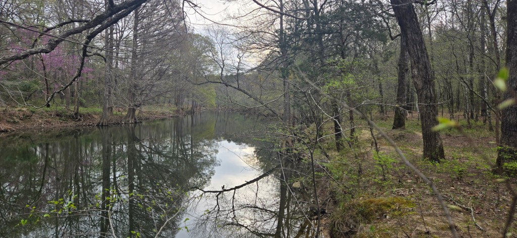
I just finished hiking the Long Trail in Vermont. It runs north/south the entire length of the state. The southern terminus is the Vermont/Massachusetts border. The northern terminus is the Canadian border.
A relief map of Vermont. The left side of the photo is north, the right side is south. At the bottom, west, is Lake Champlain. The dotted left-to-right white line on the ridge crest is the Long Trail running north/south. The dotted white line that heads east (to the top of the photo) from the middle of the photo is the Appalachian Trail on its way to Maine.
If you count approach trails at the north and south end, the Long Trail is 275 miles long. I hiked the trail over two years, 2024 and 2025. I hiked 50 miles in 2024 and 225 miles in 2025.
The blue portion of the Long Trail above is the part of the trail I hiked in 2024 with my son Char. The purple portion is the part I hiked in 2025 by myself.
I had planned to hike the entire trail in 2024 with my adult son Char. We started at the southern end on July 10th, but things didn’t go well from the start
I am an experienced hiker. Char is not. They (preferred pronoun) have only completed a couple of overnight hikes and one weeklong hike. Char lives in Canada. I live in California. We rendezvoused for our hike on the East Coast, so I didn’t have the chance to check their gear before we began. Unfortunately, Char brought too much gear, so their pack was very heavy. Even worse, Char was wearing hiking boots that were too narrow.
We began our hike at North Adams, Massachusetts. Since the Long Trail begins at the Vermont/ Massachusetts border and there is no road there, northbound hikers must start at North Adams and walk to the border to begin their Long Trail hike.
Char at the southern terminus of the Long Trail
Our first night, we camped in our tents at the site of the old Seth Warner Shelter. I’d spent a night in that shelter in 1977 when I thru-hiked the Appalachian Trail. The next day, we hiked to Vermont Route 9 near Bennington. Because Char’s boots were too tight and their toes were hurting, we got off the trail and got a shuttle ride north to Manchester Center, which has an excellent hiking outfitter. Char wanted to buy better fitting hiking shoes. They also took the opportunity to send home extra gear. That included their tent. We planned to spend most nights in shelters and felt we could squeeze into my tent if there was no room or if we needed to camp between shelters.
We got back on the Long Trail at Vermont Route 30 just outside Manchester Center. That meant we skipped 40 miles of trail between Route 9 and Route 30. We started hiking north again. Over three regular days and two partial days, we hiked 30 miles to Vermont Route 103 near Rutland. We spent each night in a shelter.
Highlights included excellent views from the top of Bromley Ski Area, trail magic at Mad Tom Notch, and a text message I received on top of Skyles Peak, letting me know I had just become a grandfather! My granddaughter June was born on July 13th to my son William and his wife Alanna.
As we hiked north, it became increasingly clear that Char was not enjoying the hike. While we were sitting on the rocks at Airport Lookout near Route 103, they let me know they wanted to quit the hike. My hiking plan was too aggressive. Char wanted to hike fewer miles each day. They also wanted to hike more slowly. My pace was too fast. This was all my fault. I hadn’t planned the hike from a novice hiker’s perspective. I should have. I know from my own experience that it’s no fun having to hike farther and faster than one wants to.
We abandoned our hike at Route 103. Instead, we went to see my new granddaughter, Char’s new niece. We also visited my oldest sister and her husband at their lovely lake cottage in New Hampshire.
Here’s a summary of the 2024 part of my Long Trail hike.
Char and I hiked 50.5 miles. We spent four nights in shelters, one night in our tents, and two nights in town. We averaged 7.2 miles per day. Not counting the two short days going into and out of town, our average was 9.2 miles per day. It rained on us the first night of our hike. Other than that, the weather was clear.
I came back by myself this September to hike the rest of the Long Trail. Instead of hiking northbound as in 2024, I decided to hike the trail southbound. That’s because I wanted to cross over the trail’s highest point, Mt. Mansfield, near the beginning of my hike instead of near the end. Autumn had just begun. I was worried about dropping temperatures, particularly at higher elevations. I thought it better to face that risk early in my hike instead of later.
I tied my hike into attending my 50th high school reunion in Connecticut. I flew east from California, attended the reunion, drove a rental car to Burlington, Vermont, and got a hiker shuttle from there to Journey’s End. That’s the closest road access to the northern terminus. There’s a shelter near Journey’s End. I spent the night there and began my hike the next day, September 22nd.
Instead of writing a day-by-day travelogue of my hike, I’ll provide an overall summary, focus on key takeaways, and mention a few highlights. Here’s the itinerary I followed.
It took me 19 days to hike 225 miles. I spent 16 nights in a shelter, one night in my tent, and two nights in a motel. I averaged 11.9 miles per day. Not counting the two short days I had when I hiked into town plus the one short day I had when I stopped early because of rain, I averaged 13.0 miles per day.
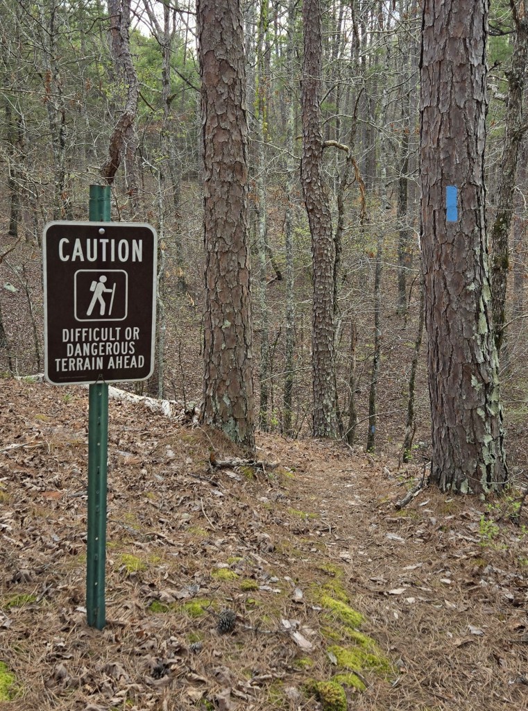
The key thing I discovered during my 2025 hike is that the Long Trail is really two different trails. The southern end is a normal graded trail. The northern end is incredibly rugged. Literally, the most difficult trail I’ve hiked in my life. The trail tends to go straight up and straight down the mountains it crosses. No switchbacks at all. In fact, when I came to the first switchback at mile 80, I stopped and exclaimed, “Oh my god, a switchback.” That switchback existed only because the trail in that section had been rerouted and newly constructed a few years before.
The trail at the north end is seemingly all roots and rocks. You’re frequently using your hands to pull yourself up the mountain and ease yourself down. It was rainy or wet four of the first five days of my hike. That meant the trail was particularly treacherous. I was constantly worried I would slip and fall and break a bone. I love hiking, but worrying about your safety is no fun at all.
About 60 miles into my hike, there began to be ladders, steps, and rebar handholds in the steepest parts of the trail, but there were none at the beginning. What was also frustrating was that there were two places where the trail passed through ski areas. Instead of using the open ski slopes as the trail, the trail builders routed the trail through the steep, slippery rocks in the woods nearby.
The Long Trail was constructed between 1910 and 1930. It’s the oldest long-distance trail in the United States. During this first portion of my 2025 hike, I came up with a slogan for the trail. “The Long Trail, barely improved in 100 years.”
The Green Mountain Club built the trail and maintains it to this day. I found myself wondering if the club is run by curmudgeonly, hardcore Vermonters who refuse to improve the trail because they like it just the way it is. I’m imaging devilish laughs and the words, “If you don’t like the difficulty, don’t hike the trail.”
On Mt. Mansfield, there’s a side trail called Profanity Trail. The northern end of the Long Trail could be called that as well.
When the trail abruptly changed to a more graded trail at mile 145 after descending the aptly named Mt. Horrid, it was startling.
Here are some of the highlights from the 2025 portion of my Long Trail hike.
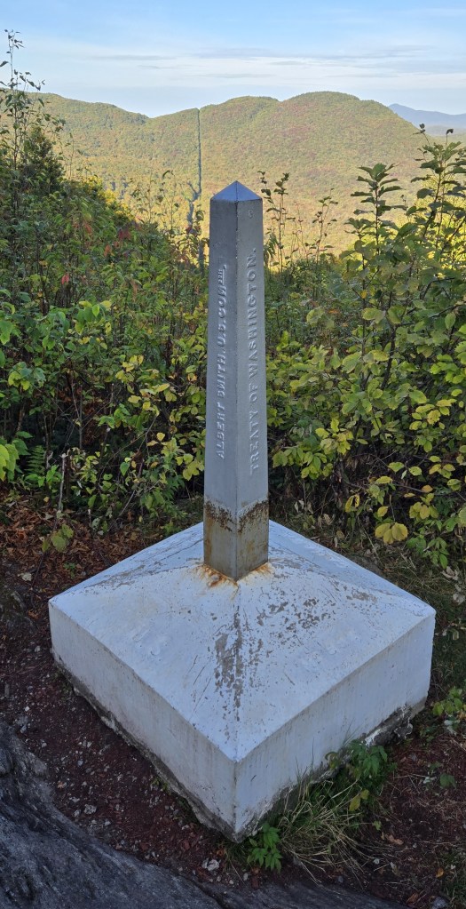
As mentioned earlier, the northern terminus of the Long Trail is the Canadian border. Here are photos of the monument and tree cut which mark the border.
Border monument at the northern terminus of the Long Trail. Note the tree cut behind the monument. That’s the border.
“Canada” is stamped on the north side of the monument pedestal, “U.S” on the south side.
There is a monument every mile along the US/Canadian border from the Atlantic Ocean to the Pacific Ocean. There’s also a tree cut when the border passes through a forest. The Pacific Crest Trail also ends at the Canadian border. Just two years prior, I saw the monument there and the same tree cut.
There’s nothing as satisfying as spending the night in a shelter when it’s raining outside. You’re in the elements, yet out of them – snug, warm and dry in your sleeping bag as the rain bounces off the roof above your head. I spent six nights in shelters when it was raining. I was glad to be in a shelter instead of inside my tent.
The shelters are great for evening camaraderie. During the day, I hiked alone, but most nights I shared the shelters with other hikers. Most of these hikers were also hiking the entire Long Trail, whether northbound or southbound.
The Long Trail passes by or through ten different ski areas. This is both a positive and a negative. The positive part is that there are excellent views from the top of these ski mountains because trees have been cut down to clear a path for the ski lifts and ski trails. Also, most of the ski areas leave their warming huts or their mountaintop lift stations open year-round. Hikers can take shelter in these buildings during inclement weather. I stopped at the Jay Peak Ski Area lift station to eat lunch on a wet and raw day. It was nice to get out of the weather.
The negative is that the tops of these mountains and their slopes have been chopped up for the ski areas. Man has imposed himself on mother nature. You notice the scars.
The hiking experience is also altered by the fact that three of the ski areas – Jay Peak, Stowe, and Killington –keep a ski lift or gondola operating year-round. At Stowe, there’s also an auto road which goes to the top. Tourists pay a fee to use these facilities to reach the top of these mountains without having to climb up them. As a hiker, after a tiring solitary climb, you reach the top and discover yourself thrown into the mass of humanity.
I began my hike at the start of leaf fall. I ended it towards the end of leaf fall. I was aware of autumn advancing with winter soon to follow. By the end of my hike, there was the constant sound of my feet shuffling through dead leaves on the ground.
I was blessed with two glorious sky-blue fall days when I crossed over Mt. Mansfield on one day and over Camels Hump and Burnt Rock the next. All three mountains have rocky tops and no trees. The views were incredible.
At the end of the second day, I texted my wife Marta to say we should move to Vermont. She was not amused. Marta grew up in Minnesota, hating the cold. She moved to California once she graduated from college. There’s no way she would move to a place with winter.
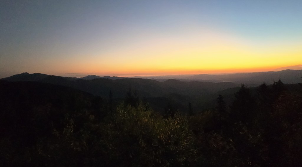
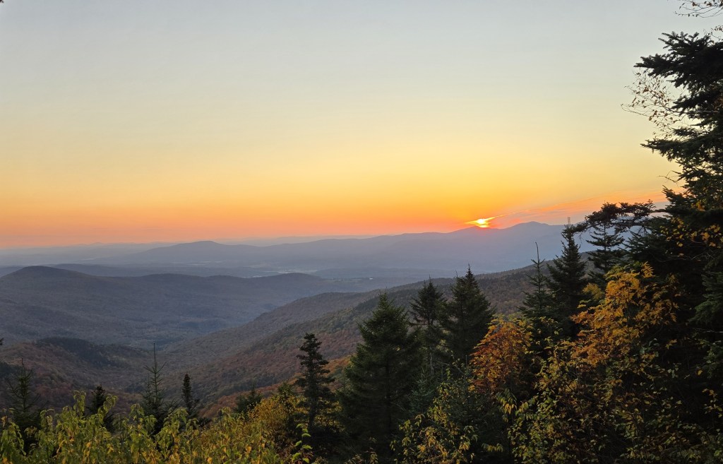
Two of the shelters I stayed in faced east with a small clearing below them. At both, I got to watch the sunrise. Here are two photos of the sunrise at Puffer Shelter.
Sunrise at Puffer Shelter
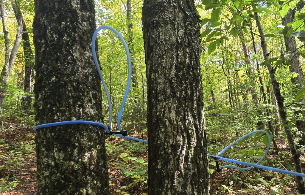
In one place, I walked through a mapling operation. In the past, each tapped tree would have had a bucket to collect the maple sap. The sap would have been collected every day or so, taken down the mountain on sleighs, and then boiled into maple syrup. Now, gravity transports the sap down the mountain through plastic piping strung between the trees.
Maple syrup collection
Near the top of Pico Mountain, I stopped at Pico Camp. It’s an enclosed cabin. During my 1977 Appalachian Trail thru-hike, I spent a cozy night in this cabin after a rainy, sopped-in day. I was 20 then. I’m 68 now. Seeing Pico Camp again made me think about the span of my life and the changes that have taken place over time.
Pico Camp
I saw a bear during my hike. On most hikes, I don’t see any bear. I also saw deer, not unusual, and an amazing number of grouse. As you approach, they take off in a thunder of flapping wings. I didn’t see moose, but I saw a lot of moose poop. At the very top of one mountain, there was a pile of it. I found myself wondering why a moose would climb to the top of a mountain. Since I had just used my cellphone to call my wife, I humorously thought about a moose climbing the mountain to use his cellphone. Did he call his wife?
I’ll close with a self-portrait. That’s a ski lift behind me.
In the posts that follow, you’ll find photos and videos from my hike. I hope you enjoy them.
It’s been a while since I’ve added new content to my hiking blog. Other than information on my forthcoming book, you’ll have to go back to 2023 when I hiked the Ozark Highlands Trail in Arkansas in May and completed my PCT hike in Washington in August. Since then, I’ve been busy off the trail – finishing the first draft of my “Two Trails” book, fixing up three homes, two in preparation for sale, one before moving in, and moving twice.
In 2024, the only hiking I did was a six-day 50-mile on the Long Trail in Vermont with my son Char and a four-day 50-mile hike in the Sierra by myself.
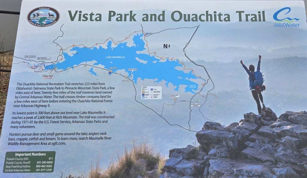
This year, I’ve managed to get out on the trail twice. First in March, to hike the 223-mile Ouachita Trail in Arkansas. Then in late September and early October, to complete the remaining 225 miles of the Long Trail I didn’t hike in 2024.
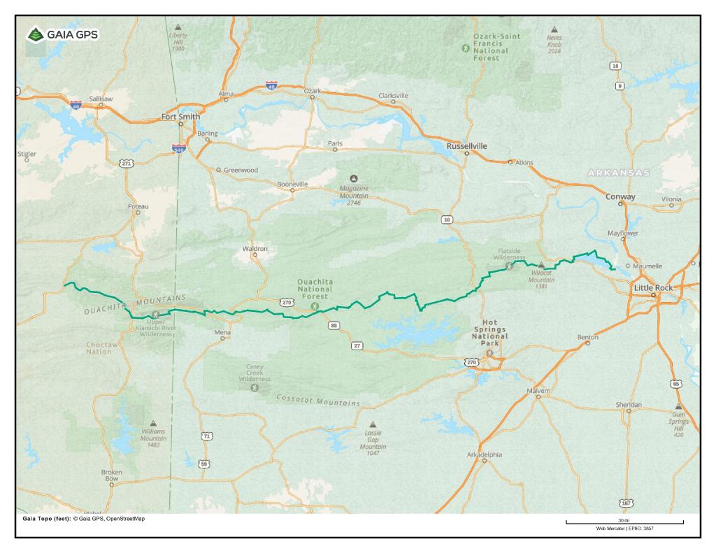
The map below shows the Ouachita Trail. It runs from Talimena State Park in Oklahoma to Pinnacle Mountain State Park in Arkansas, just outside of Little Rock. The trail is 223 miles long and follows the crest of the Ouachita Mountains. This is a legitimate mountain range, albeit a low one. The highest point on the trail is 2610 feet on Rich Mountain near the Oklahoma/Arkansas border. The lowest point is 260 feet near the end of the trail, where it crosses the Maumelle River.
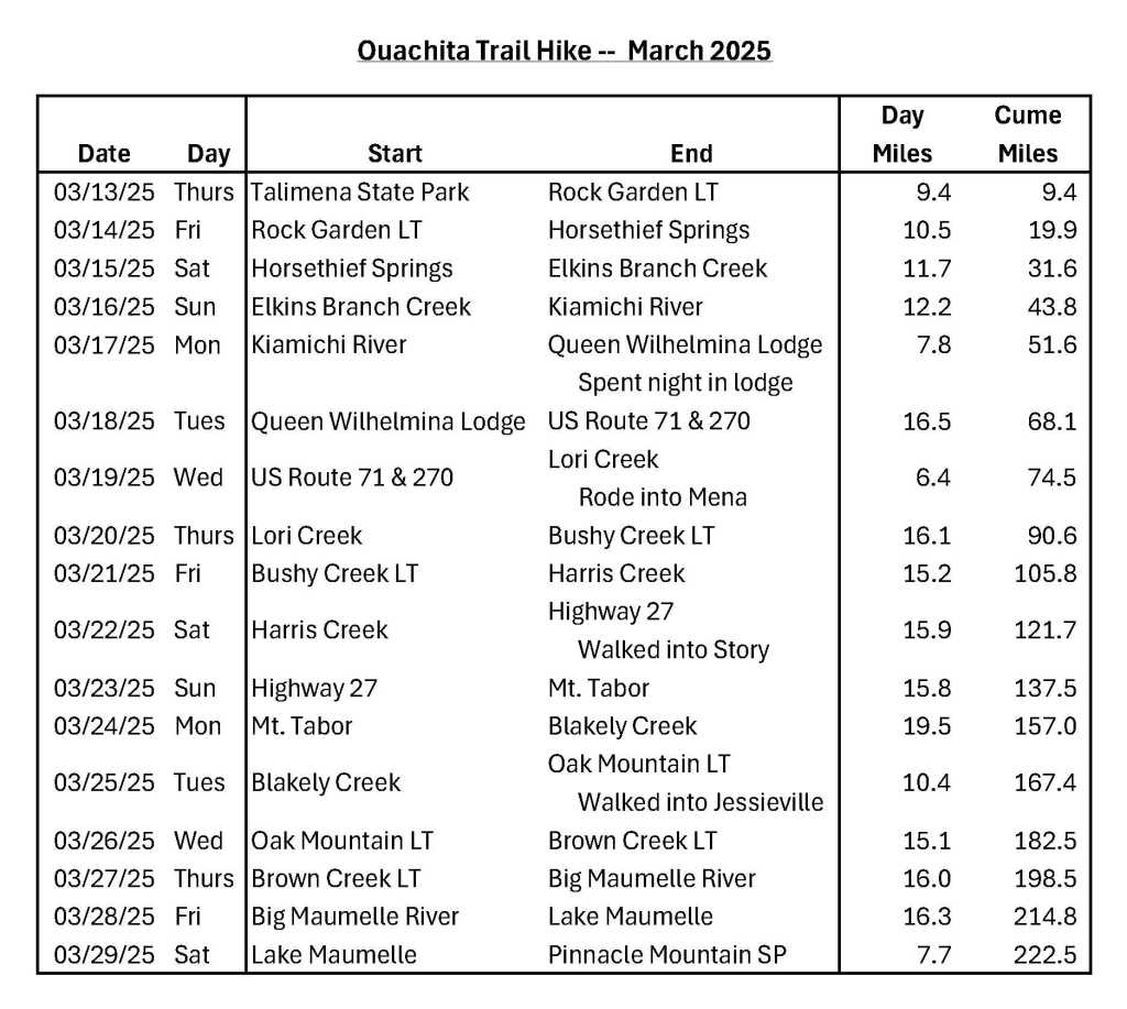
It took me 17 days to hike the trail. Hiking west to east, I started on March 13th and finished on March 29th.
It proved to be an excellent time to hike the Ouachita Trail. The usual high temperature during the day was in the 70’s, the usual low at night in the 40’s. There were a couple of cold nights, but it never got below freezing. Even better, it only rained once and that was at night when I was in my tent.
There was adequate water along the entire length of the trail, although not necessarily at shelters, no flies, and excellent views. The good views were because there were no leaves on the trees when I started my hike. It was only at the very end that spring caught up with me, and the trees were leafing out.
I reached the western end of the trail at Talimena by flying to Northwest Arkansas “International” Airport. It serves Fayetteville, home to the University of Arkansas, and Bentonville, home of Wal-Mart. I used a hiker shuttle to get from there to Talimena, 110 miles away. That cost me $200. It was 110 miles for me, but a round-trip of more than 220 miles for the shuttle driver.
It was much easier to get home. The trail ends in suburban Little Rock. I was able to take an Uber from the Pinnacle Mountain State Park Visitors Center to Bill and Hillary Clinton National Airport in East Little Rock.
Here’s the itinerary I followed. I averaged 13.1 miles per day overall. If I don’t count partial days, I averaged 14.6 miles per day. My longest day was 19.5 miles. My shortest day, 6.4 miles.
The big jump in daily mileage on my sixth day, March 18th, was because my “trail legs” finally kicked in. On my first day, I was absolutely exhausted after hiking less than 10 miles. When I reached the lean-to where I spent the night, I plopped down on the wooden floor to nap and recuperate.
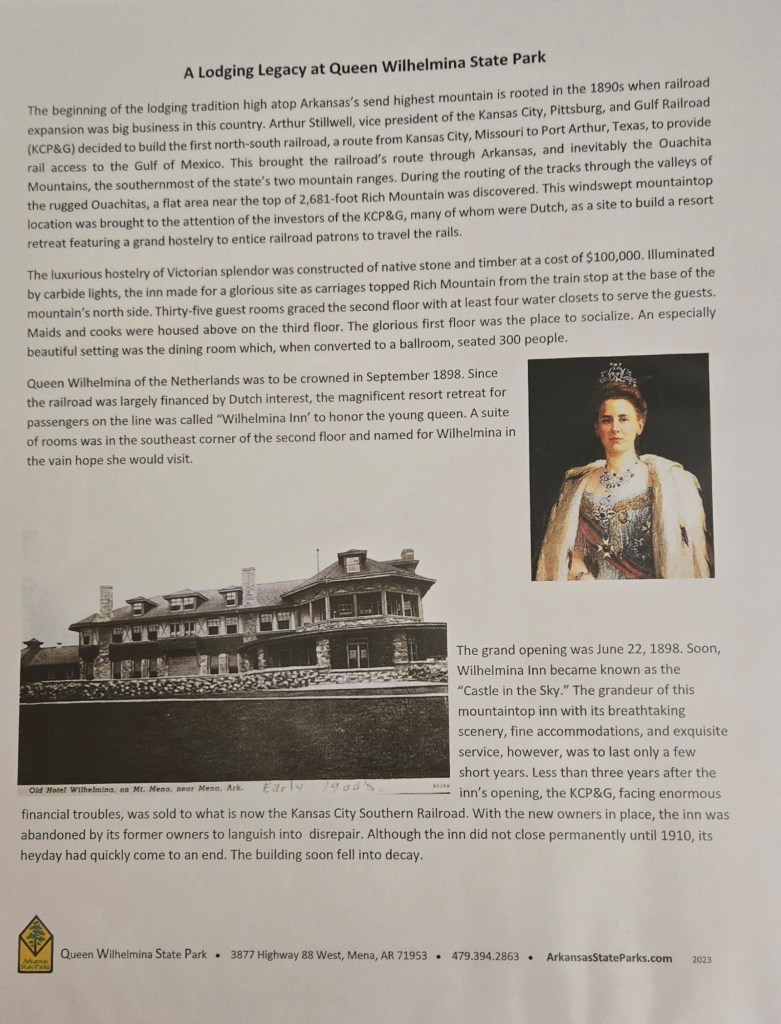
I spent four nights in shelters (shown as LT above, as in “lean-to”), eleven nights in my tent, and one night in a motel – Queen Wilhelmina Lodge in Queen Wilhelmina State Park. The trail goes right past it. There’s an interesting story behind why a state park in Arkansas is named after a Dutch queen. You’ll learn that story in two of the photographs below.
The Lodge has a restaurant with a mountain view. The dinner I ate there was fine – grilled chicken and mashed potatoes. Breakfast, not so much. Over-cooked eggs, okay sausage, dry toast, and the worst grits I’ve eaten in my life. Quaker Instant Grits are infinitely better. I grew up in the South, I love grits, I was extremely disappointed.
There are twenty shelters on the Ouachita Trail. I only stayed in four because several are well off the trail and most have no water source nearby, which doesn’t make sense to me. To spend the night in Oak Mountain Shelter, I carried water for 3.5 miles from a spring I passed before reaching the shelter. Other shelters I passed during the middle of my day, and I didn’t want to stop.
There are many crossroad communities and little towns near the trail. I walked into two of them, Story and Jessieville, to pick up food I’d sent myself through the mail. I hitched into a third, Mena, because I needed to charge my smart phone, power bank, and satellite texting device. I had foolishly forgotten to charge my devices when I spent the night in the Lodge two days before.
It was an immigrant Latino family who gave me the ride into Mena. I’m sure they were undocumented. They worked in a nearby Tyson Chicken facility. I’m sure their employer knew they were undocumented, paid them poorly, and relied on immigrant labor to boost the company’s bottom line.
In case you’re wondering, the working class are much more likely to give someone a ride than the middle class. Those in the upper class, never stop. On my recent Long Trail hike, I got a ride from a young farmer in a beat-up pick-up truck. On my PCT hike, I got a ride from a man who seemed to be living in his car.
When I’m in town, I usually get a restaurant meal. In Story, I ate at the Bluebell Café, which offers a wide selection of sandwiches and short-order meal items. What a sad little place. It’s in a former gas station and feed store. So run down. Story has but a handful of houses and very little car traffic, so the café gets little business. Once the very friendly, aging owner retires, I doubt the café will remain in business.
In Jessieville, I ate at The Shack, a hamburger and fried chicken joint. Jessieville is bigger than Story. It’s an actual small town and is located on a busy state highway. The Shack is across the street from a regional high school. I’m sure that helps their business. The Shack only accepts cash. I was fortunate to have cash. It would have been sad if I didn’t.
Mena is a small city of 6000 people with a wide selection of restaurants and fast-food establishments. I ate at McDonalds. Sometimes, I just want to save money.
There weren’t a lot of other people hiking. I spent only one night with another hiker. That was at Oak Mountain Shelter. The busiest day was on a Saturday when I passed two Scout troops and several day hikers. There were several days I saw no one.
I did meet three other thru-hikers. One was a young man in training to attempt a FKT, Fastest Known Time, on the trail in April. He was hiking eastbound like me and sped by me. Two were seniors like me. One was a 70-year-old westbound hiker. It was his birthday the day I met him. The other was an eastbound hiker in his 80’s who was “slack-packing.” That means he was carrying a day pack, not a backpack. At the end of each day, his wife met him in their car at a trailhead, and they spent the night together in a motel. The next morning, she drove him back to the trail. Rinse and repeat. Slack-packing or not, I was impressed. I’m not sure I’ll be able to hike when I’m that age.
You’ll find other highlights of my hike in captions to many of the photos below.
I thoroughly enjoyed my Ouachita Trail hike. It was a far cry from my dismal experience on the Ozark Highlands Trail in 2023, also in Arkansas. The Ouachita Trail was exactly what the doctor ordered after so many months away from hiking. Happy trails.
For photos, I’ll start with some of the views I saw.
(All photographs and videos are copyright by Andrew Carter, 2025.)
View from Queen Wilhelmina Lodge
View from Lovers Leap, Queen Wilhelmina State Park
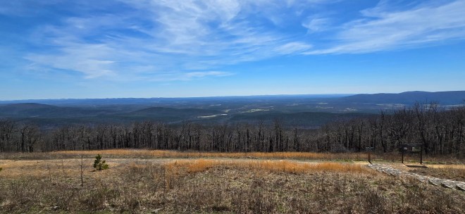
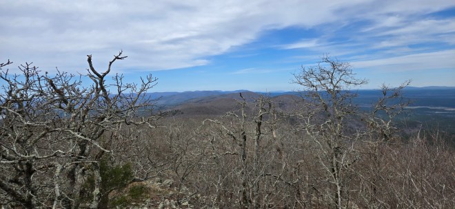
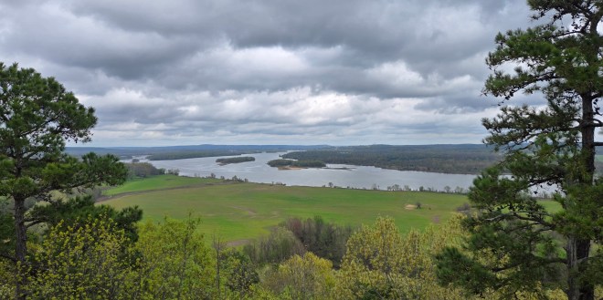
Views from Ouachita Pinnacle
Views from Flatside Pinnacle
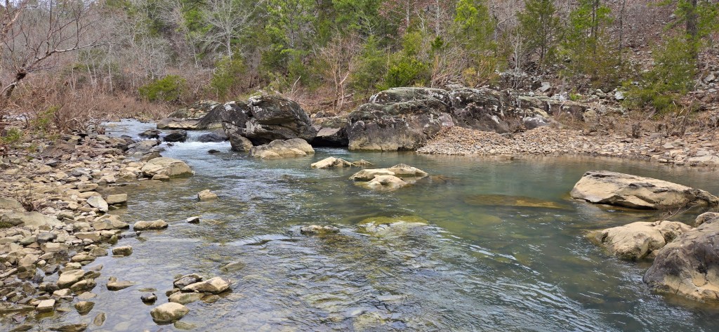
Lake Maumelle
The Arkansas River
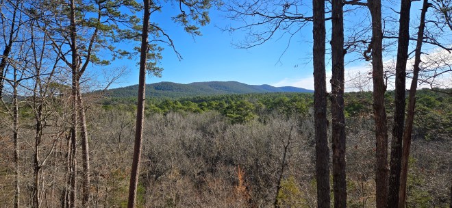
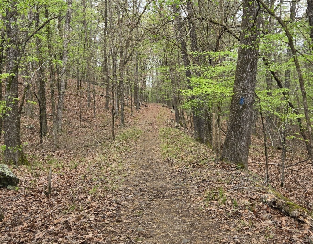
Views from other places on the trail
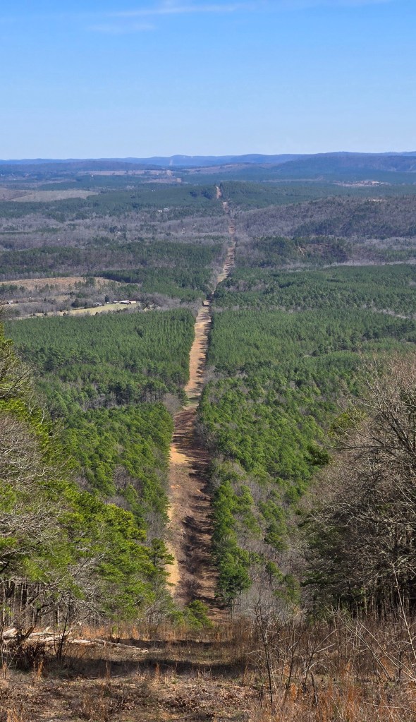
A pipeline cut
360 degree video from Ouachita Pinnacle
360 degree video from Flatside Pinnacle
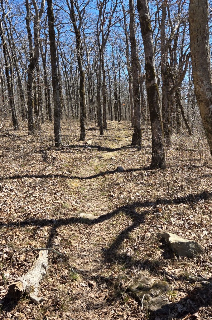
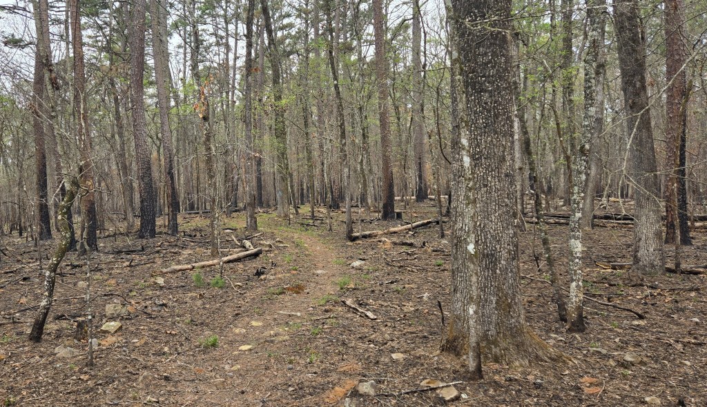
Views of the trail. The last one is from a burned area.
The trail on forest roads. The second one is an old carriage lane which served a long-ago mountain top resort.
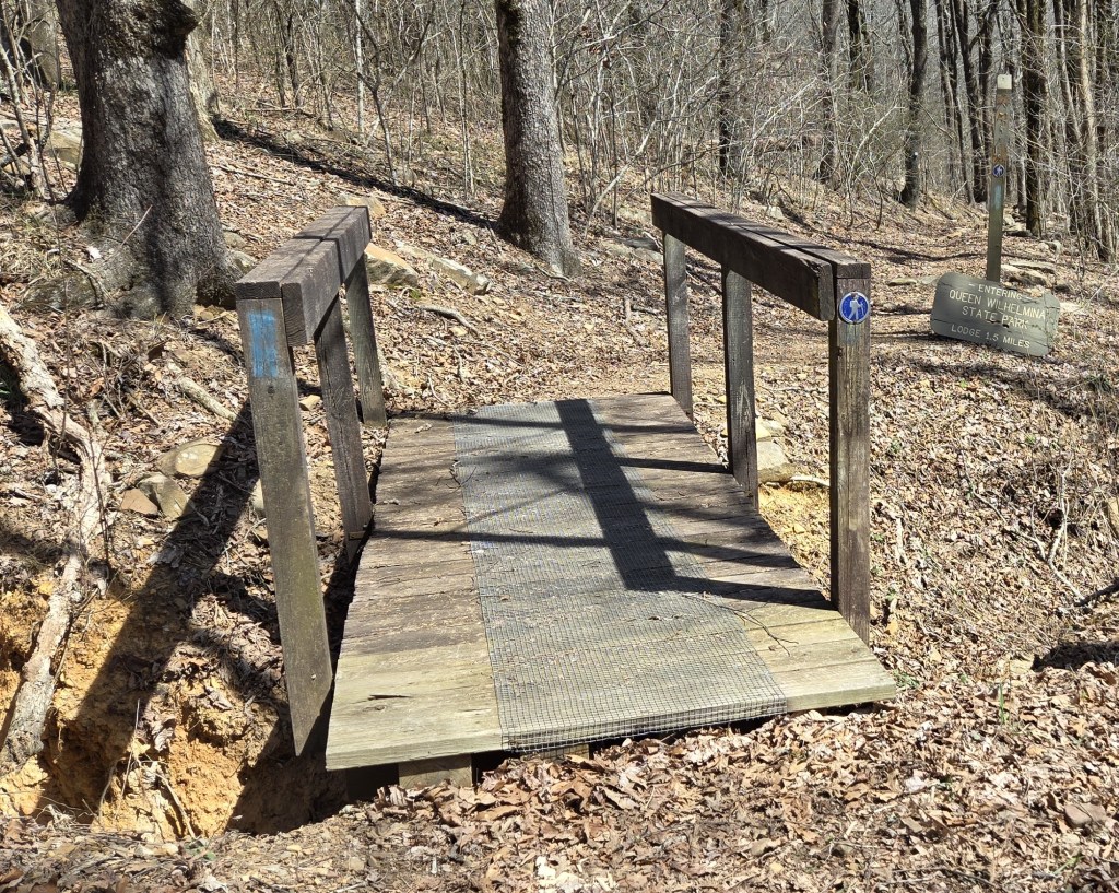
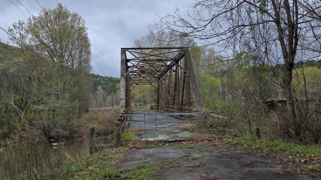
Bridges on the trail
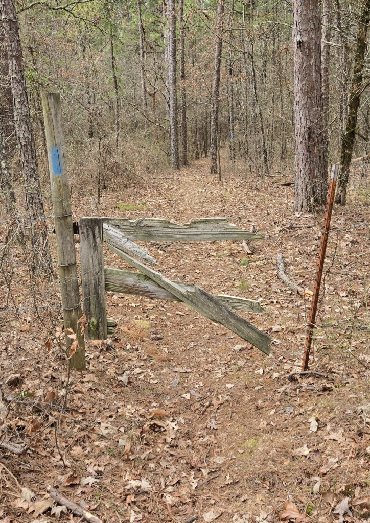
A broken gate
A road crossing
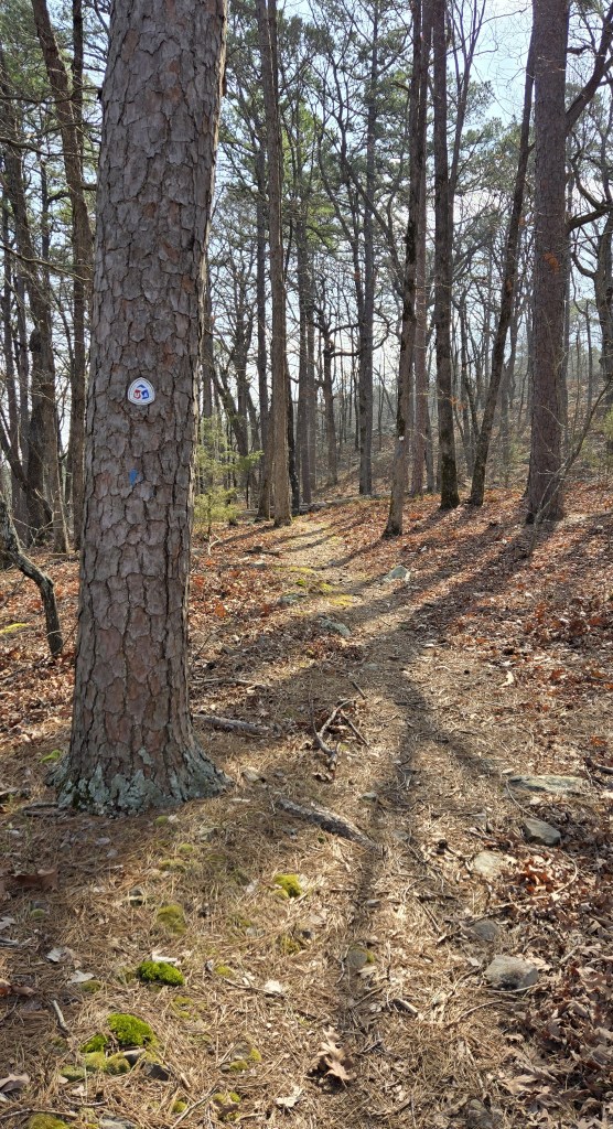
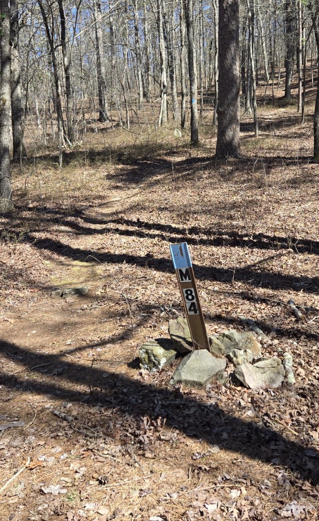
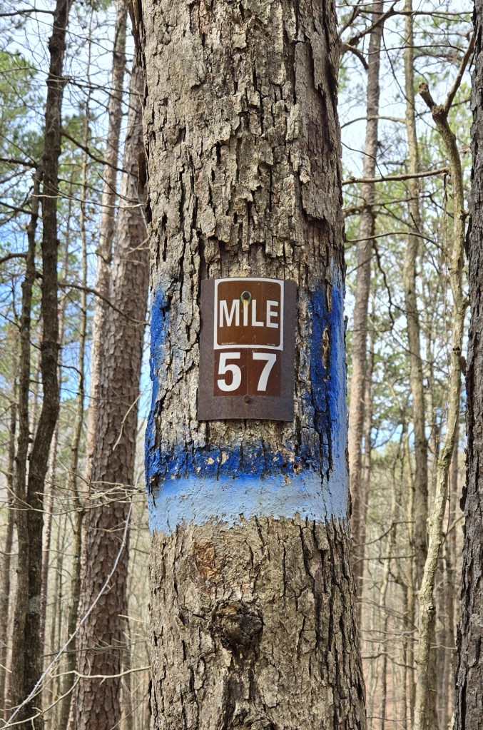
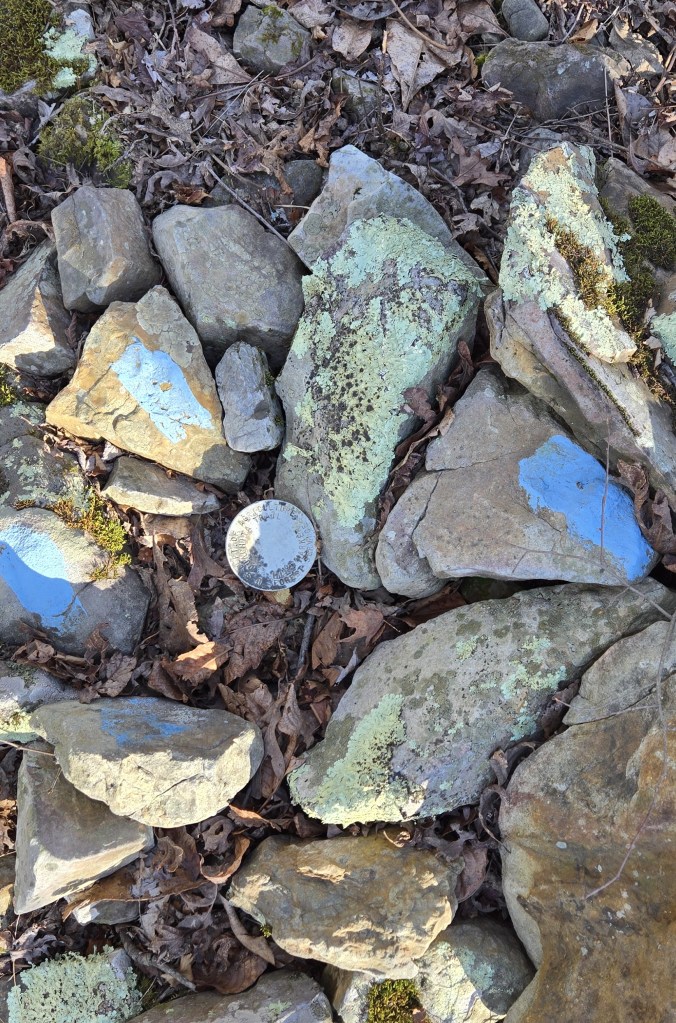
Different Ouachita Trail markers
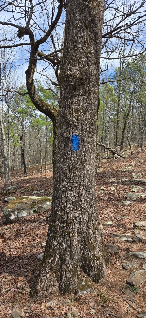
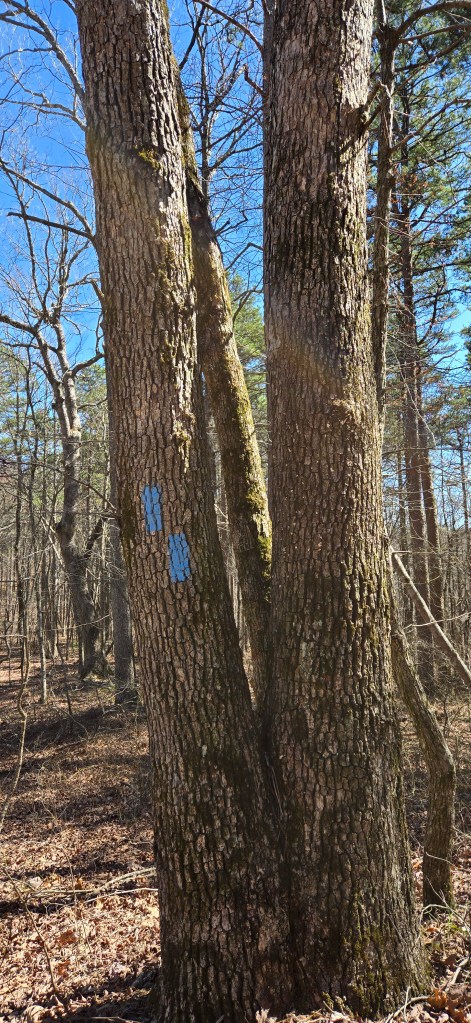
Blue blazers are used to mark the trail. One blaze above another means the trail is turning in the direction of the top blaze.
In principle, there is a numbered marker to denote every mile of the trail
If not a mile marker, then a surveyor’s post
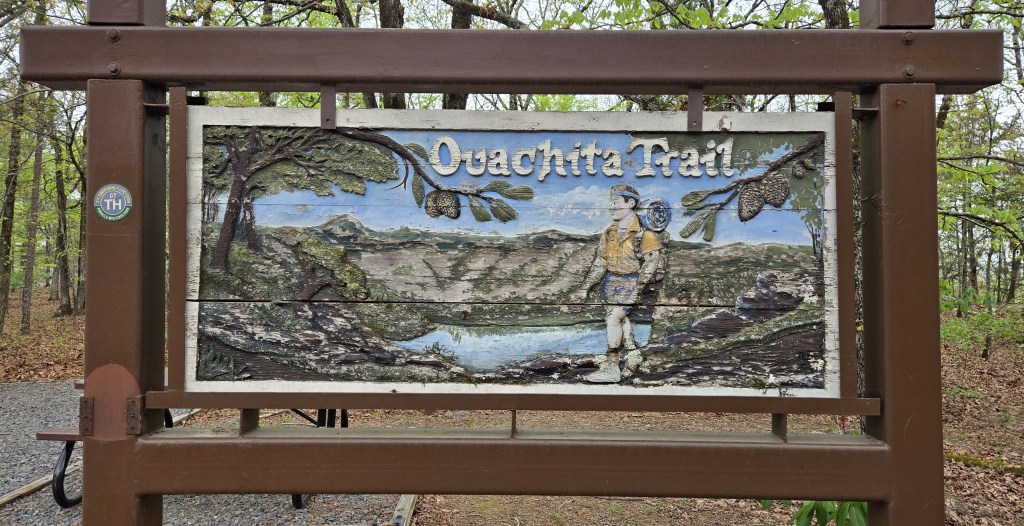
Signs along the trail
This stop sign has seen better days
Something tells me the backpack on this hiker is filled with styrofoam
Whomever created this sign has never walked the north end of the Long Trail
This gate welcomes hikers at the beginning of the trail in Talimena State Park
Information on flora and fauna hikers might see on the trail
I camped at Horsethief Springs. I slept on a picnic table there since there was no cleared flat ground.
The story of Queen Wilhelmina State Park, the mountain lodge therr, and why a state park in Arkansas is named after a Dutch queen
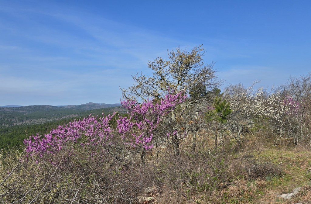
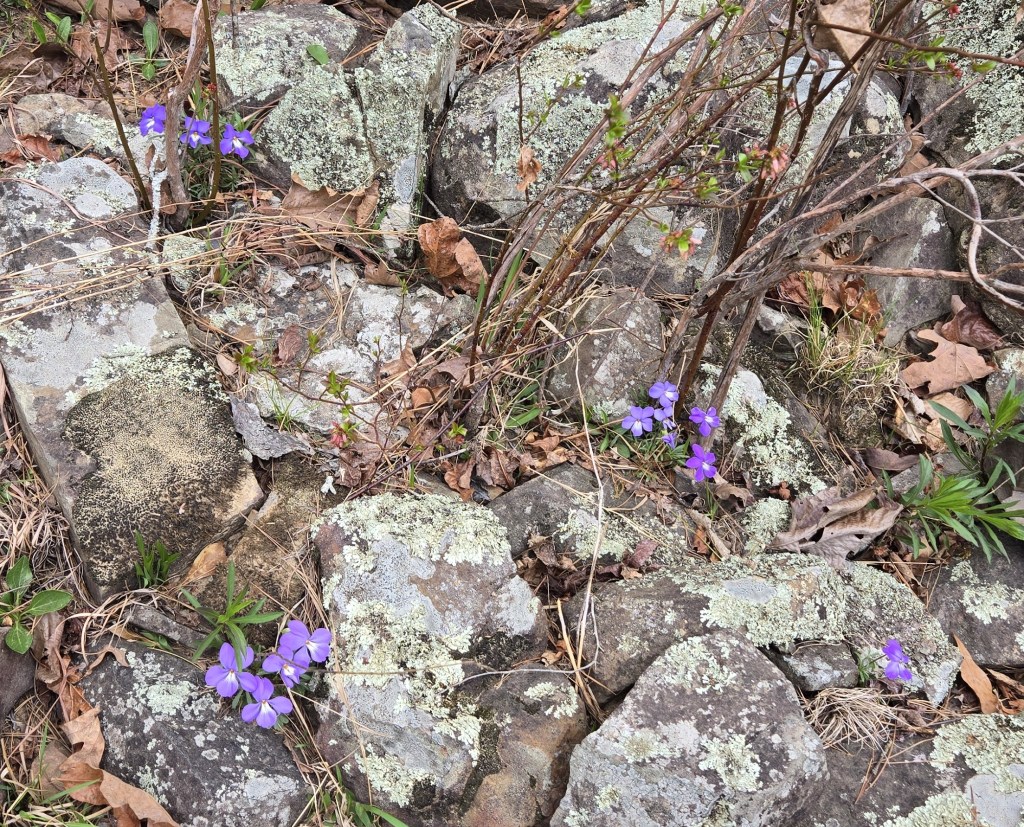
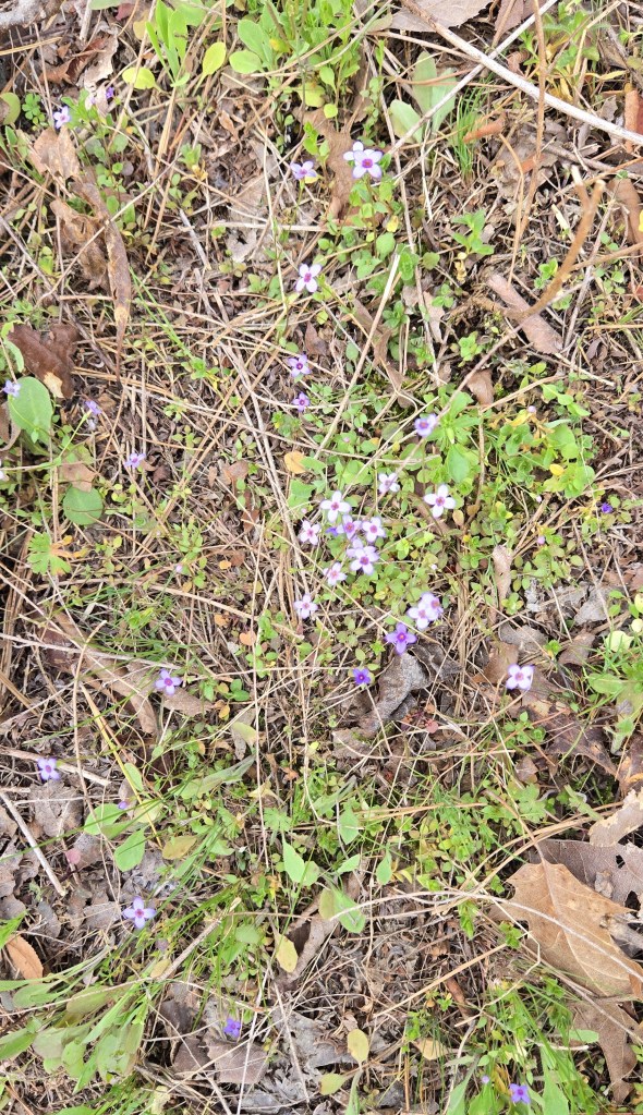
The trees were in bloom
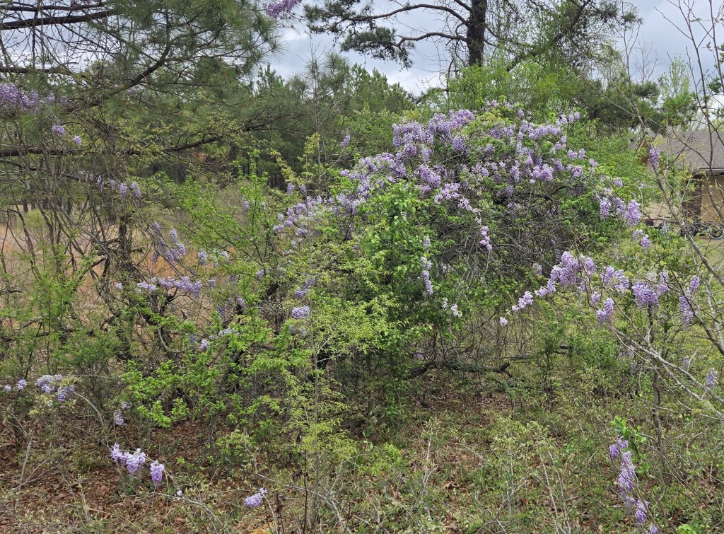
So were the flowers. In order: daffodils, violets, bluets, and lilac.
Vulture in a tree
Water moccasin, poisonous. I came across this snake when I was getting water. It scared the heck out of me because it had been hiding, then came out to greet me.
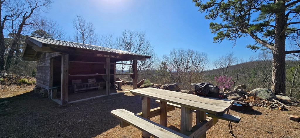
Shelters on the trail. I spent the night at the first one, but not the second one.
Cowboy camping. I had rinsed my clothing in a creek and hung it up to dry.
It’s been over a year since I talked about finishing the first draft of my book, “Two Trails.” Perhaps you’re wondering, “Is it completed? Can I get a copy?”
No, it’s not completed. It needs major editing, and life got in the way. During the past 15 months, my wife and I moved … twice. In addition to the physical moves we completed ourselves (go U-Haul), we took furniture and other items across country to my stepdaughters in South Carolina and Minnesota. We also completed extensive repair work on the house we had lived in (my wife for 30 years, me for 10) to prepare it for sale, extensive work on the house we had just bought, and extensive work on the rental property my wife owned which we lived in temporarily to prepare it for sale.
Finally, finally, I’m about to get back to the book. As I wrote above, it needs major editing. This sentiment based on my own thinking and that of everyone (mostly family) who read the first draft.
In its current form, the book is schizophrenic, alternating between travelogue and fact-based commentary on the Appalachian Trail, the Pacific Crest Trail, and hiking then vs. now. I’m searching for an outline which makes sense. Also, a single editorial voice to use. The fact-based parts of the current draft use a business-like expository writing style. The travelogue parts, a personal narrative style. Like I said, schizophrenic.
So, time to get back at it. I’ll keep you posted.
In case you’re wondering if I’m still out there hiking. Yes, I am. In addition to hiking the 2650-mile Pacific Crest Trail since I retired in April 2001, I’ve hiked the 290-mile Benton MacKaye Trail (Georgia, North Carolina, and Tennesse), the 250-mile Tuscarora Trail (Virginia, West Virginia, Maryland, and Pennsylvania), the 270-mile Ozark Highlands Trail (Arkansas), and the 225-mile Ouachita Trail (also Arkansas). And in 10 days, I plan to start hiking the 270-mile Long Trail (Vermont).