c) Andrew Carter, 2026
In April, I went on a one-week hike on the Pacific Crest Trail (PCT) in Southern California. I started at Cajon Junction on April 15th, heading north, and ended at Agua Dulce on April 22nd. Most of the time I was in the Angeles National Forest. I hiked 102.9 miles.
I had planned to go on a three-week hike, but that didn’t happen. The reason was I shouldn’t have been hiking at all given other things on my plate at the time. The biggest one was that my wife Marta and I have begun the process of remodeling our home. We’ve been working with an architect to develop plans. I should have stayed at home to move that process along. I also needed to start interviewing contractors to do the work. Once I realized this, I cut my hike short.
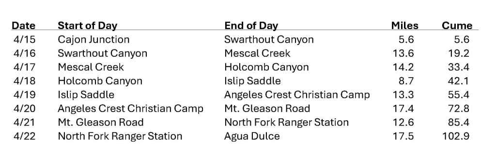
I like to rely on public transportation to get to and from the trail because I don’t like asking Marta to make special trips to get me to the trail. Cajon Junction, where I started, is between San Bernardino and Victorville on I-15. To get there, I took Amtrak from San Luis Obispo to Union Station in Los Angeles, Metrolink suburban rail from Union Station to San Bernardino, and an Uber from San Bernardino to the trailhead.
Cajon Junction and nearby Cajon Pass is a major thoroughfare linking Southern California to the Mojave Desert and the Great Basin states further east. Today, I-15 and two different railroads use the pass – the Burlington Northern Sante Fe and the Union Pacific. Route 66 used to travel through the pass, and hundreds of years before that, the Sante Fe Trail and the Salt Lake Trail.
My hike started poorly. I can only blame myself. I planned poorly. Yes, even an experienced hiker can plan poorly. I’d hiked this section of the PCT in 2021, but I was headed southbound then, not northbound. I’d forgotten there is a long waterless climb at the southern end from Cajon Junction to the Angeles Crest. That’s because I was headed downhill in 2021, not uphill. In 2021, when I hiked this section, I was also in excellent physical shape because I’d been hiking for a month. This year, I was just starting my hike.
I arrived at Cajon Junction on the afternoon of April 15th. From there, I hiked 5.6 miles to a campsite in Swarthout Canyon. That campsite is near a gravel road, and trail angels maintain a water cache. I arrived at dusk.
About two weeks later, this cache and campsite became the source of a major outbreak of norovirus on the trail. Apparently, two hikers arrived at camp with norovirus. They were overcome with diarrhea and failed to clean their hands properly afterwards. Then they spread norovirus-contaminated fecal matter on bottles in the cache and the shelves holding those bottles. Other hikers using the cache then got norovirus on their hands and later injested it into their mouths when eating and drinking.
I’m glad this took place after I spent the night at the cache, not before. Dozens of hikers would get sick, and one had to be airlifted to a hospital for treatment.
The next day, the 16th, I needed to hike 17 miles uphill before I would reach the next water source. Those 17 miles included 4700 feet of vertical gain. I knew that would be impossible for me on the first full day of a hike. So instead, I detoured, following rural roads from Swarthout Canyon, through the town of Wrightwood, and on to Big Pines. In Big Pines, I took a side trail which led back to the PCT. I camped by a creek only a few tenths of a mile down this trail. I’d hiked 13.6 miles that day. The elevation gain was a more modest 3300 feet.
On April 17th, I followed the side trail for about 3 miles before I rejoined the PCT. I didn’t stay on the PCT for long, however. After another 3 miles, I reached Vincent Gap. Here, the PCT begins a steep ascent to Mt. Baden Powell, which at 9383 feet is the second tallest mountain in the Angeles Crest National Forest. Here, poor planning on my part raised its ugly head again.
Baden-Powell was still covered in snow. I should have known this, but I didn’t. As a consequence, I didn’t have crampons, micro spikes, or an ice ax to navigate the trail. Some hikers had been crossing the mountain without these tools, but I wasn’t prepared to take the risk. In 2022, on my two-year section hike of the PCT, I crossed a 50-yard stretch of steep trail in Washington that was still covered in snow late in the summer. It was early morning, and the slope was frozen. I used the postholes of previous hikers to get across. Halfway across, I stumbled. If I’d fallen, I would have gone sliding down the steep slope to serious injury or death. My immediate thought was, “Andrew, what the f’ are you doing?” I vowed I’d never take such a risk again.
To get around Baden-Powell, hikers would normally follow the Angeles Crest Highway. That’s what I’d done in 2021 when the trail across Baden-Powell was close due to wildfire damage. Unfortunately, in December 2025, there was a rainstorm which completely washed away several segments of the highway, making it impassable. Now, it couldn’t be used as a detour.
Instead, I hiked from Vincent Gap down a fire road which led to a side trail which I could use to climb back to the PCT north of Baden-Powell. The beginning of the fire road was washed out but passable. I followed it and reached the side trail. I started down the side trail. Parts of the trail were washed out, too. I made it across these parts, but then I came to spot that was barely passable at all. The downhill slope beside the trail was extremely steep with loose rock and soil. Here I was again in a dangerous situation. I made it across, but I was spooked. It was late in the afternoon, so I camped when I reached the next water.
What to do? I was camped on a creek which led back to the fire road I’d been on earlier. The next morning, the 18th, I decided to bushwhack down the creek to the road. I didn’t want anything more to do with the trail I was on. I made it back to the road and followed it to a different side trail which led to the PCT. That trail also had washed out sections, but none were impassable. By the end of the day, I was finally back on the PCT. Because of the washouts and the bushwhack, I’d only hiked 8.7 miles. My detour folly had taken a day-and-a-half. I was frustrated and discouraged, but things started looking up the next day.
On the 19th, I hiked the PCT and the Angeles Crest Highway to a Christian camp that was hosting hikers overnight. I got a shower. I washed my clothes. I ate leftover food from a church group who’d been on retreat the previous weekend. Very nice indeed.
The 20th was a beautiful blue-sky day – sunny and warm, but not too hot. Most of the day, I had incredible views of the Angeles Forest and the Antelope Valley. The trail was easy, so I hiked 17.4 miles to Mt. Gleason Road.
The 21st started nicely. I was again on a ridge top with outstanding views. It was windy, but not too cold. After lunch, however, a cold front came through, and the weather changed dramatically. The temperatures dropped to the 40’s, and it started to rain. Because of the wind, the rain was blowing diagonally. I was in the rain cloud, so visibility dropped to 50 feet in the fog. It was dangerous hypothermic weather on an open ridge, but I had appropriate gear.
It wasn’t fun hiking, but the day ended positively when I reached the closed North Fork Ranger Station. A retired Forest Service employee serves as watchman there. The Ranger Station also serves as an emergency fire station during wildfire season. The watchman let me and five other hikers spend the night in the firefighters’ bunkhouse. There was no electricity or running water, but we were out of the weather.
Looking back, I regret not having pulled out my phone to take pictures or video of the storm, simply to be able to show how bad it was. There was only one point in my life where I faced more dangerous weather while hiking. That was during my 1977 Appalachian Trail thru hike when I got caught in a late winter ice storm on an open mountain ridge in Tennessee.
I got up early on the 22nd. I needed to hike 17.5 miles to reach Agua Dulce and the end of my hike. The weather was glorious, in the 70’s and sunny. The trail led me off the Angeles Crest down towards the Antelope Valley. This is the high desert, which is beautiful in spring. There were wildflowers everywhere.
I reached Agua Dulce by late afternoon and began my journey home. I took an Uber to Santa Clarita and then Metrolink to Burbank. I spent the night in a hotel in Burbank, and the next day I took Amtrak home to San Luis Obispo.
My hike was shorter than I wanted. There were good days and bad. But it’s always a treat to get out into the wild.
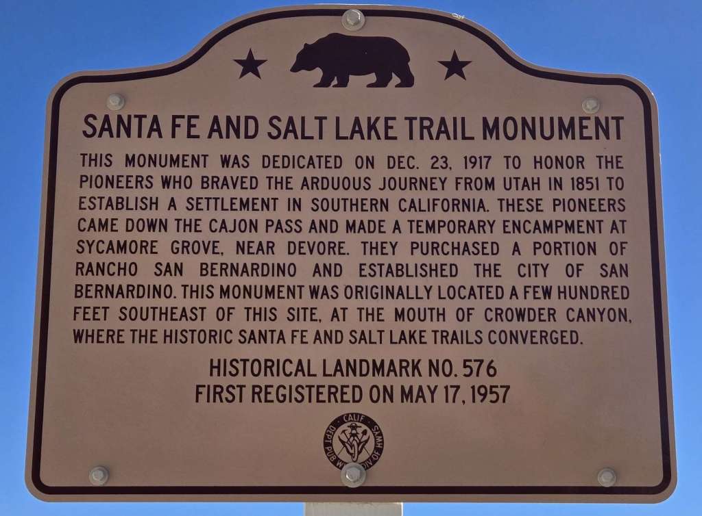
Historical Marker, Cajon Junction
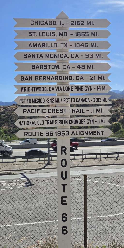
Route 66 marker, Cajon Junction. I-15 behind it.
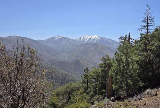
Mt. Baden-Powell with snow
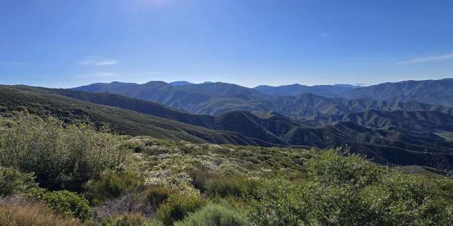
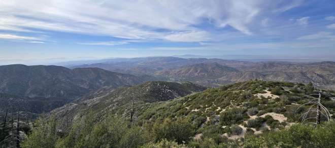
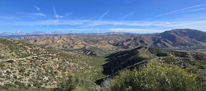
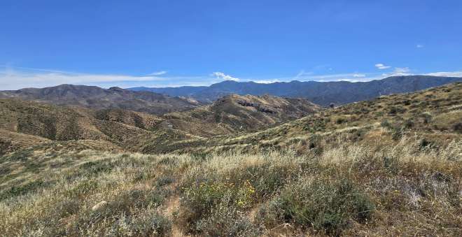
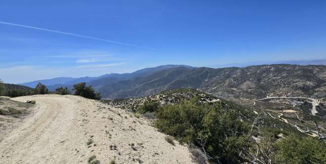
Views from the Angeles crest
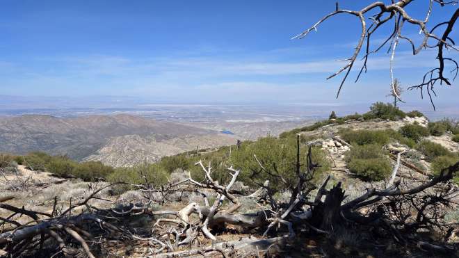
Looking towards the Antelope Valley
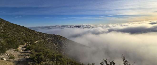
Bad weather coming in
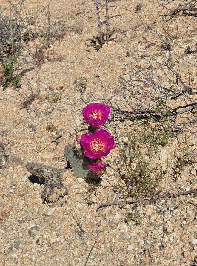
Cactus flower
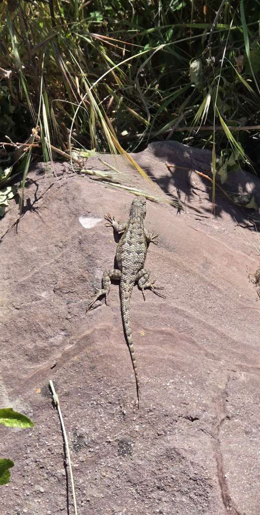
Lizard
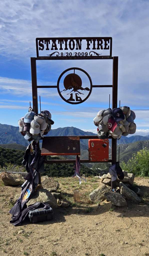
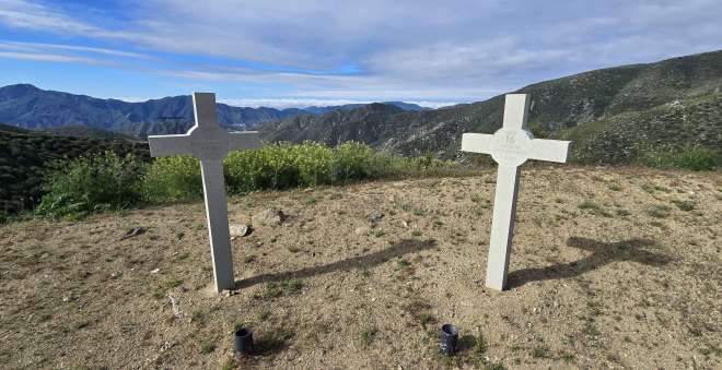
Firefighter memorial
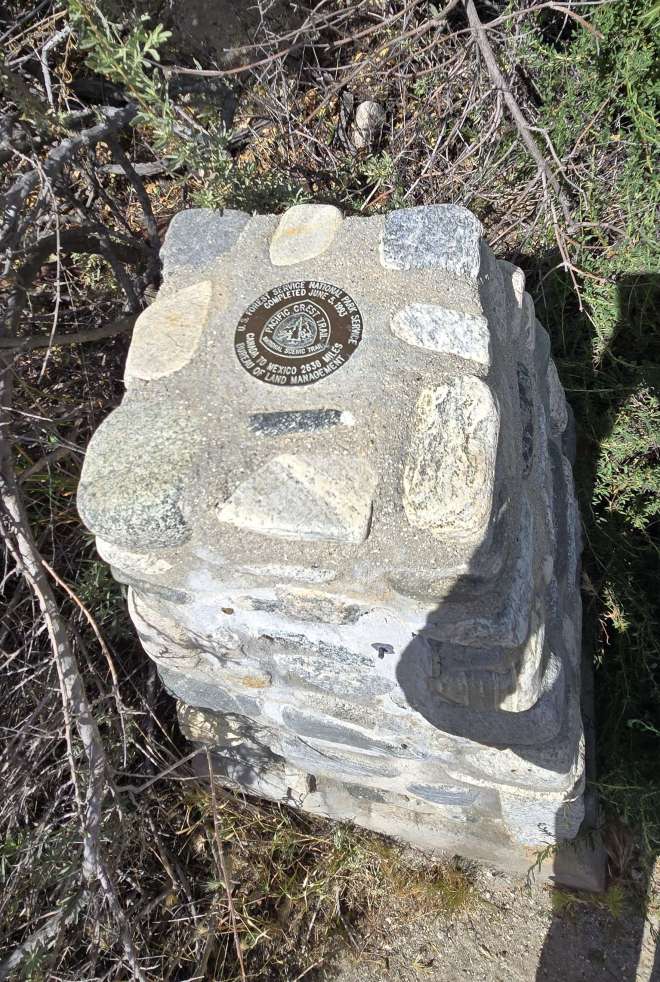
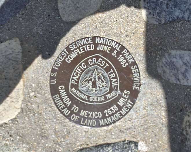
PCT “golden spike.” Although the trail was officially completed in 1993, it existed in various forms prior to that.
360 degree videos


As much as we humans would like to think we are so very important, the truth is we are but a tiny, tiny part of a much larger balance.
LikeLike
😎👍
Sent from my iPhone
LikeLike
Thanks, Andrew. I enjoyed reading your account and definitely LOVED the videos. Much love,Janet
LikeLike
Thanks. Lots & lots of views on this hike.
LikeLike