c) Andrew Carter, 2023
Author: Andrew Carter
I just completed a multi-year thru hike (MYTH) of the Pacific Crest Trail (PCT). It took three years. I hiked 1840 miles in 2021, 733 miles in 2022, and 122 miles in 2023. The only reason I had to hike in 2023 was a wildfire closure at the north end of the PCT in 2022. During the past two years, I've also thru hiked other, shorter US trails. I hiked the Benton MacKaye Trail (GA, NC, TN) and the Tuscarora Trail (VA, WV, MD, PA) in 2022 plus the Ozark Highlands Trail (AR) in 2023. I hope to hike the Long Trail (VT) next year and the Colorado Trail at some point in the future. Please note, all content on this site is copyright.
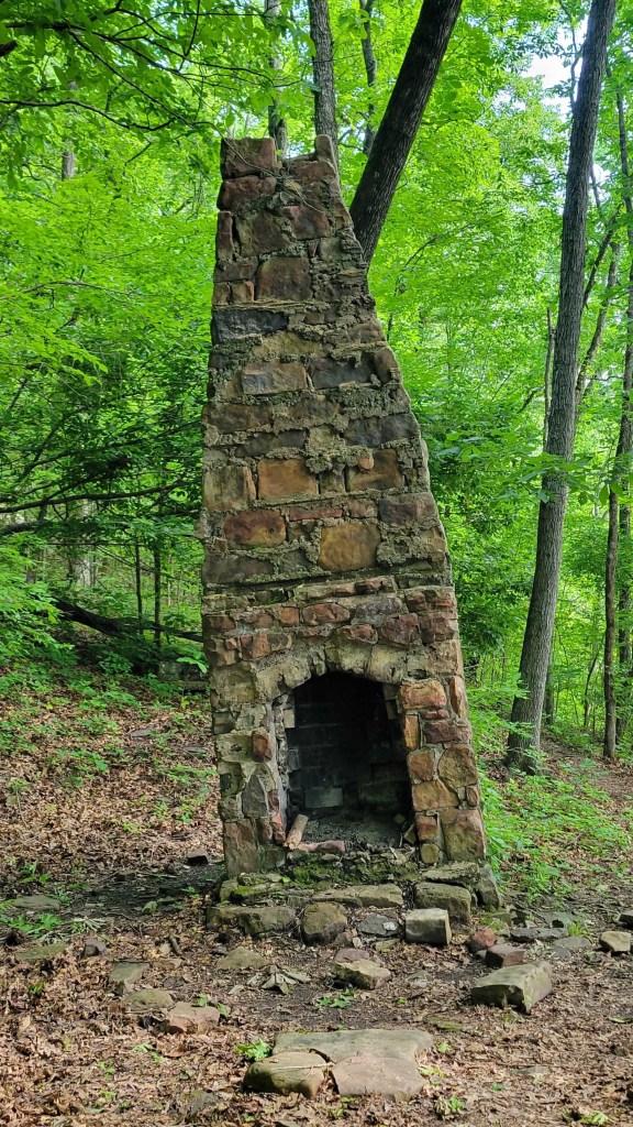
A Shorter, Greener Tunnel — Hiking the OHT
c) Andrew Carter, 2023
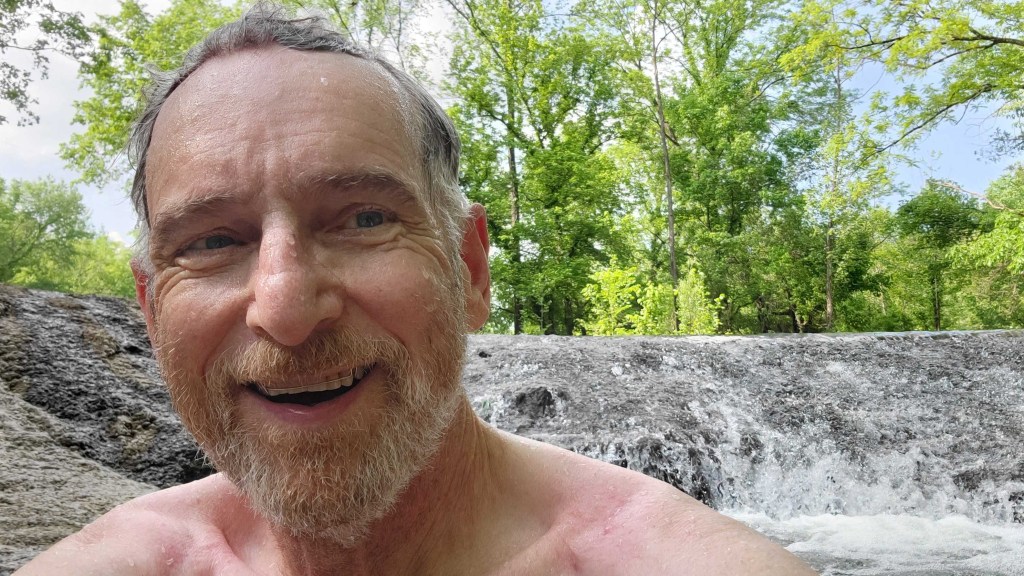
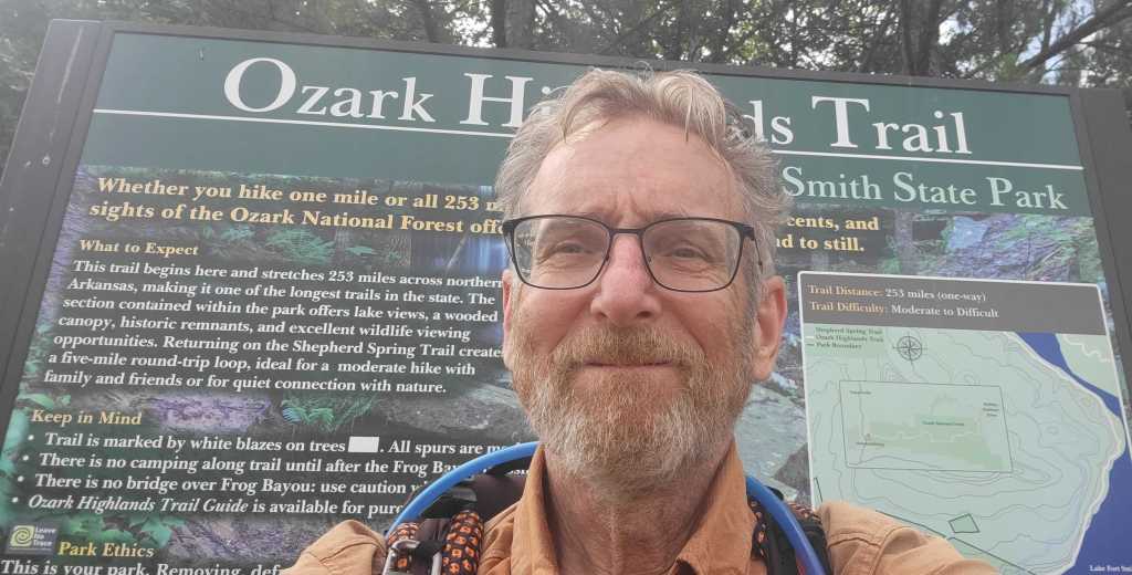
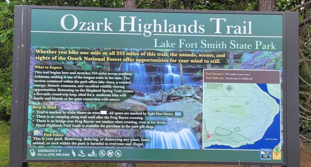
On May 8th, I went to Arkansas to hike the 254-mile Ozark Highlands Trail (OHT) and the 223-mile Ouachita Trail. In the end, I only hiked the OHT. It’s the first time in my life I’ve abandoned a hike halfway through. For me at least, that’s a sign of maturity. I wasn’t having fun, so why continue?
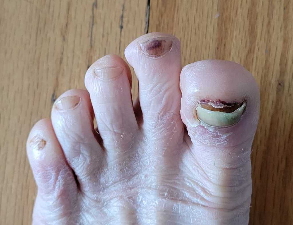
Why wasn’t I having fun? There was way too much poison ivy, which I’m allergic to. There were too many ticks, which can can give you Lyme Disease. There were too many creeks to ford, some of which were impassable. And there were almost no views.
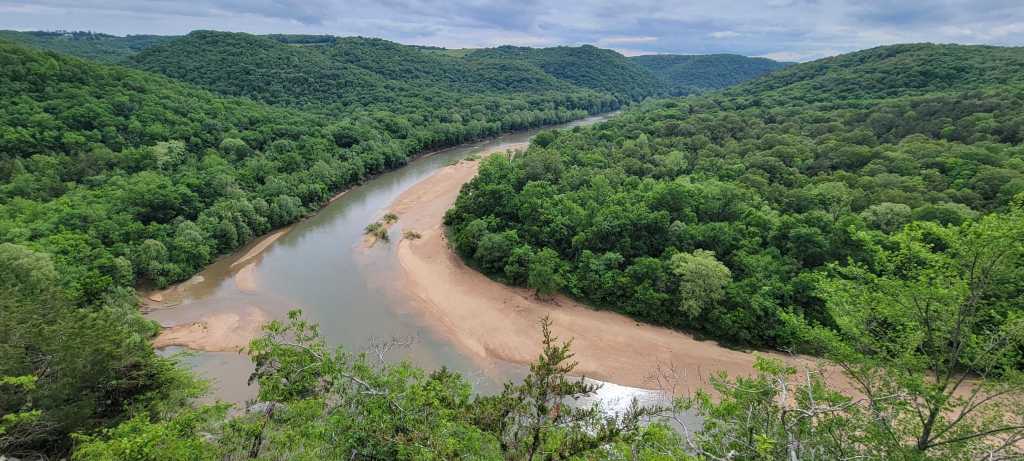
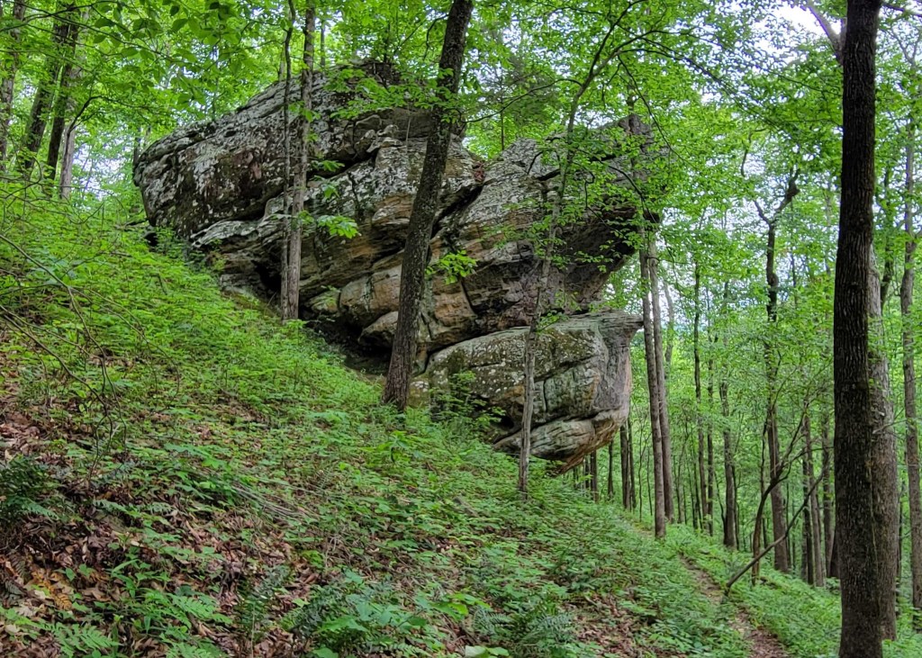
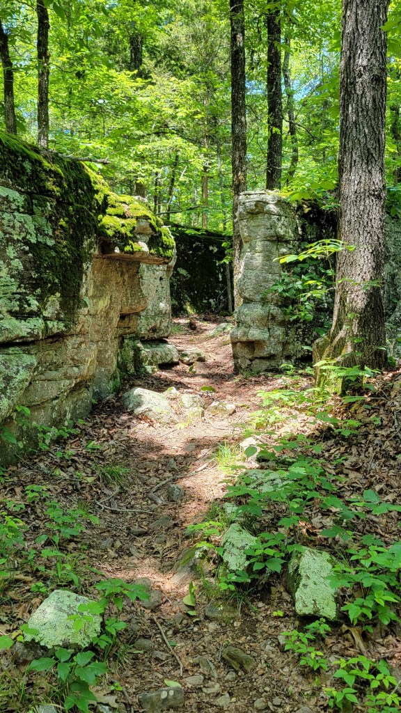
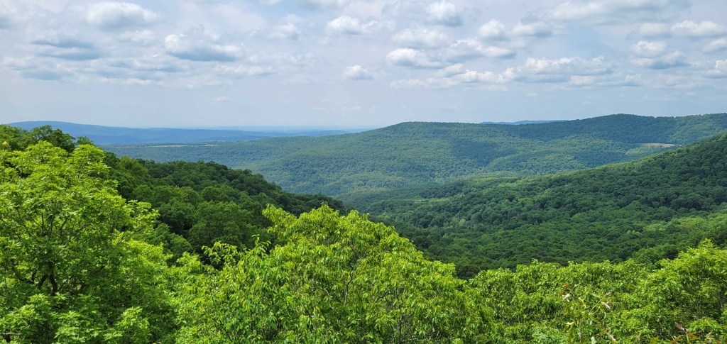
The OHT is a low-altitude woodlands trail. On its entire length, the trail never gets above 2250 feet. In fact, the eastern half never gets above 1000 feet. The tree canopy is thick. During leaf season, the best a hiker can count on is a view every two or three days. That’s right, one view every two or three days. (Putting “two” in the previous sentence may be too generous.) What views you get tend to be partial views. Since the trail is low, those views are never sweeping. No expansive views with ridge after ridge of mountains. Just one ridge, one valley, one creek or river.
The Appalachian Trail (AT) is often called “the long green tunnel” because hikers spend so much time in the woods. But on the AT, you tend to get at least one good view a day, usually more. The OHT should be called “the shorter, greener tunnel.”
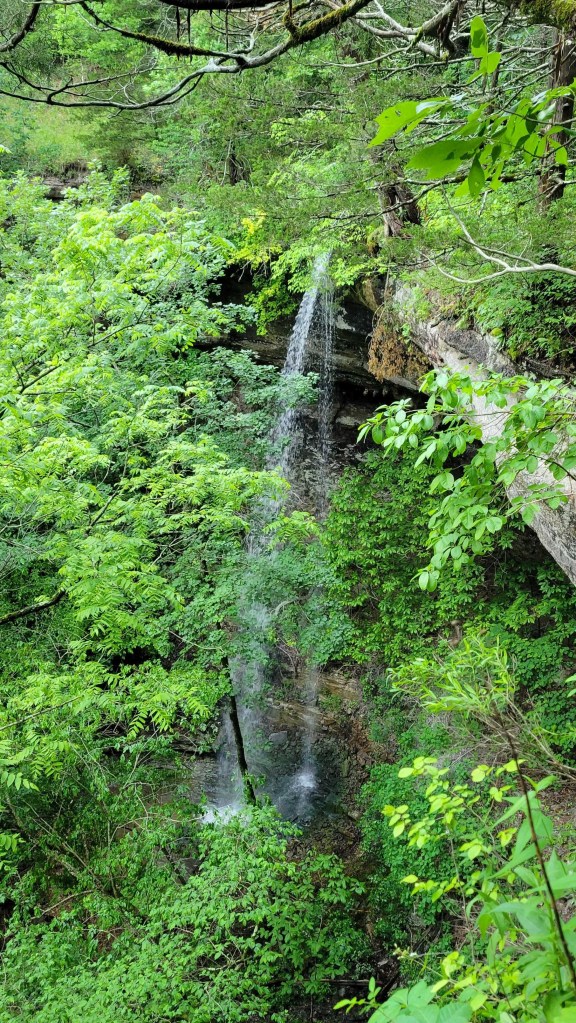
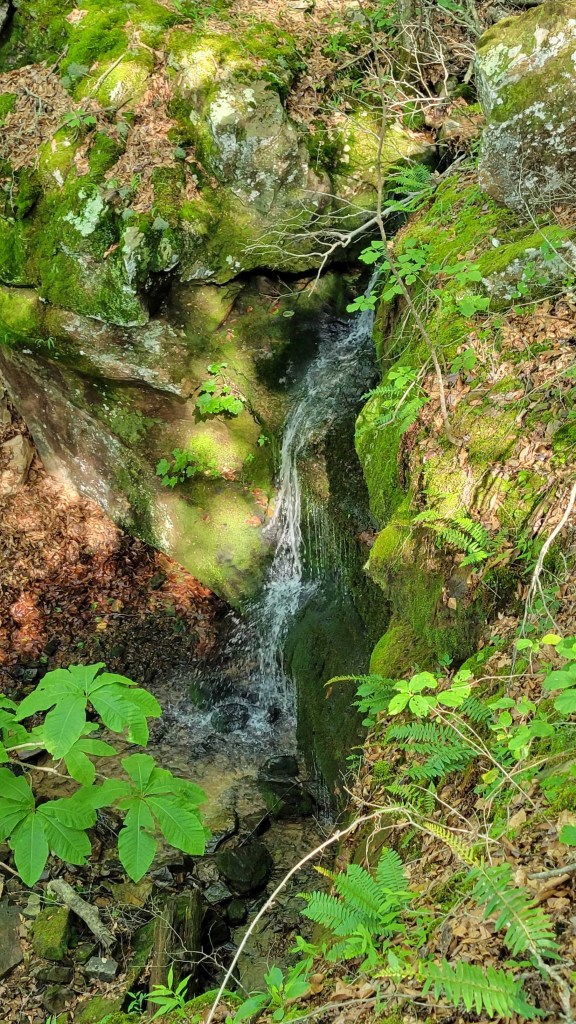
To be fair to the OHT, the western end includes many waterfalls which make up in part for the lack of views.
The weather also wasn’t great at the beginning of my hike. The first six days, it rained part of each day. You shouldn’t be hiking if you’re not prepared to suffer through the weather, so this wasn’t a deal-breaker for me. I had forgotten about humidity, however. I grew up in the humid East but have lived in dry California the last twenty-five years. I had forgotten that when it’s humid, unless the sun is brightly shining, nothing will dry out. As a consequence, I was wearing damp clothes for six days straight. (I always make sure I have dry clothes to sleep in.)
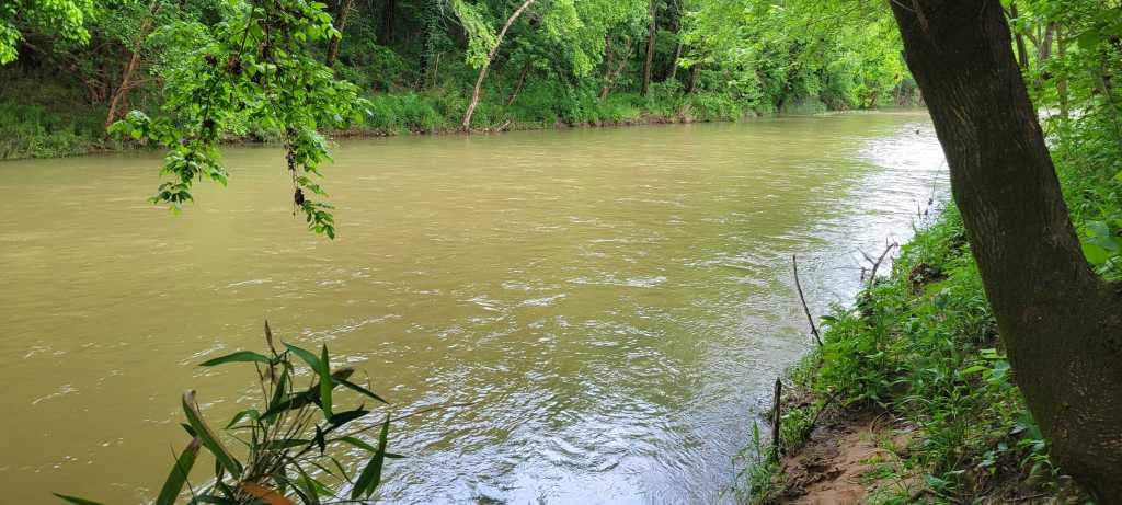
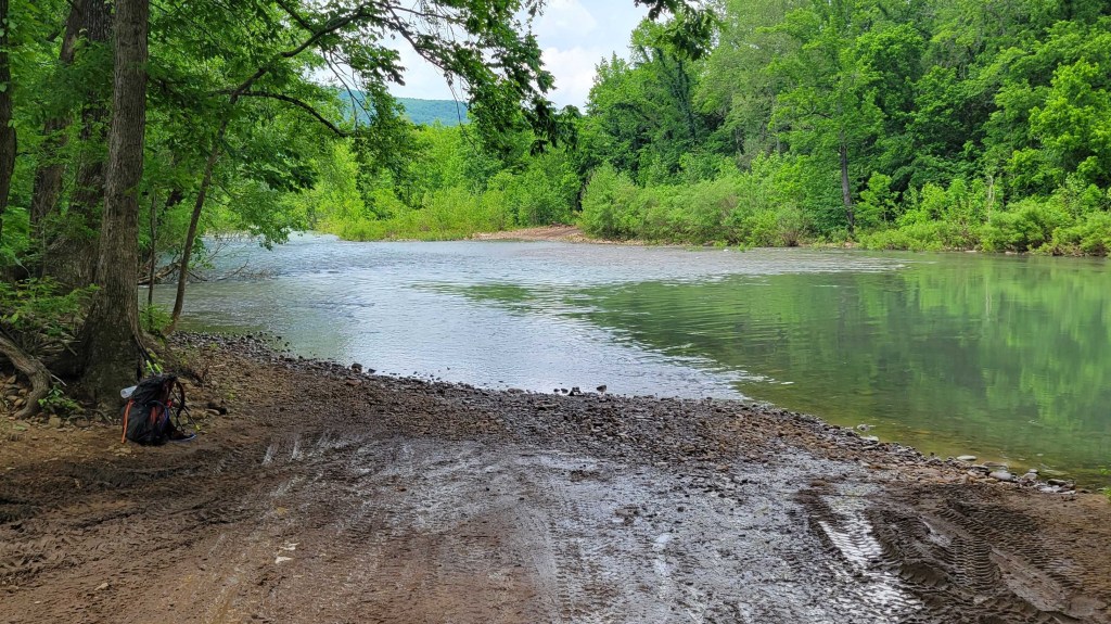
Let’s talk about the fords. There are a lot of creeks to cross on the OHT because the trail is so low, but there are very few bridges to use. Instead, you have to walk across each creek. In the summer and winter, that usually involves rock-hopping. Unless you slip, you’re able to get across the creek without getting your feet wet.
In the spring and fall, however, rock-hopping isn’t always possible. Instead, you do have to get your feet wet. This can mean walking through the creeks with your hiking shoes on or it can mean stopping at every creek, taking off your pack, taking off your shoes, putting on water shoes, rolling up your pant legs (or taking off your pants altogether), stowing your hiking shoes (and perhaps your pants) in your pack, putting back on your pack, then wading across. Once you’re on the other side, you do all these things in reverse order to continue on your way. What’s more, this is a “rinse and repeat” activity. It’s not unusual to have three or four fords a day.
Because of the rain, in particular a deluge on the second night, the creeks were running very high. On Day 3, I was scheduled to cross Big Creek, which according to my guidebook is at least up to one’s knees all year long. I assumed it would be unpassable, so I left the trail three miles before I came to the creek and followed a fire road into town. From there, I was able to hitch around the creek on a state highway. Sure enough, when I crossed the creek on a highway bridge ten miles upstream from the ford, the creek was a raging torrent.
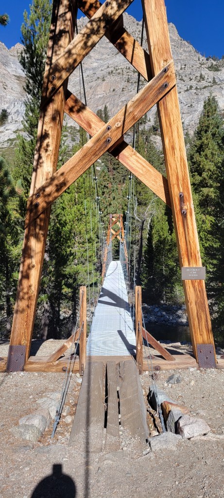
On Day 5, I came to another unfordable creek. This one was called Bear Creek. (You’ll find a picture below.) This time, I followed a county road into town. From there, I hitched once again on a state highway to get around the creek.
Beyond these two impassable fords, I had two thigh-high fords, one waist-high ford, and dozens of ankle- and calf-high fords. This was true even though I often took detours (some short, some long) on fire roads or county roads, figuring that the fords of creeks on these roads would be easier than the fords of the same creeks on the trail. One of the thigh-high fords was at a road crossing. Given that, the ford on the trail eight miles downstream might have been impassible.
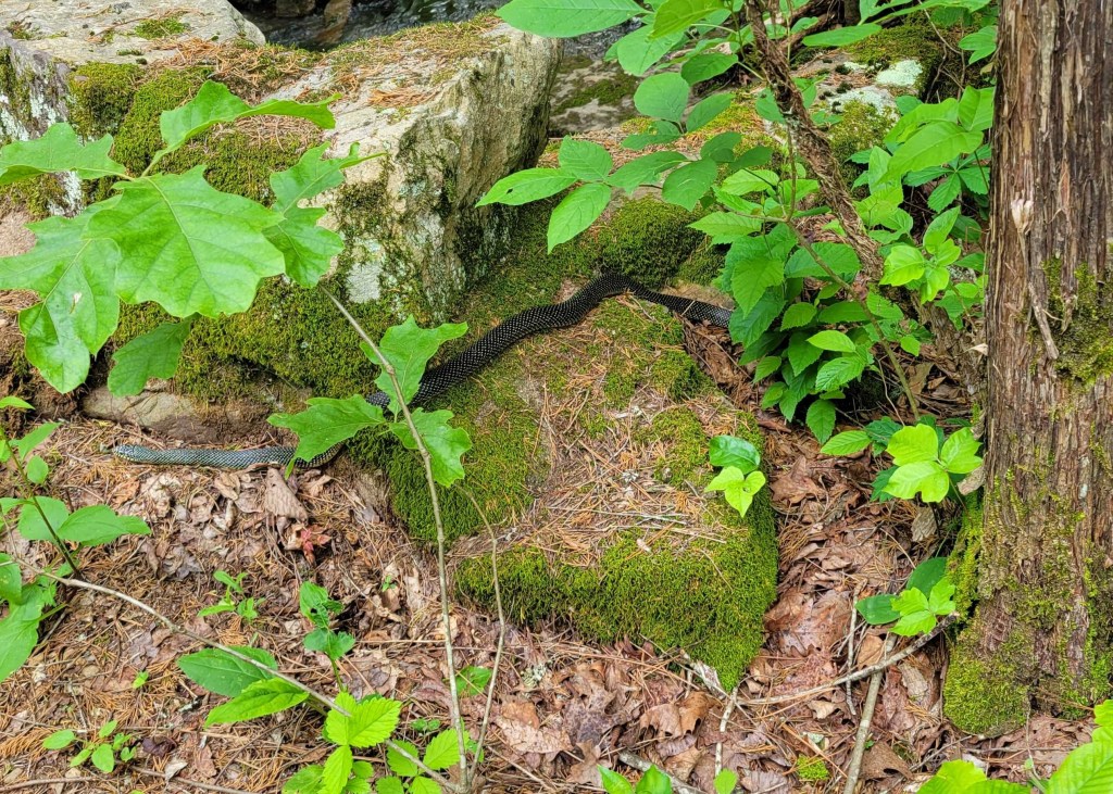
I mentioned poison ivy and ticks. Because the OHT is so low and isn’t intensely used, it has a lot of undergrowth. Unfortunately, much of that is poison ivy. I’m very allergic, so I always had to pay attention to where I was walking. That’s true even wearing long pants. Knowing there would be poison ivy on the trail, although I never expected so much, I did bring Tecnu.
Tecnu is a lotion which is used to wash away urushiol, the poison ivy oil which causes the allergic rash. It’s amazing stuff and truly works. There were several times at lunch or at the end of the day that I used Tecnu on all my exposed skin, including my neck and head. Why the neck and head? Because poison ivy is a vine which can climb trees. Often, you’re so focused on the ground that you forget to make sure you don’t accidentally brush against a tree which has poison ivy on it.
Thanks to my caution, to Tecnu, and to luck, I only suffered rashes from the poison ivy in a few small places.
As for the ticks, the issue wasn’t the ones you can see, but the ones you don’t initially notice. These are ticks in their larva or nymph stage. The ticks can be the size of a poppy seed. Some are black. Others are translucent brown. The brown ones are particularly hard to spot. There were four or five times I found ticks which had already bitten me. I’m on a prophylactic regimen of antibiotics right now to ward off Lyme disease.
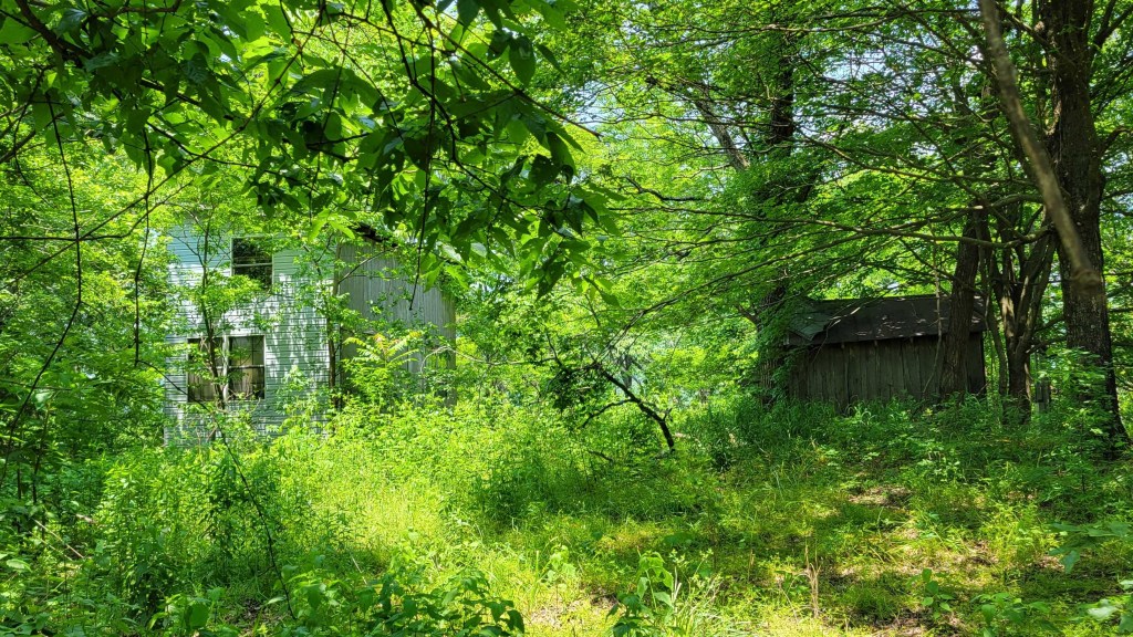
Because of poison ivy and ticks as well as the roughness of the trail (rocks and side slant), I began to take fire road detours off the trail instead of staying on the trail itself. As my hike progressed, I spent more and more time on fire roads. Arkansas has an incredible number of dirt roads and gravel roads in its national forests. Hiking them was more enjoyable than hiking the trail. I was able to enjoy the woods around me instead of having to focus on the rocks in front of my feet.
Using fire roads was also faster. This was important on two days when I was scheduled to pick up a package of food at a post office. Rural Arkansas post offices tend to be open only in the morning. If you miss the closure time (noon or 12:30 pm), you’ll have to stop, camp nearby, and wait until the post office opens the next day.
Speed was also important because I’d planned my hike before I learned my son was getting married in June. As a result, I had two days less to hike the OHT than originally planned.
At the end, speed was also important because I simply wanted to get my hike over with. I ended up hiking the OHT in 13.5 days. My original plan was 16 or 17 days. My accelerated plan was 15 days.
A sidelight of hiking fire roads was that I saw more people this way, especially on the weekends. A lot of Arkansas residents and residents of nearby states use these roads to recreate in their two-wheel and four-wheel all-terrain vehicles. Many stopped to chat when they saw me.
On the OHT itself, I didn’t see another soul until Day 9. In 13.5 days of hiking, I ended up seeing five overnight hikers (a group of two and a group of three) and six dayhikers (two groups of two and two singletons). It turns out the western end of the OHT is more used than the eastern end, but no part of the OHT is truly heavily used, especially in the spring and summer.
All the locals I met on my hike were very friendly. Those who stopped to chat on the fire roads wanted to know what I was doing, how I was doing, was I enjoying myself, was there anything they could do to help. The two people who gave me rides around the unpassable fords went out of their way to take me to trail crossings on side roads even when I said, “You can let me off here. I can walk the rest of the way.” In a separate incident, a woman in truck saw me hitching from town back to the trail. She was headed in the opposite direction, yet she turned around, picked me up, and drove me to the trailhead. In addition, I twice had people ask me if I needed any money. (Dirty hikers are often confused with the homeless.) Both times, I thanked the person and said, “I know I look like a bum, but I’m a retired bum with Social Security and a small pension.”
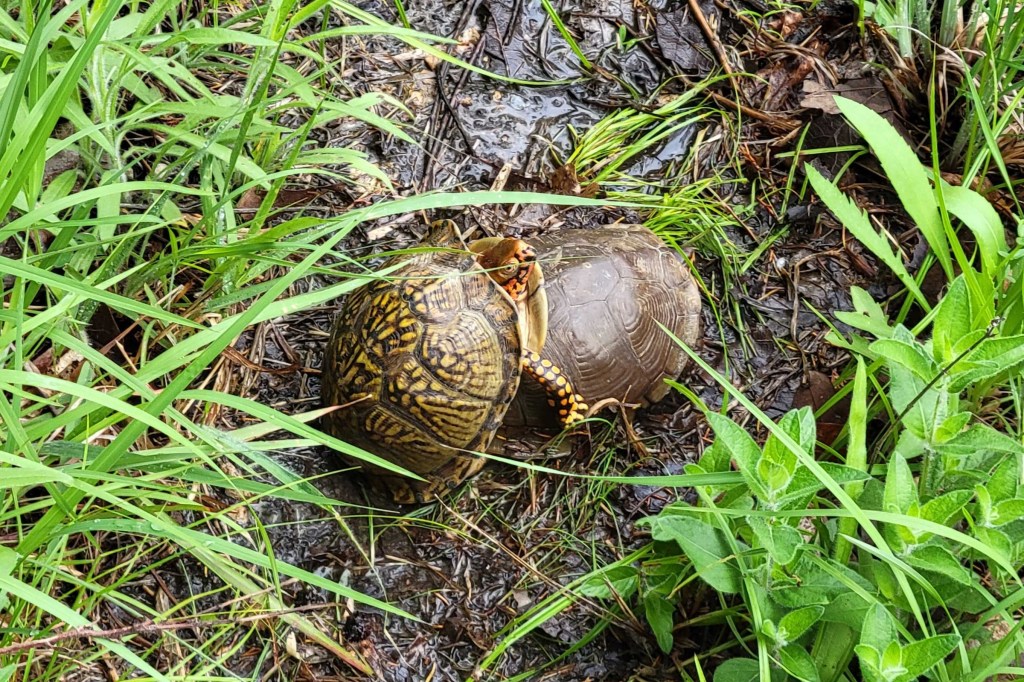
That’s all for now. Enjoy my Arkansas trail hike photos below.
In case you’re wondering, I plan to finish the Pacific Crest Trail in August. I have 80 miles left to hike at the northern end. I wasn’t able to complete those miles last year due to wildfire. In fact, I also plan to re-hike the 180 miles before that because I found the Cascades of northern Washington so incredibly beautiful.


I heard music from 5 miles away the night before
and couldn’t figure out what it was.
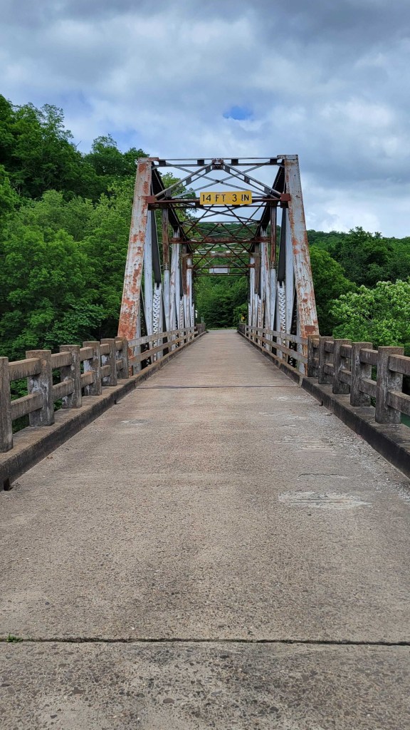
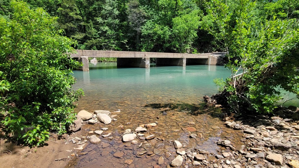
This is a one-lane state highway bridge.

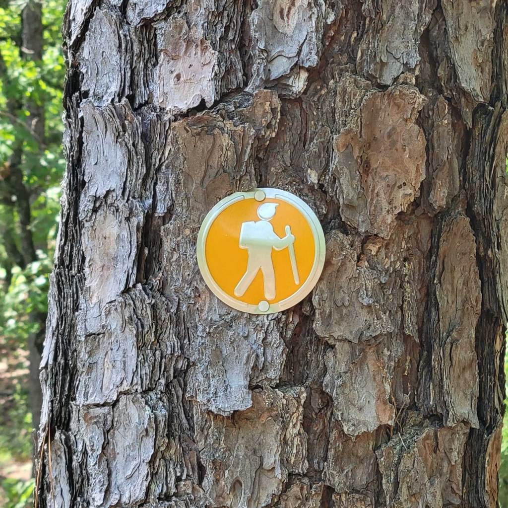
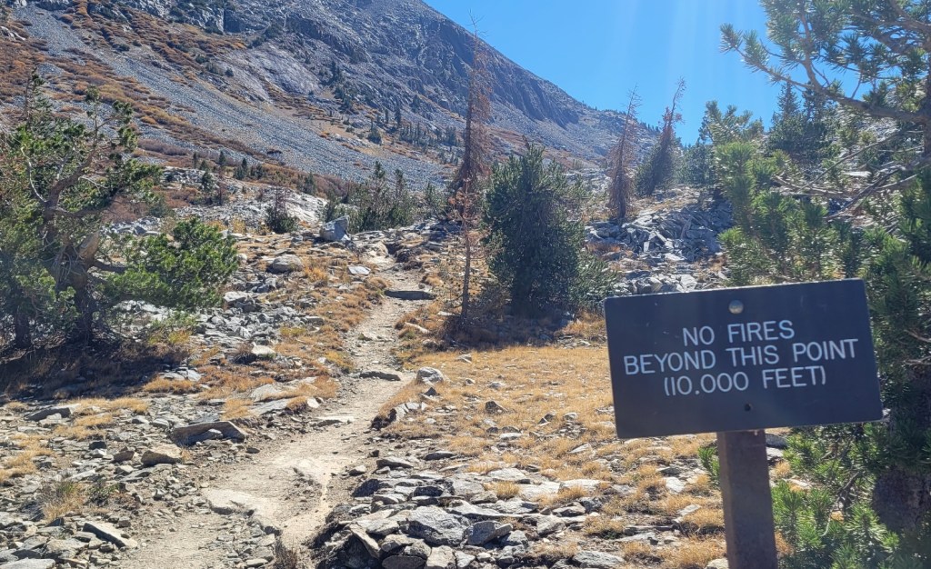
I only saw this sign in one place.
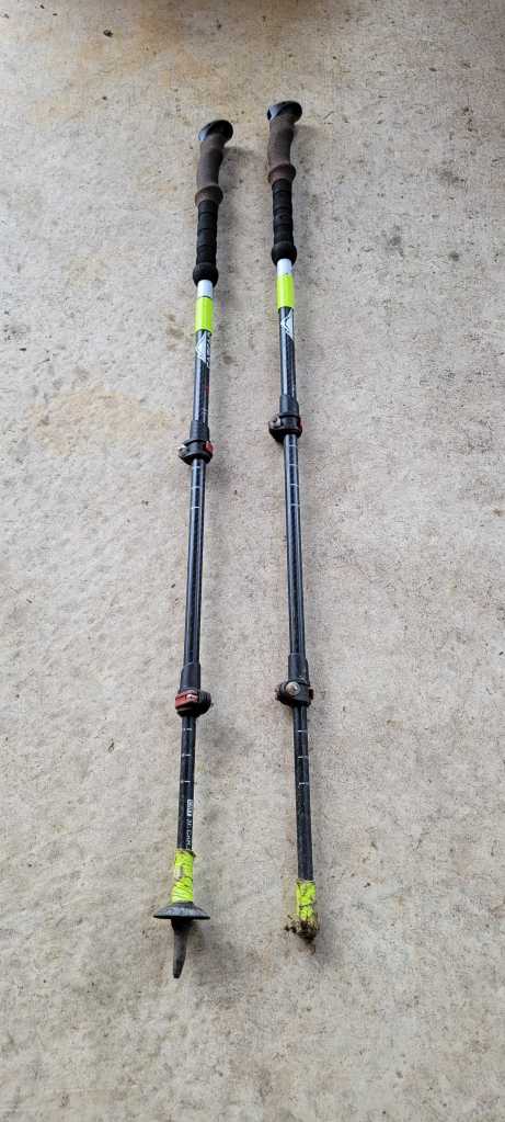
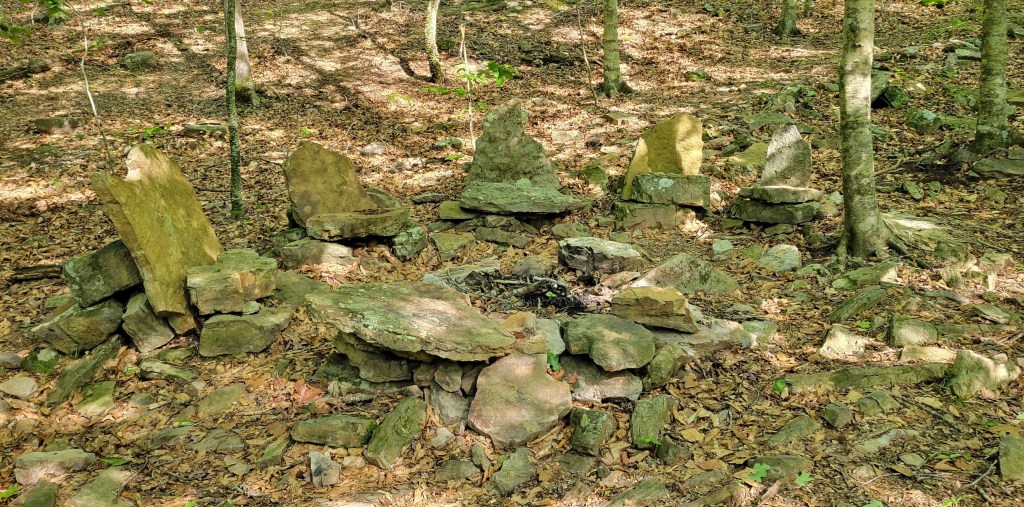
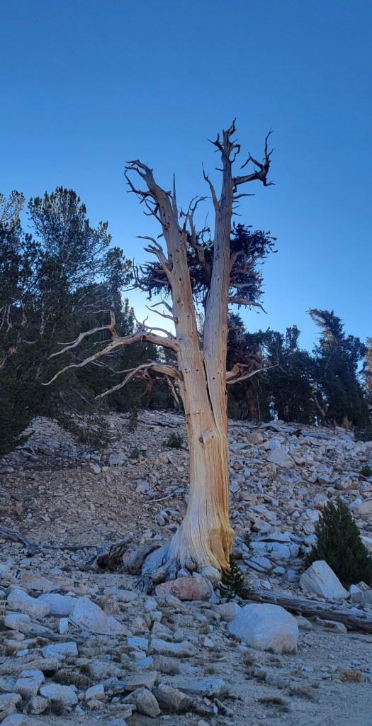
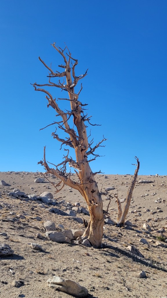
The one on the left has lost its point.
On my way
C) Andrew Carter, 2023
I’m on my way to Arkansas at the moment. Last night, I flew from Fresno to Las Vegas on Allegiant. This morning, I’m flying from Las Vegas to Memphis on Spirit. Trying to save money on my airfare.
Once I arrive in Memphis, I’ll take a rental car to Mountain Home, AR. Tomorrow morning, I’ll get a shuttle ride from there to the Matney Knob trailhead of the Ozark Highlands Trail
Las Vegas Airport is crazy. It was hopping at 4:30 am on a Monday morning. Tons of people heading home after a weekend on the town, I guess. Perhaps it also has something to do with the discount airlines.
I can’t wait to be back on the trail. I haven’t been out there since last October. Far too long.
I’ll be hiking west on the Ozark Highlands Trail from 5/9 to 5/24. Then hiking east on the Ouachita Trail from 5/25 to 6/7.
Once I’m done, I’ll be flying east to Massachusetts to attend my son’s wedding. I can’t wait for that, of course.
The plane is about to take off. Everyone take care.
My Hiking Plans in 2023
c) Andrew Carter, 2023
It’s the beginning of May, and I’m still at home and not on the trail. What gives?
What gives is that I had arthroscopic knee surgery at the beginning of February and I’ve been on the mend since. But I’m about to head out on the trail in a week.
In May and June, I’ll be hiking two different trails in Arkansas. The first is the 241-mile Ozark Highlands Trail. The second is the 223-mile Ouachita Trail.
Then in August, I’ll finish up my PCT hike. I only have the northernmost 81 miles to go, but I plan to hike 258 miles for the fun of it. I fell in love with the northern Cascades last year. I want to hike the best portion of those mountains again.
You may recall that I injured my left knee at the start of my 2022 hike of the Benton MacKaye Trail (BMT). I was just 37 miles into that hike when I heard my knee pop as I was walking downhill. That’s not good, I thought. I wasn’t in pain, so I continued hiking — 228 miles on the BMT, 253 miles on the Tuscarora Trail, and then 733 miles on the PCT.
I got home towards the end of October and set up an appointment with my orthopedic surgeon. After X-rays and MRI’s, it was determined I’d torn the meniscus in my left knee and needed to have it repaired. I had torn the meniscus in that knee before and had had arthroscopic surgery to repair it in early 2017. That time, the tear was on the outside of my knee. This time, it was on the inside.
I went under the knife in early February and went through a course of physical therapy afterwards. My final follow-up appointment is next week. Assuming I get the go-ahead, I’ll immediately head to Arkansas.
I’m sure the second knee injury was related to the first. Realistically, your knee doesn’t get stronger after surgery. It just gets put back together. Now, I’ve had it put back together a second time. I hate to say it, but I’m sure I’ll injure it again in the future. The only way not to would be to give up hiking and other strenuous activity. Perish the thought. I’ll wear my knee braces and “keep on trucking” as long as I can.
Except for my knee, I start this year’s hike in excellent shape. I joined a gym in early November and except for February and early March — knee surgery, recovery, and physical therapy — I’ve been going three or four times a week ever since. I’ve focused on aerobic activity, of course — rowing machine and elliptical trainer. But I’ve also focused on building upper body and core strength. A particular focus has been my back and my groin which I injured last year.
Clearly, my body is an old jalopy, but I want to use it and enjoy it as long as I can.
As in 2021 and 2022, I’ll be posting photographs, videos, and commentary of this year’s hikes as they take place. Thanks for your interest.
The Trail Provides
c) Andrew Carter, 2022
There’s an old hiker saying, “the trail provides.” What that means is that when you least expect it and when you most need it something truly amazing will happen to help you out of a bad situation. You can call this good luck, providence, a miracle. It doesn’t really matter. You can even say, “the Lord provides,” if that conforms to your belief system.
On both of my long-distance hikes, I’ve experienced this over-the-top trail magic.
In 1977 on my Appalachian Trail thru-hike, it happened to me in Hanover, NH when a Dartmouth student took me in off the street, gave me a cold drink, let me use her shower to clean up, and was prepared to let me spend the night in her apartment if I wanted to.
She’d seen me on the street, looking distressed, hot and tired, walking back and forth between a bench and a payphone. It was a very hot day. I was out in the bright sun. I was expecting to spend the night with some friends of my father while I was in Hanover, but I couldn’t reach them on the telephone. This young woman, just a year or two older than me, walked across the street from her apartment to talk to me and offered to take me in.
I will always think of her as my “Dartmouth Angel.” Getting off the street, getting cool, and getting clean were exactly what I needed at that moment.
Trail magic also happened to me during my PCT hike in Snoqualmie Pass, WA. In this case, I’d lost my hiking sticks and I didn’t know what to do to replace them. My hiking sticks are crucial, especially since they help prevent me from falling on the trail, and I was about to head into a very rocky section of trail.
I was spending the night at a motel. It wasn’t until I was checking out that I realized I no longer had my hiking sticks. I was pretty sure I had left the sticks in the lobby when I was checking in, but they were no longer where I thought I left them. The motel maintains a hiker box, and the desk clerk said the sticks would be there if anyone at the motel had found them. The sticks weren’t there. What to do?
First, I went next door to a convenience store which carried hiker supplies. After much looking, I was able to find and purchase a wooden hiking staff to use instead of my hiking sticks. I would have bought two if the store had two, but they didn’t. Not a perfect solution, but better than nothing.
After buying the staff, I sat outside the store and took time to put duct tape on the staff where I planned to grip it, so my hand wouldn’t slip off while in use. I also went online to order a pair of hiking sticks to be sent to me at the next trail town I would pass through. This took a while because I had to make sure the sticks I ordered would reach that trail town before I arrived.
Then I remembered there was an outdoors store a quarter mile down the street. Maybe that store would have hiking sticks for sale. I walked down to the store, but they didn’t have hiking sticks. The store’s focus was bicycle supplies, not hiking supplies. (There’s a ski area at Snoqualmie Pass which attracts mountain bikers during the off-season.)
The clerk at the store was friendly. She asked me if I was certain the convenience store didn’t have hiking sticks. I began to think, “Perhaps she’s right.” The convenience store was a mess, with things stored hither and yon and similar items often in two different places. So I walked back the quarter mile to the convenience store. I did a thorough search. No hiking sticks. It looked like the hiking staff I purchased would have to do.
I went outside again and decided to text Marta to tell her of my plight before walking to the trailhead. Before I left, however, I decided to go back to the motel to check one last time before heading off. After all, the motel was next door. How could it hurt?
I walked in, looked in the hiker box, and holy heck, my sticks were there! I know for certain they weren’t there before, but now they were. Perhaps another hiker had found them the day before and taken them to their room with the plan of putting them in the hiker box later. Perhaps the motel desk clerk had decided to go check the motel’s lost-and-found after I talked to her earlier. I’ll never know. All I do know is the sticks weren’t there, then they were, and so many things had happened to delay my departure from Snoqualmie Pass and bring me back to the motel one last time.
There have been other lesser instances of trail magic on both my AT and PCT hikes. I’m grateful every time it happens. The trail provides.
2021-22 Itinerary
c) Andrew Carter, 2022
I hiked 1840 miles of the PCT in 2021 and 733 miles in 2022 for a total of 2573 miles to date. That leaves 81 miles to hike next year — from Stehekin, WA to the Canadian border.
Here’s the day by day itinerary I followed in 2021 and 2022.
The Sierra, a Few More Photos
c) Andrew Carter, 2022
But wait, there’s more.


You can’t see it, but the trail crosses that rock chute near the top.
Photos — 50 miles in the Sierra
c) Andrew Carter, 2022
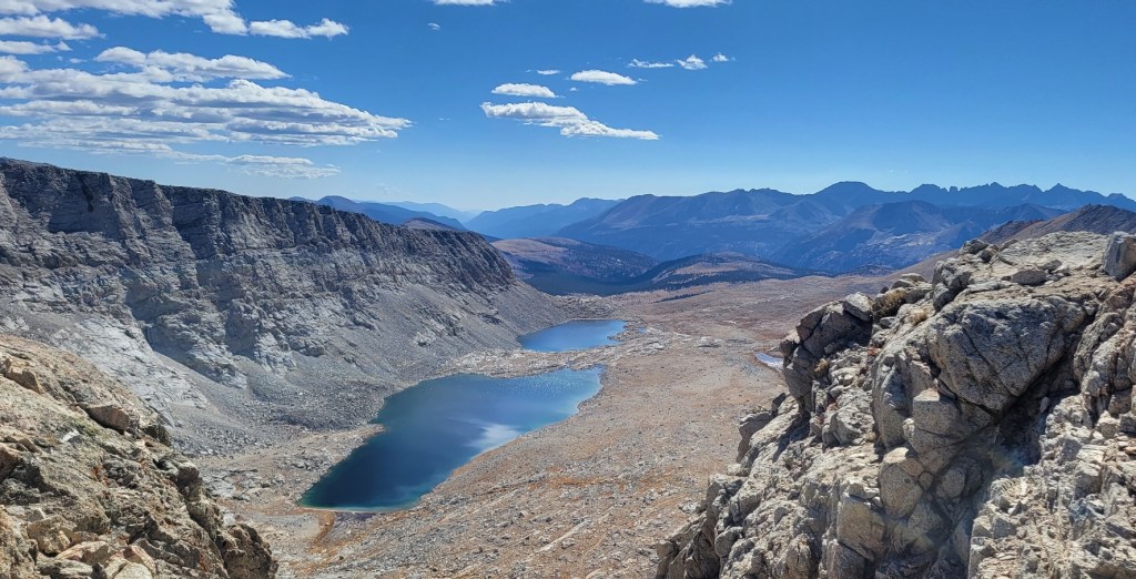
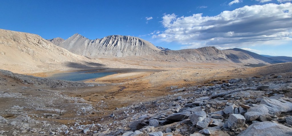
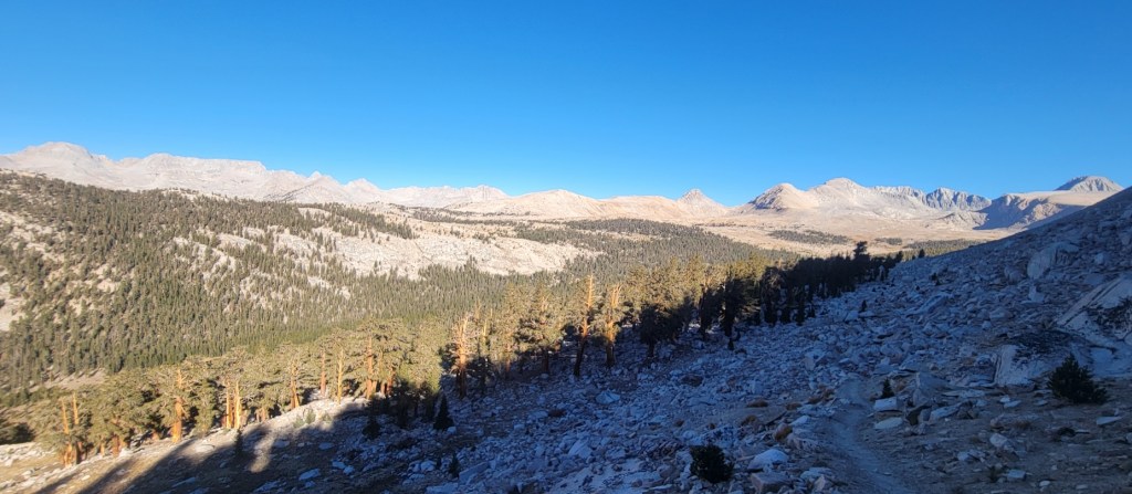
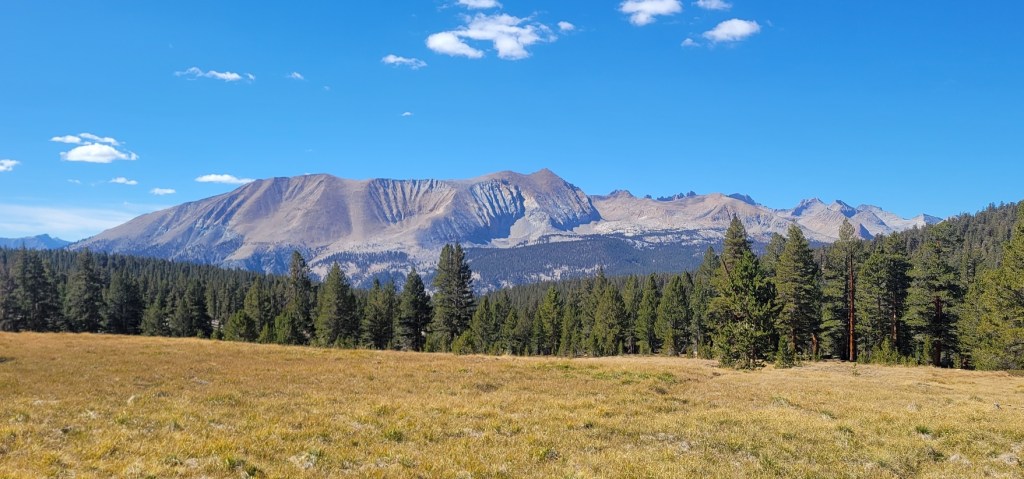
I was able to get back to the PCT on October 14th to finish the last 50 miles I had to hike in the Sierra. I had to skip these miles last year because of fire and smoke in Sequoia National Park. I had intended to complete these miles in August, but the “world’s largest blister” I got on my right foot, hiking south of here, put the kibosh on that.
I was blessed with perfect October weather — no rain, clear skies, warm days, and not too chilly nights. It only got below freezing on one night.
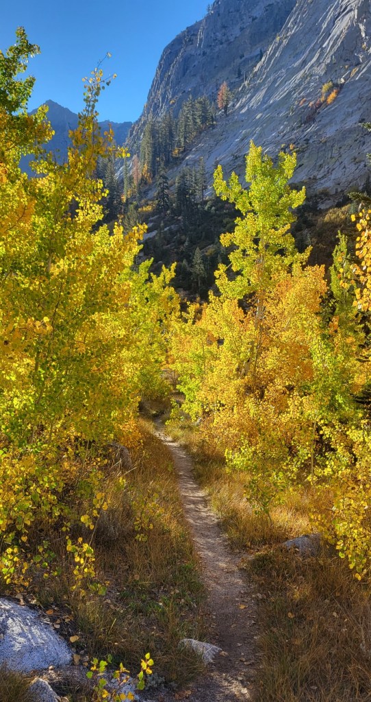
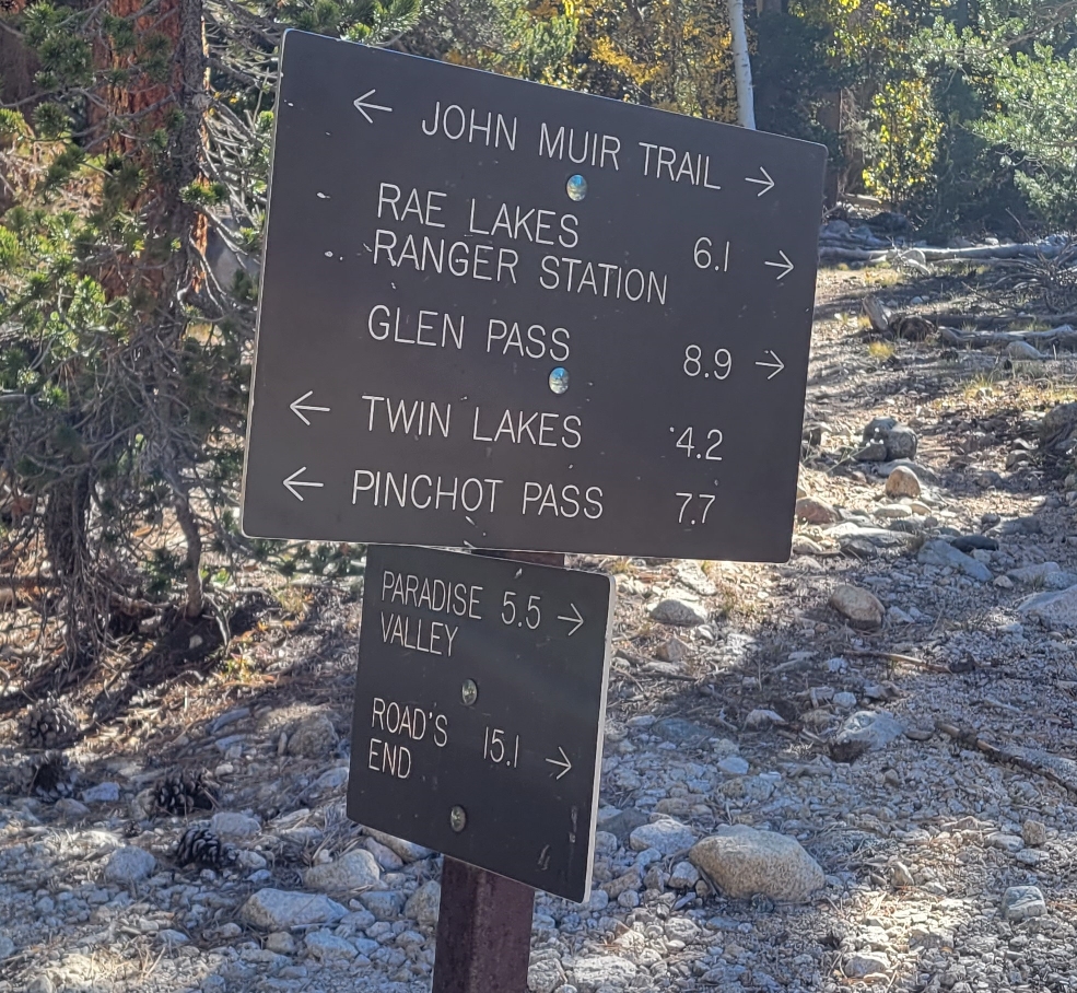
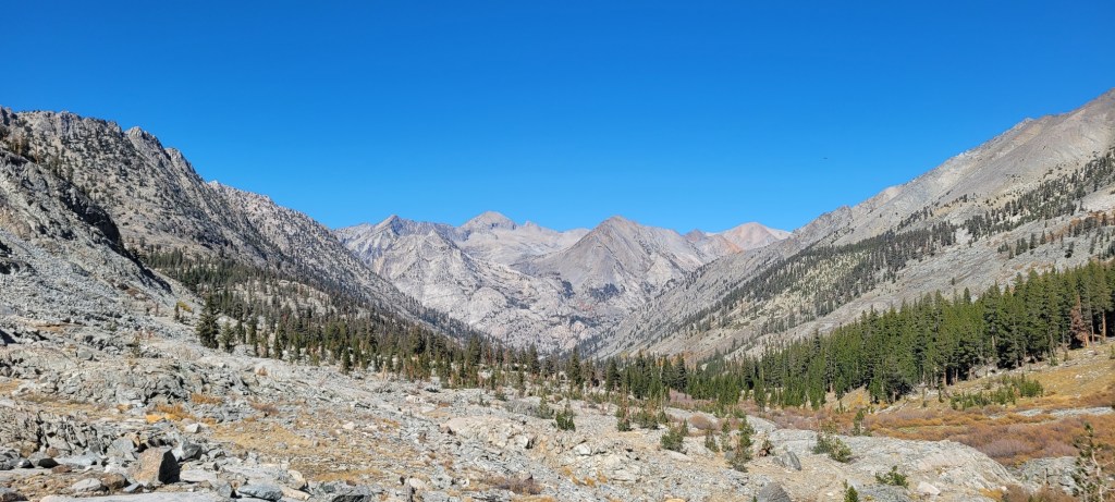
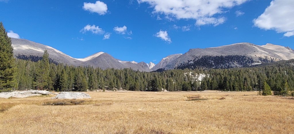
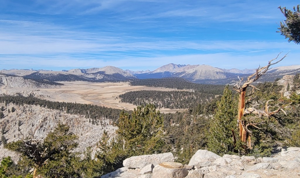
I began my hike where Woods Creek crosses the PCT in Kings Canyon National Park. To get there, I had to hike 15.1 miles in from Roads End on the Kings River. California Rt. 180 dead-ends there.
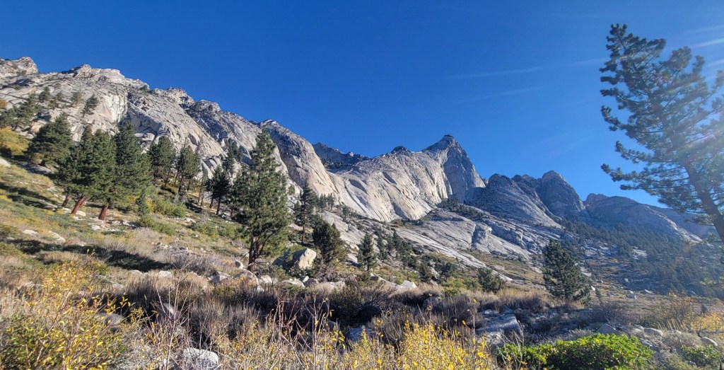
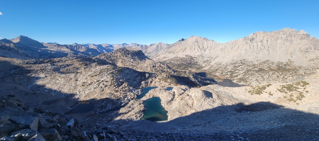
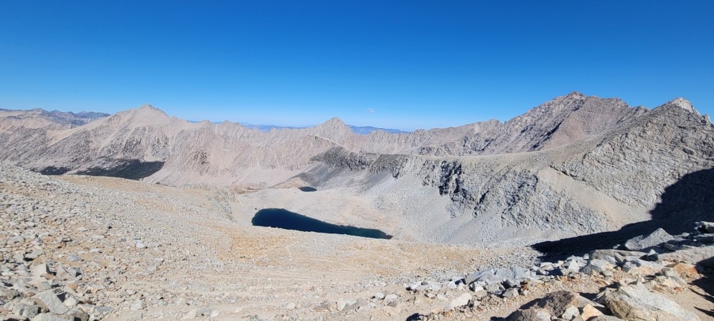
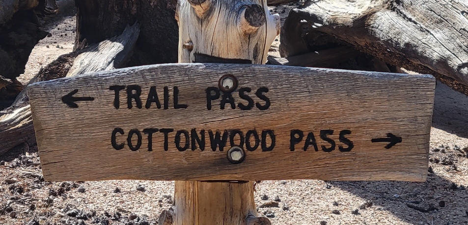
I then hiked 49.7 miles south along the PCT before exiting at Cottonwood Pass and hiking 3.9 miles down to Horseshoe Meadows and the incredible county road which connects the Meadow to Lone Pine and US Rt. 395. That road climbs over 6600 feet in 20 miles. It was built for a proposed ski area Walt Disney wanted to develop in the Meadow and up to the Sierra crest. Because of the Wilderness Act, the ski area was never built.
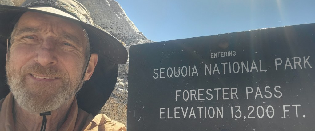
With the in and out, my 49.7 mile hike along the PCT became a total hike of 68.7 miles. I took five days to do that. In the process, I crossed Forester Pass which is the highest point on the PCT (13,160 feet) and passed near Mt. Whitney which is the highest point in the continental United States (14,494 feet). I also crossed Glen Pass, which is “only” 11,930 feet, but which I think is the most difficult climb on the PCT for southbounders.
Connecting all the dots of my multiple section hikes along the PCT in 2021 and 2022, I have now hiked 2573 miles. That leaves just 81 miles to go, from Stehekin, WA to the Canadian border. I plan to do those miles next August.
Here are the photos I took. I hope you enjoy them.
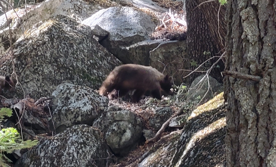
Her baby was just behind her.
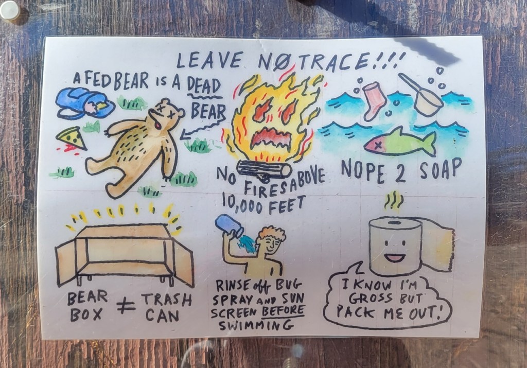
I confess I don’t pack out my soiled TP. I dig a cat hole and bury it.

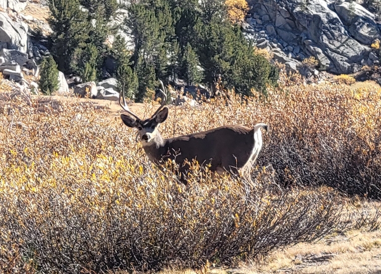
The deer are tame since no hunting is allowed.


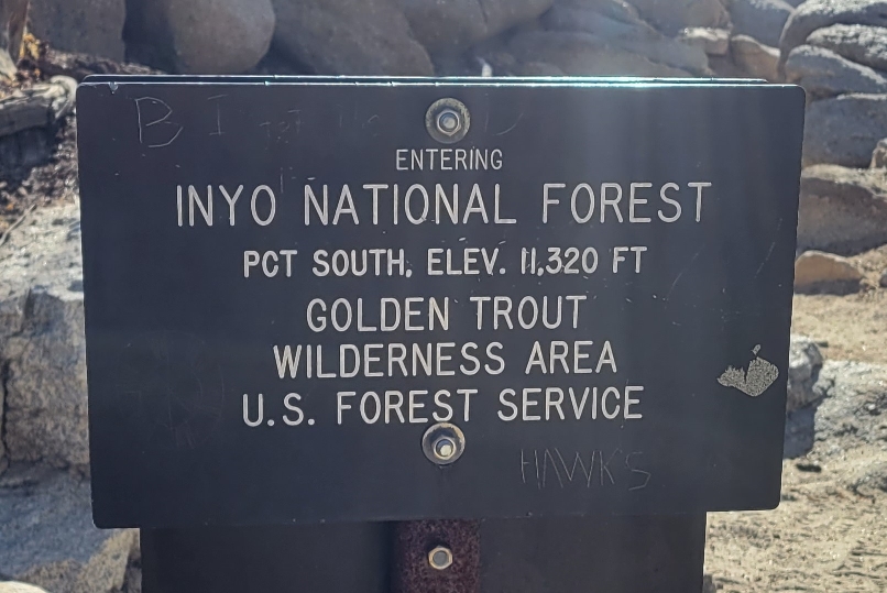
Entering Inyo National Forest
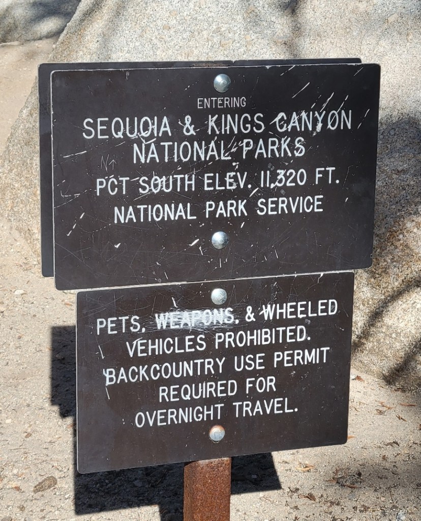
Entering Inyo National Forest

Video — In the Sierra
c) Andrew Carter, 2022
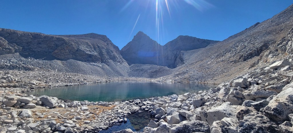
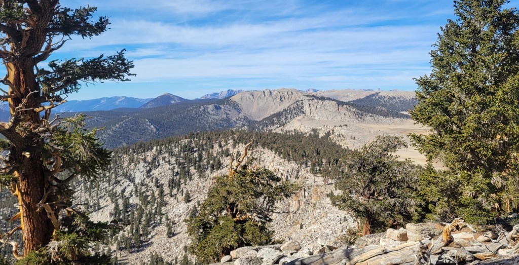
I took this video on October 18th, my last day in the Sierra. It’s a 360-degree view of the scenery near Cottonwood Pass, which is just southwest and above Lone Pine. So much beauty.
At the start of the video, I’m looking northeast. Then I pan clockwise — east, south, west, north. I’m in the Golden Trout Wilderness of Inyo National Forest.
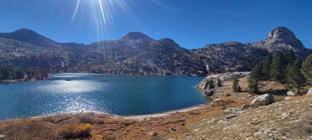
The small lake you see at the start is Chicken Spring Lake, which sits at an elevation of 11,242 feet. As I pan to the east and then southeast, I’m looking down the ridge which forms the eastern flank of the Sierra above Rt. 395 and Owens Lake. The tall mountain you see in the distance along this ridge is Olancha Peak. It tops out at 12,132 feet.
As I continue to pan around, the large meadow to the southeast is Big Whitney Meadow. Then I come back around to the Lake. In the process, almost falling off the rock I’m standing on. Unfortunately, you can’t see Mt. Whitney, the tallest mountain (14,494 feet) in the Lower 48, because it’s hidden by the unnamed mountain above the Lake.
Happy trails.
What Lies Ahead
c) Andrew Carter, 2022
I hiked 1840 miles of the PCT in 2021. I had hoped to hike the remaining 814 miles in 2022. That’s not going to happen.
When I got to northern Washington earlier this month, I learned that the northernmost portion of the PCT is closed due to wildfires in Washington and British Columbia. So I got off the trail in Stehekin, leaving 81 miles of the PCT in Washington still to hike. I’ll have to return in 2023 to complete those miles. My “thru in two” becomes a “thru in three.”
I also have 50 miles of the PCT in the Sierra still to hike. I’ll take care of those miles in October.
Since April 3, 2021, I’ve hiked 2523 miles of the PCT. I’ve also hiked another 517 miles on the Benton MacKaye Trail and Tuscarora Trail back East. That’s 3040 miles in a year and a half. Add in the 50 miles in the Sierra I’ll hike next month plus the walk-in miles needed to reach trailheads in 2021 and 2022, and I’ll be close to 3200 actual miles before winter hits.
My long distance hiking days are coming to an end, however. It’s one thing to “ghost” Marta when she’s working, but she’ll be retiring soon and we have traveling we want to do together. I can envision shorter hikes in the future, but not anything longer than two or three weeks.
I hope you have enjoyed my posts, pictures, and videos. I’ve been blessed to be able to spend so much time in the wilderness these past two years. Who knows what the future holds?
